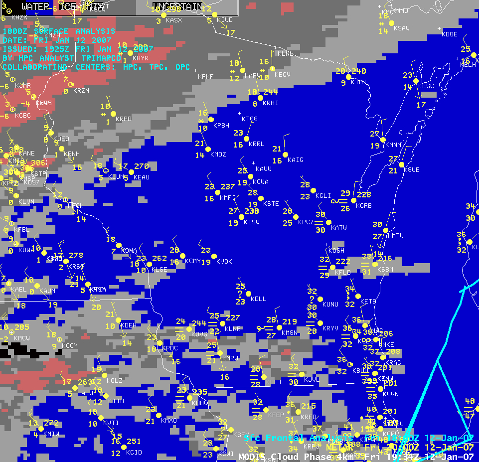
Freezing drizzle in southern Wisconsin
A cold frontal boundary moved southeastward across Wisconsin early in the day on 12 January 2007 — an extensive deck of post-frontal stratus cloud covered much of the southern half of the state during the afternoon hours, as seen on the MODIS true color image (above). As cold air advection in the wake of the frontal passage began to cool surface temperatures below freezing, patches of drizzle began to precipitate from the stratus deck; AWIPS imagery of the MODIS Cloud Phase Product (below) indicated that this stratus cloud deck covering southern Wisconsin was composed primarily of supercooled water droplets (blue enhancement = water phase clouds). This scenario of supercooled liquid precipitation falling onto surfaces that have cooled below freezing created icing conditions that prompted the issuance of freezing rain advisories for many of the counties across southern Wisconsin (farther to the south, ice accruals of 1-2 inches were reported across parts of OK, KS, MO, and IL during the 12-14 January period). Regional rawinsonde profiles at 12:00 UTC (6am local time) showed that the arctic air mass was fairly shallow (especially evident on the Minneapolis sounding), but temperatures were below freezing throughout the atmospheric column on both the Minneapolis MN (KMPX) and Green Bay WI (KGRB) soundings; however, the sounding at Davenport IA (KDVN) did reveal two layers of above-freezing air located between the surface and the 700 hPa pressure level.


