Thunderstorms in the Alaska Interior
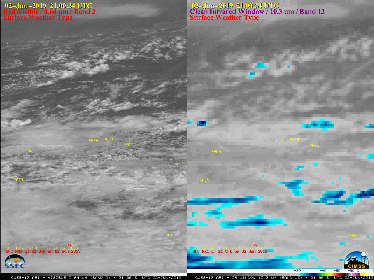
GOES-17 “Red” Visible (0.64 µm, left) and “Clean” Infrared Window (10.3 µm, right) images, with hourly precipitation type plotted in red [click to play animation | MP4]
Severe Thunderstorm Warning including Fairbanks AK until 6:30 PM AKDT pic.twitter.com/DguPuFDsbg
— NWS Severe Tstorm (@NWSSevereTstorm) June 3, 2019
Usually the GOES-17 Mesoscale Domain Sector #2 is positioned over Alaska to provide 1-minute imagery — but on this day it was relocated to cover severe thunderstorms across New Mexico and Texas — so imagery over Alaska was only available at the 10-minute Full Disk scan interval.
In addition to the hail, these storms also produced heavy rainfall — especially at Fairbanks, with 0.65 inch falling in only 21 minutes.
![Time series of surface report data from Fairbanks International Airport [click to enlarge]](https://cimss.ssec.wisc.edu/satellite-blog/wp-content/uploads/sites/5/2019/06/190602_PAFA_SFCMG.GIF)
Time series of surface report data from Fairbanks International Airport [click to enlarge]