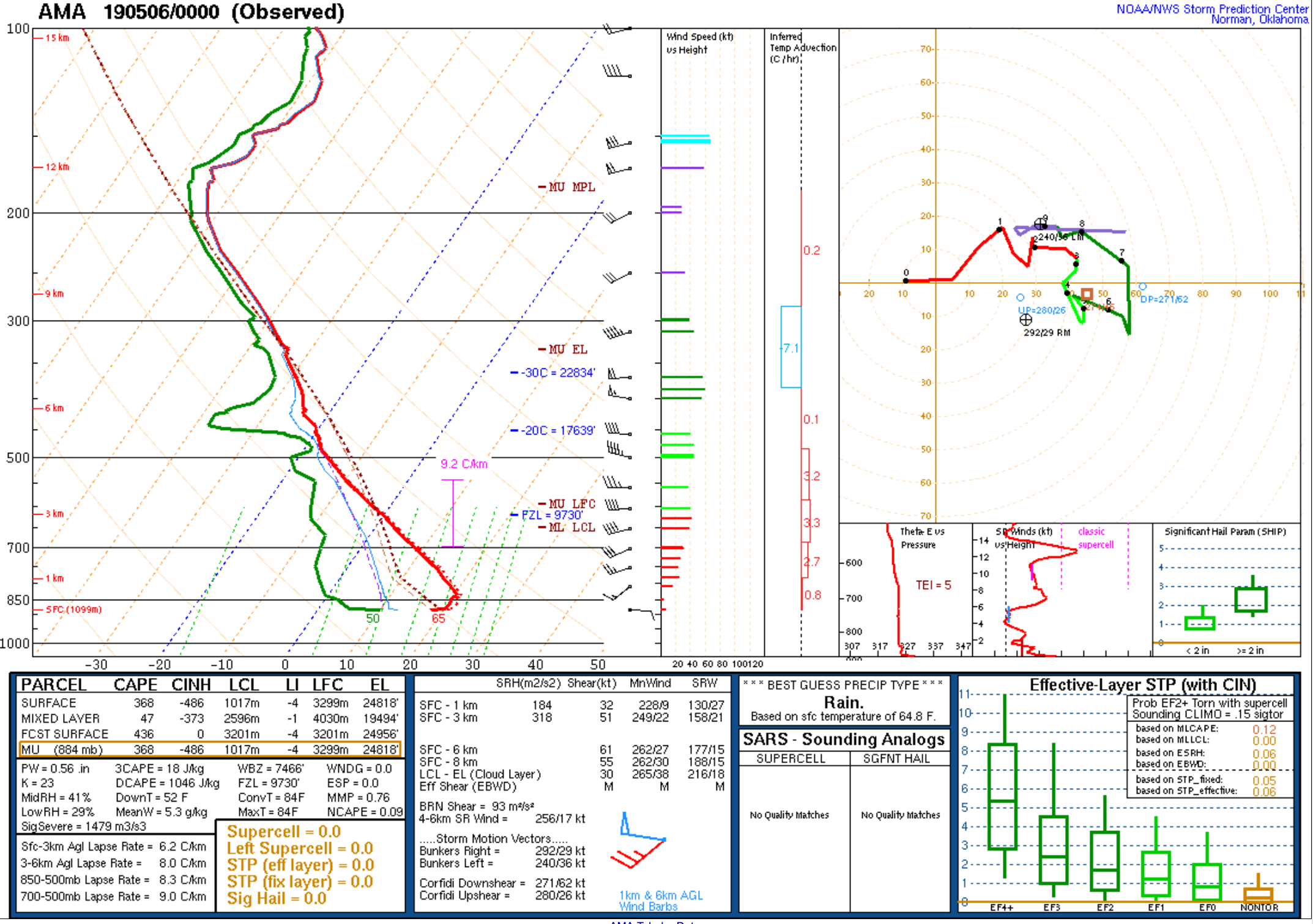
Severe thunderstorms over the southern Plains

GOES-16 “Red” Visible (0.64 µm) and “Clean” Infrared Window (10.3 µm) images [click to play animation | MP4]
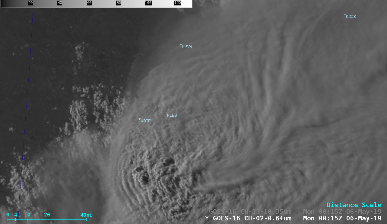
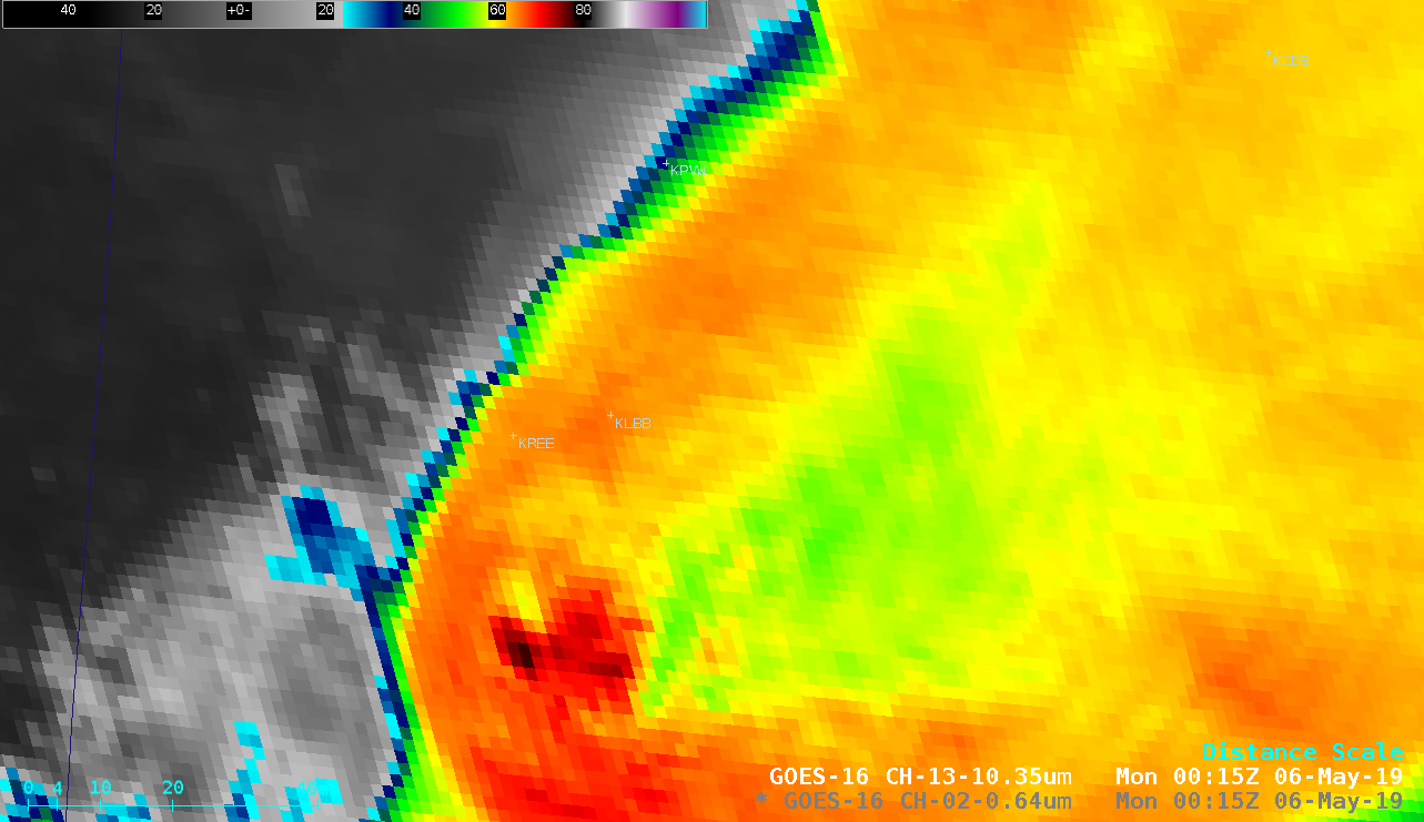
The storm also exhibited very prominent Enhanced-V and Above-Anvil Cirrus Plume signatures — a toggle between 0015 UTC Visible and Infrared images (below) illustrated these two signatures.
![GOES-16 "Red" Visible (0.64 µm) and "Clean" Infrared Window (10.3 µm) images at 0015 UTC on 06 May [click to enlarge]](https://cimss.ssec.wisc.edu/satellite-blog/wp-content/uploads/sites/5/2019/05/190506_0015utc_goes16_visible_infrared_TX_anim.gif)
GOES-16 “Red” Visible (0.64 µm) and “Clean” Infrared Window (10.3 µm) images at 0015 UTC on 06 May [click to enlarge]
![GOES-16 "Red" Visible (0.64 µm, left) and "Clean" Infrared Window (10.3 µm, right) images, with plots of SPC storm reports [click to play animation | MP4]](https://cimss.ssec.wisc.edu/satellite-blog/wp-content/uploads/sites/5/2019/05/190505_goes16_visible_infrared_spcStormReports_LBB_TX_anim.gif)
GOES-16 “Red” Visible (0.64 µm, left) and “Clean” Infrared Window (10.3 µm, right) images, with plots of SPC storm reports [click to play animation | MP4]
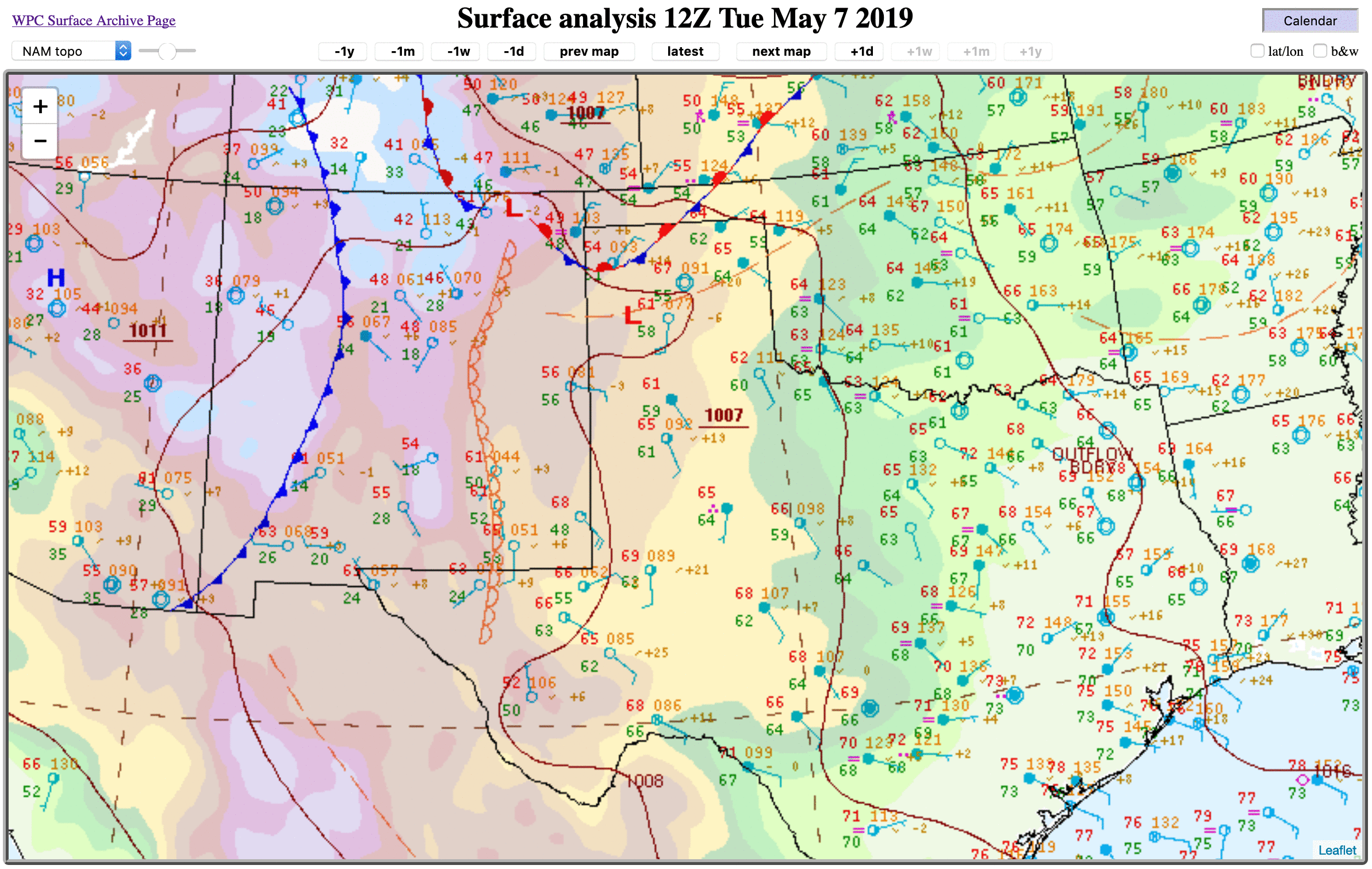
===== 07 May Update =====

GOES-16 “Red” Visible (0.64 µm, top left), Near-Infrared “Snow/Ice” (1.61 µm, top right), “Clean” Infrared Window (10.3 µm, bottom left) and Cloud Top Temperature product (bottom right) [click to play animation | MP4]
GOES-16 Visible and Infrared images with plots of SPC storm reports are shown below.
![GOES-16 "Red" Visible (0.64 µm, left) and "Clean" Infrared Window (10.3 µm, right) images with plots of SPC storm reports [click to play animation | MP4]](https://cimss.ssec.wisc.edu/satellite-blog/wp-content/uploads/sites/5/2019/05/190507_goes16_visible_infrared_spcStormReports_KMAF_anim.gif)
GOES-16 “Red” Visible (0.64 µm, left) and “Clean” Infrared Window (10.3 µm, right) images with plots of SPC storm reports [click to play animation | MP4]