Mesoscale Convective Vortex (MCV) in the Upper Midwest region
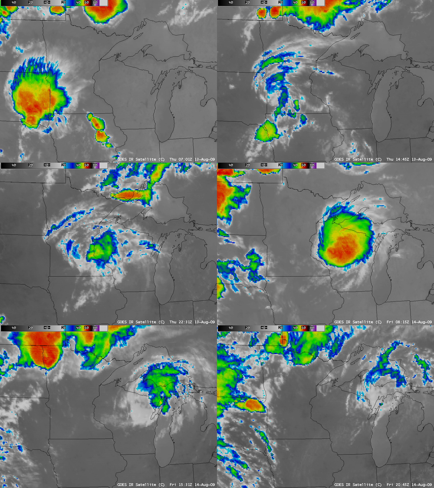
AWIPS images of the GOES-12 10.7 µm IR channel (above) showed a strong Mesoscale Convective System (MCS) that developed over South Dakota on 13 August 2009. This MCS spawned a long-lived Mesoscale Convective Vortex (MCV) — sometimes referred to as a Mesocale Vorticity Center or MVC — that later helped to initiate another MCS over Minnesota and Wisconsin during the pre-dawn hours on 14 August 2009.
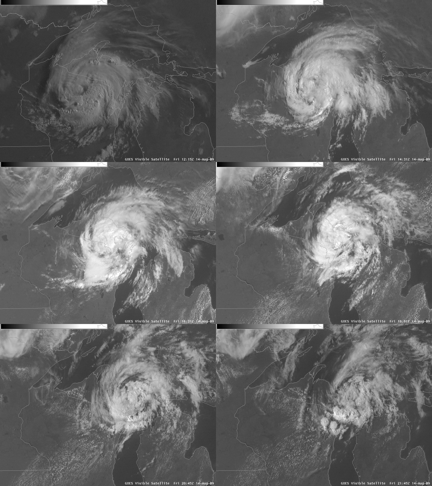
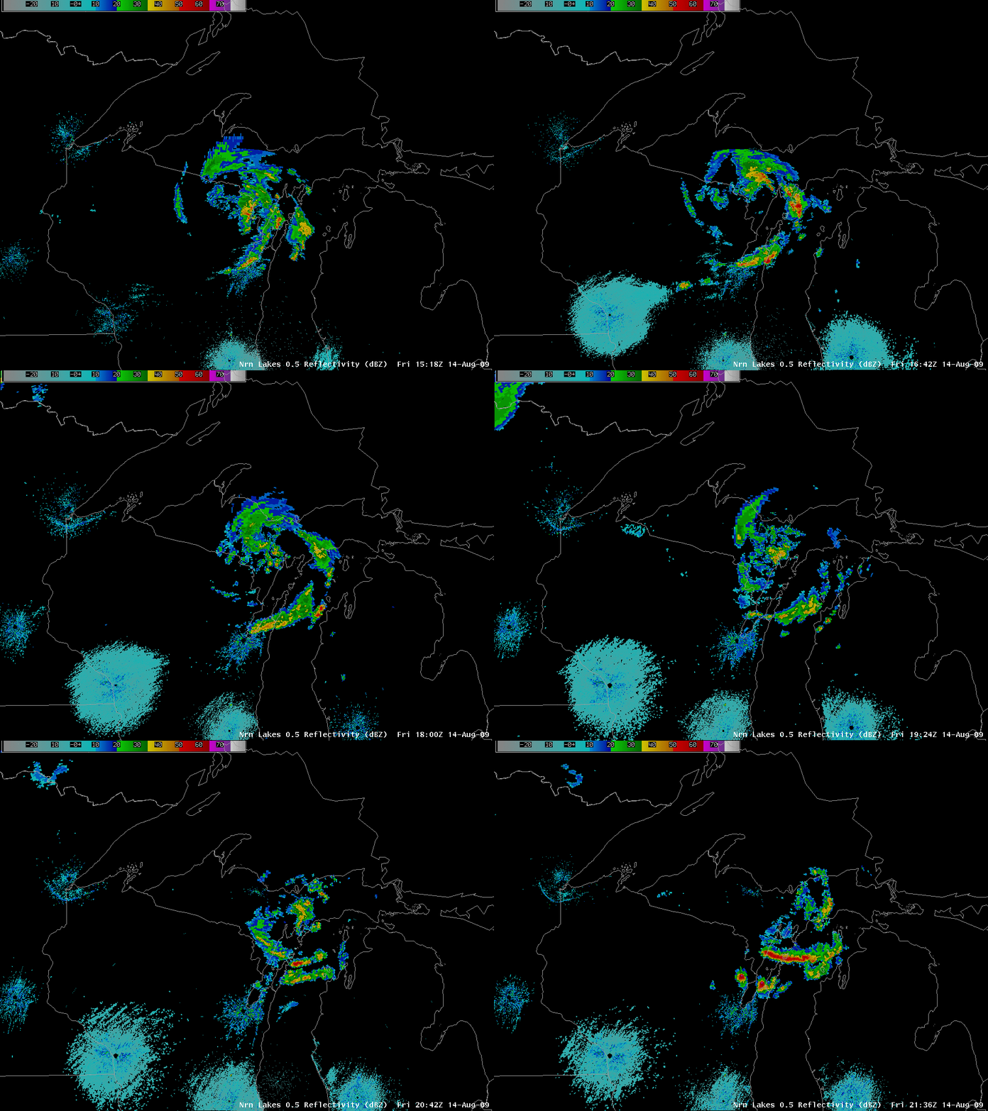
The circulation of the MCV then continued to move northeastward across the Upper Peninsula of Michigan during the day on 14 August, as seen on an animation of GOES-12 visible images (above) and radar reflectivity (below).
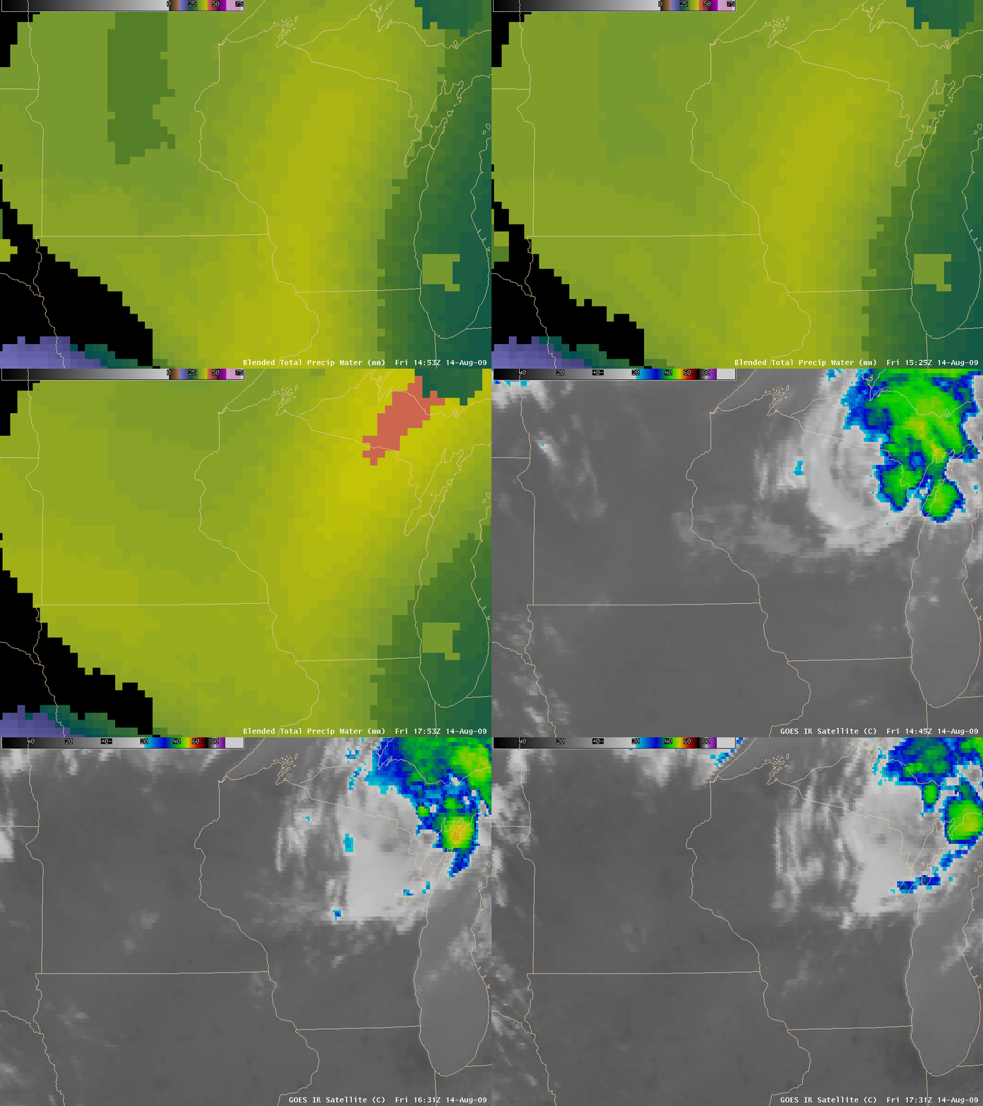
The Blended Total Precipitable Water (TPW) product (below) showed that there was a plume of higher moisture (TPW values of 37-41 mm or 1.5 to 1.6 inches) feeding northeastward across Wisconsin into the Upper Peninsula, helping to sustain convective development in the vicinity of the MCV.
Since the Atlantic Basin has been seemingly disinterested in producing any notable tropical cyclone activity so far this season, one had to look to the Upper Midwest region of the US for signs of any “tropical development”:
AREA FORECAST DISCUSSION
NATIONAL WEATHER SERVICE MARQUETTE MI
500 PM EDT FRI AUG 14 2009

.SYNOPSIS...

TO THE S...LAZY FLOW EXISTS ACROSS THE UPPER MISSISSIPPI VALLEY AND
GREAT LAKES. AS A RESULT...MESOSCALE VORTICITY CENTER GENERATED BY
CONVECTION IN SD TWO NIGHTS AGO AND NOW LOCATED OVER CNTRL UPPER MI
IS STILL JUST DRIFTING ALONG IN AN ERLY DIRECTION. MVC CIRCULATION
REMAINS VERYWELL-DEFINED...JUST AS IMPRESSIVE AS IT WAS 24HRS AGO
DUE TO THE VERY LIGHT MID/UPPER FLOW IN WHICH IT IS EMBEDDED. WEAK
FLOW HASKEPT IT FROM SHEARING APART. IF THIS WAS LOCATED IN THE TROPICS...
YOU WOULD THINK IT WAS A TROPICAL SYSTEM. ALTHOUGH COMPACT...TIGHT
SPIRALING CLOUD CANOPY AROUND MVC HAS BEEN SUFFICIENT TO LIMIT AFTN
HEATING...SO CONVECTIVE DEVELOPMENT HAS BEEN KEPT IN CHECK THIS AFTN.


