Tornadoes in Ohio and Pennsylvania
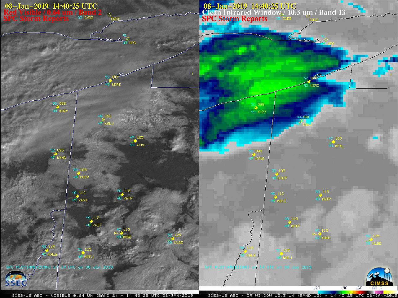
GOES-16 “Red” Visible (0.64 µm, left) and “Clean” Infrared Window (10.3 µm, right) images [click to play animation | MP4]
GOES-16 Mid-level Water Vapor (6.9 µm) images (below) revealed the broad cyclonic flow associated with a trough of low pressure aloft over the Great Lakes, and RAP40 model fields showed an elongated lobe of 500 hPa vorticity pivoting across Ohio and Pennsylvania. After the initial tornado/hail-producing thunderstorms during the late morning hours, a second round of storms produced additional hail in the afternoon.
![GOES-16 Mid-level Water Vapor (6.9 µm) images, with overlays of surface fronts and NAM40 geopotential height and vorticity [click to play animation | MP4]](https://cimss.ssec.wisc.edu/satellite-blog/wp-content/uploads/sites/5/2019/01/190108_goes16_waterVapor_rap40_height_vorticity_OH_PA_tornado_anim.gif)
GOES-16 Mid-level Water Vapor (6.9 µm) images, with overlays of surface fronts and NAM40 model 500 hPa geopotential height and vorticity [click to play animation | MP4]
An EF-1 tornado occurred in Cortland, OH in Trumbull County this morning: https://t.co/VypmgiqrIG pic.twitter.com/p8LQzoXuwN
— NWS Cleveland (@NWSCLE) January 8, 2019
– Today was only the seventh January #tornado of record in Ohio dating to 1950.
– Average high today in nearby Youngstown, OH is 32?.
– Snow is forecast tonight in northeast #OHwx. https://t.co/u0idTHCDZ4
— Jonathan Erdman (@wxjerdman) January 8, 2019
Here’s more info (click link for our PNS) on yesterday’s EF-1 tornado in Mercer County, PA: https://t.co/fCr81lbDxA
It’s not very often that we do tornado surveys in the snow! pic.twitter.com/n7RJLf2HK6— NWS Pittsburgh (@NWSPittsburgh) January 9, 2019