Severe thunderstorms in Iowa and Minnesota
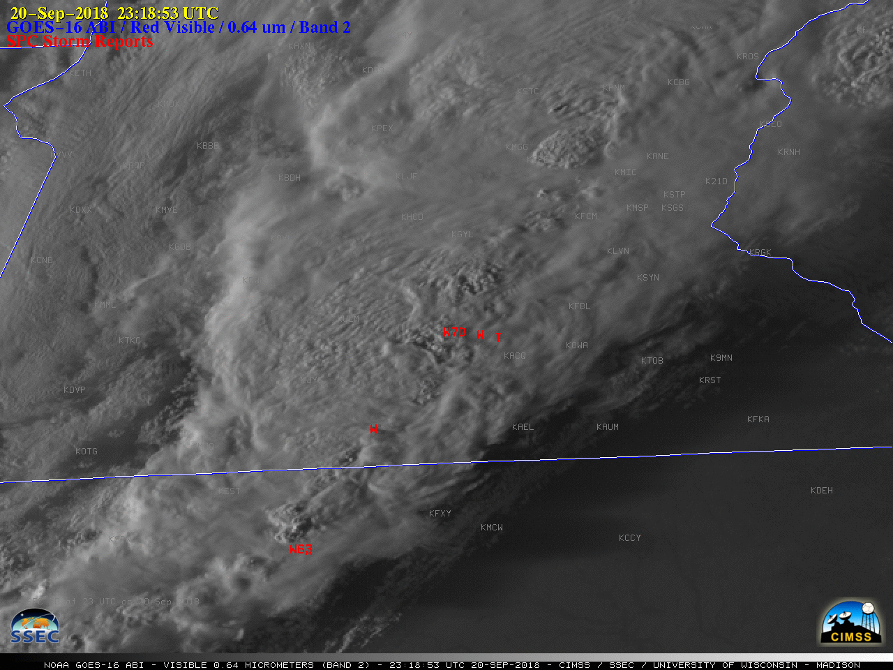
GOES-16 “Red” Visible (0.64 µm) images, with SPC storm reports plotted in red [click to play MP4 animation]
GOES-16 “Clean” Infrared Window (10.3 µm) images (below) showed cloud-top infrared brightness temperatures as cold as -70 to -75ºC (black to light gray enhancement) with the more vigorous overshooting tops. These thunderstorms continued moving eastward as a squall line, causing additional damaging winds across northern Wisconsin.
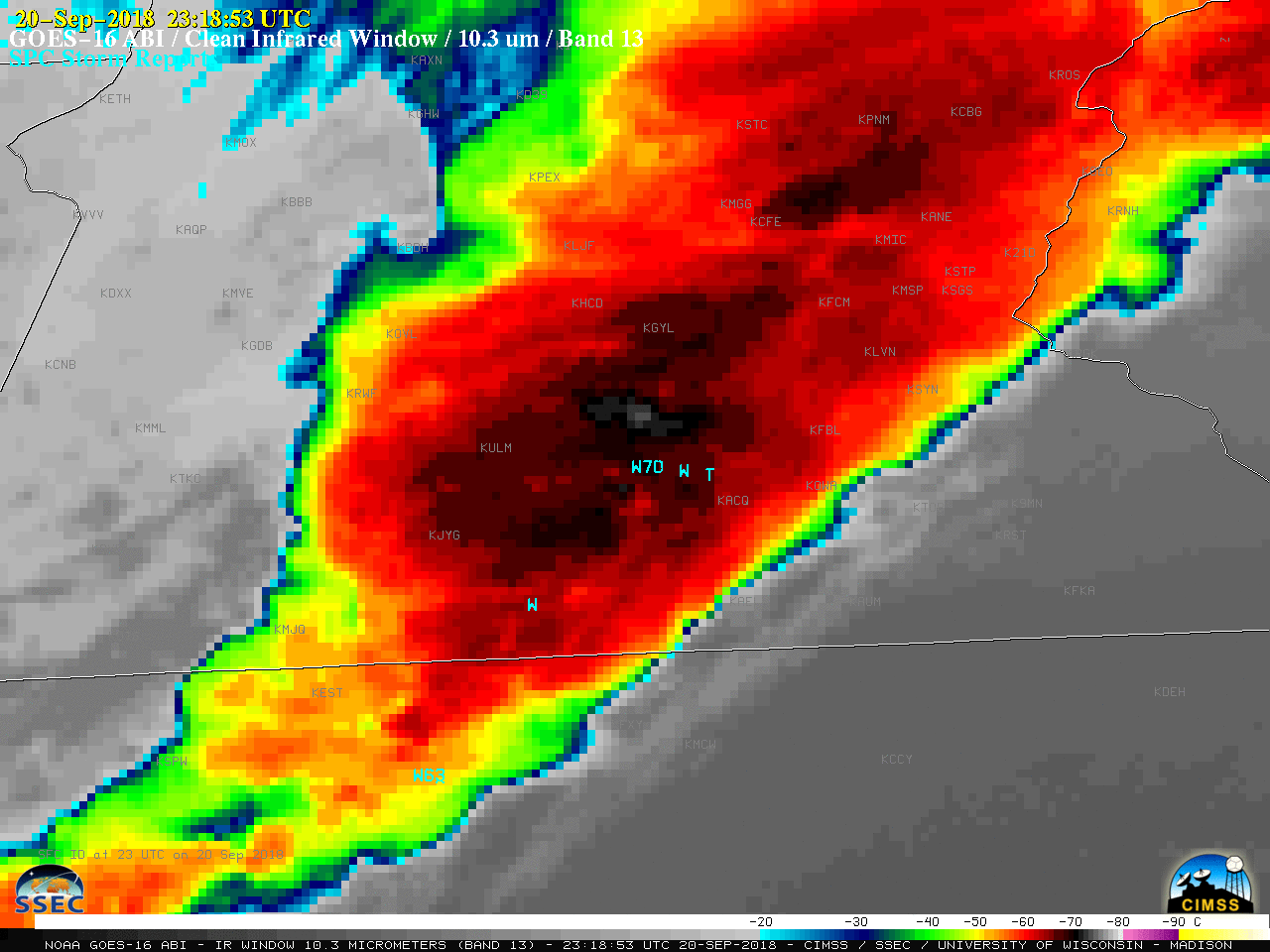
GOES-16 “Clean” Infrared Window (10.3 µm) images [click to play MP4 animation]