Severe thunderstorms in South Dakota and Nebraska
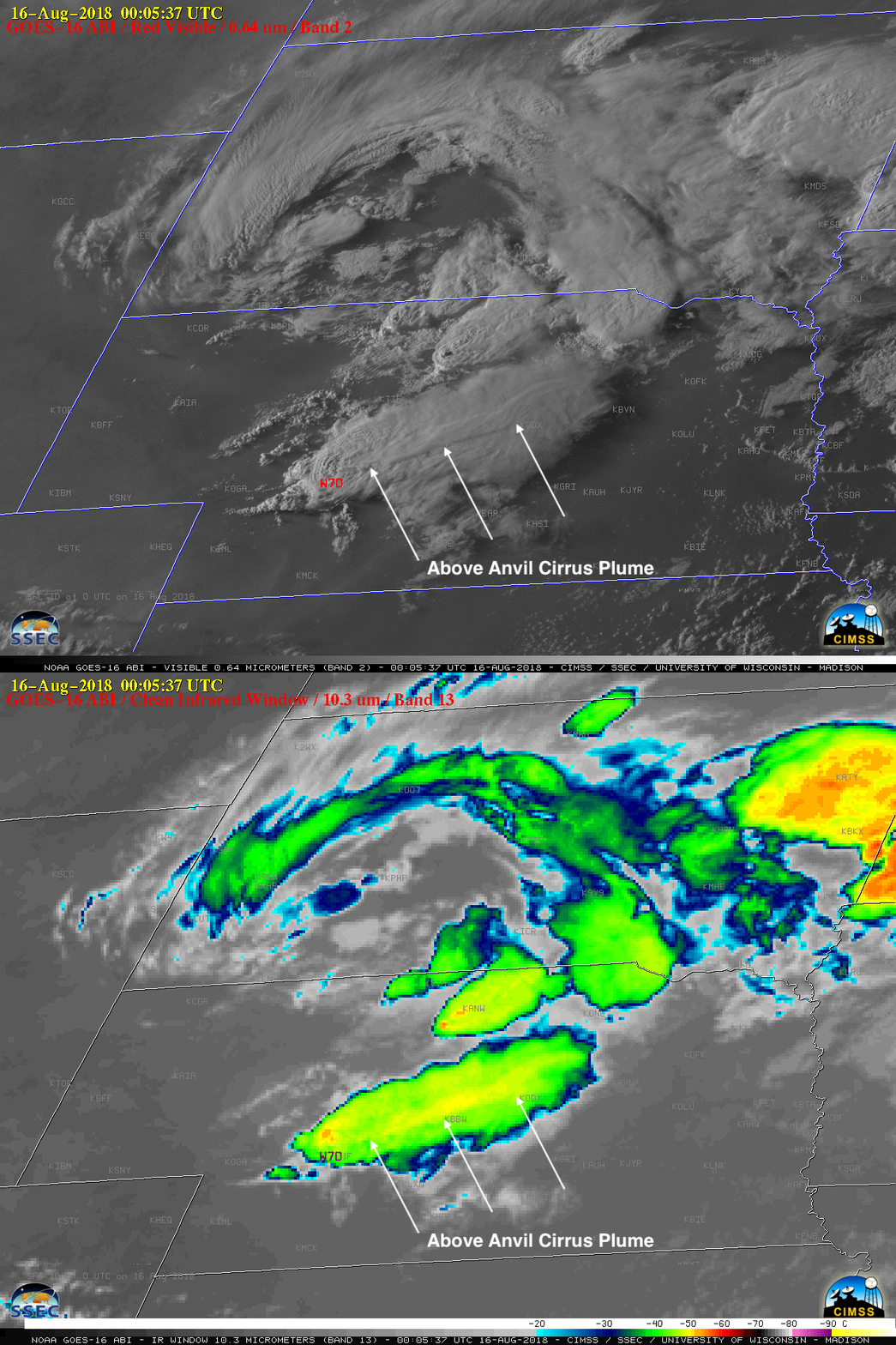
1-minute Mesoscale Domain Sector GOES-16 (GOES-East) “Red” Visible (0.64 µm) images (above) showed the development of thunderstorms which produced large hail and damaging winds across parts of southwestern South Dakota and western/central Nebraska (SPC Storm Reports) on 15 August 2018. The dominant storm in Nebraska exhibited a well-defined Above Anvil Cirrus Plume (AACP), which is often an indicator of a storm producing severe weather such as tornadoes, large hail or damaging wind (reference). Also note the slow-moving parallel bands of boundary layer wave clouds or “billow clouds” in northwestern Nebraska — this is a signature of warmer air flowing along the top of a low-level temperature inversion (caused by a pool of cold outflow from earlier thunderstorms). A stereoscopic view of this convection (using GOES-16 and GOES-17 visible images) can be seen here.The corresponding GOES-16 Mid-level Water Vapor (6.9 µm) images (below) better revealed the broad circulation of a middle-tropospheric low that was centered over South Dakota (500 hPa analysis).
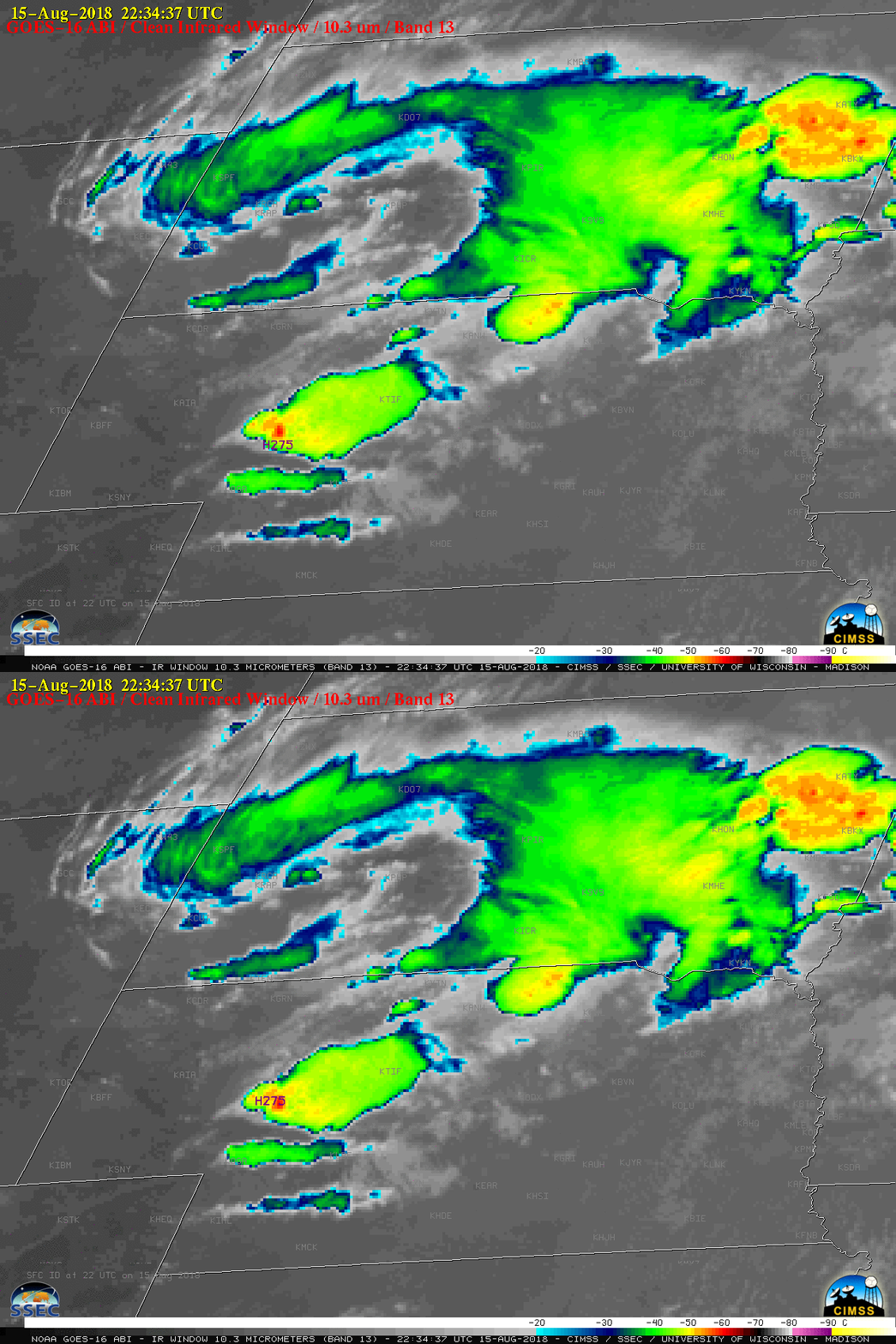
GOES-16 “Clean” Infrared Window (10.3 µm) images (above) showed that the coldest cloud-top infrared brightness temperatures associated with thunderstorm overshooting tops were around -60ºC (darker red enhancement) — slightly warmer than that of the tropopause on rawinsonde data from North Platte, Nebraska (below). Regarding the AACP feature, in this case the plume was colder than the adjacent underlying thunderstorm anvil, as seen in a toggle between GOES-16 Visible and Infrared images at 0005 UTC — when the storm produced a wind gust of 70 mph at the surface (below). The temperature profile and lapse rate of the upper tropospheric/lower stratospheric air directly above the thunderstorm overshooting top will have an influence on whether an AACP is warmer or colder than the underlying thunderstorm anvil surface. Finally, when trying to correlate the location of storm-top satellite image features with reports of hail/wind/tornadoes at the surface, it is important to factor in the effect of parallax. The GOES-16 satellite (positioned over the Equator at 75.2º W longitude) viewing angle for the North Platte area is 54 degrees — which has the effect of shifting the apparent location of storm-top features to the northwest of their true location over the Earth’s surface. The pair of image toggles shown below demonstrate how the “parallax-corrected” (northwest-shifted) location of the hail or wind reports more closely aligns with the cold overshooting top (orange to red enhancement) associated with the strongest storm updraft at that time.