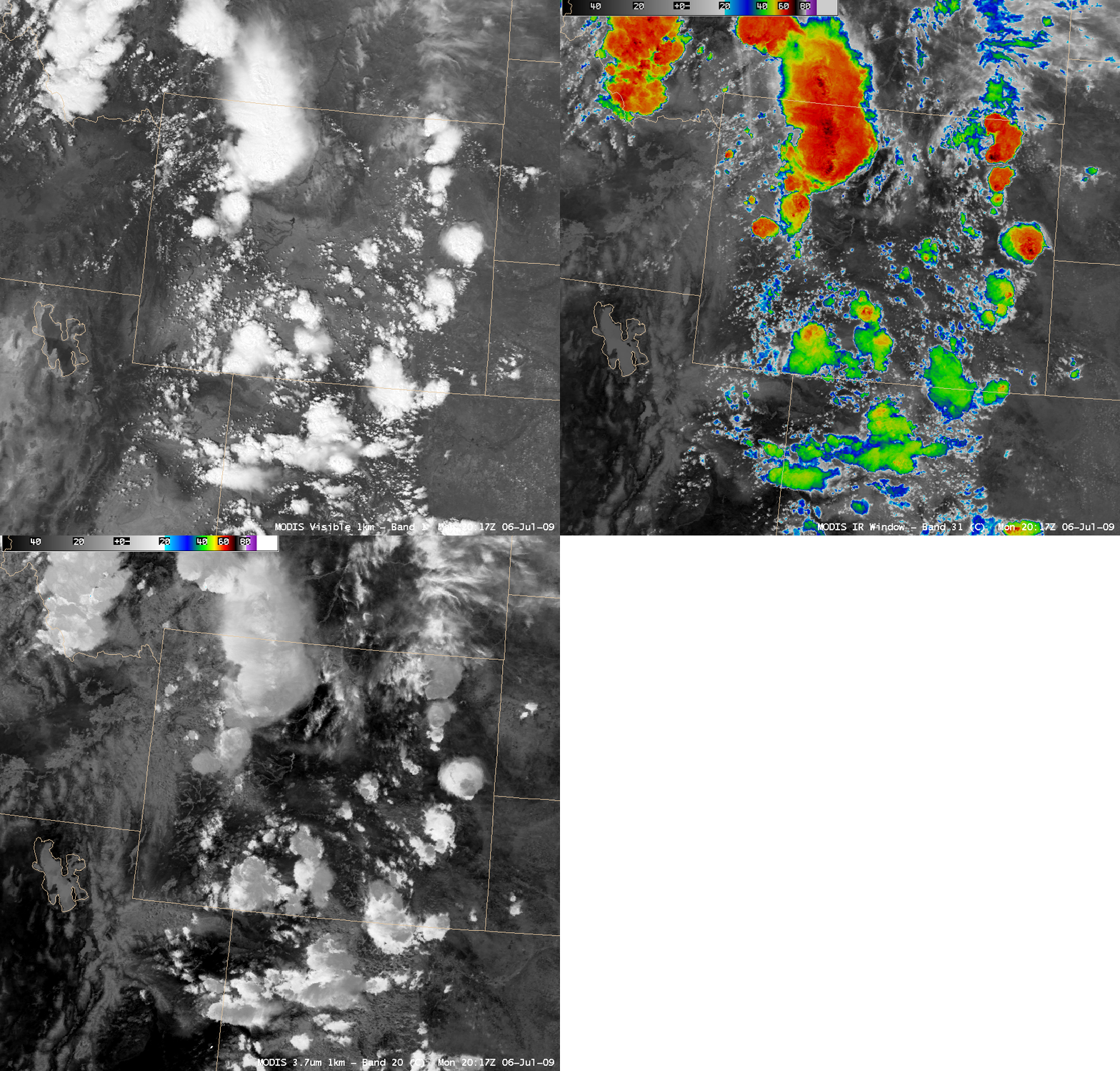
Convective storm tops and different sizes of cloud ice crystals
AWIPS images of the 1-km resolution MODIS visible, 11.0 µm IR window, and 3.7 µm shortwave IR channel data (above) showed some interesting differences in the appearance of convective storm tops over the northern and central Rocky Mountain region on 06 July 2009. Note that some portions of the storm tops appear significantly warmer (darker gray colors) on the 3.7 µm image — this is due to solar reflection off of smaller ice particles within the upper anvil layer. Such differences in cloud top particle size are not apparent on the visible or the standard IR window images (nor do they necessarily correspond to differences seen in the IR brightness temperature patterns on the storm tops). Storms forming with stronger updrafts may produce a higher concentration of smaller ice crystals within the anvil region of the storm top, due to less time for the ice particles to grow in size during their rapid ascent.


