Severe thunderstorms in southwest Missouri
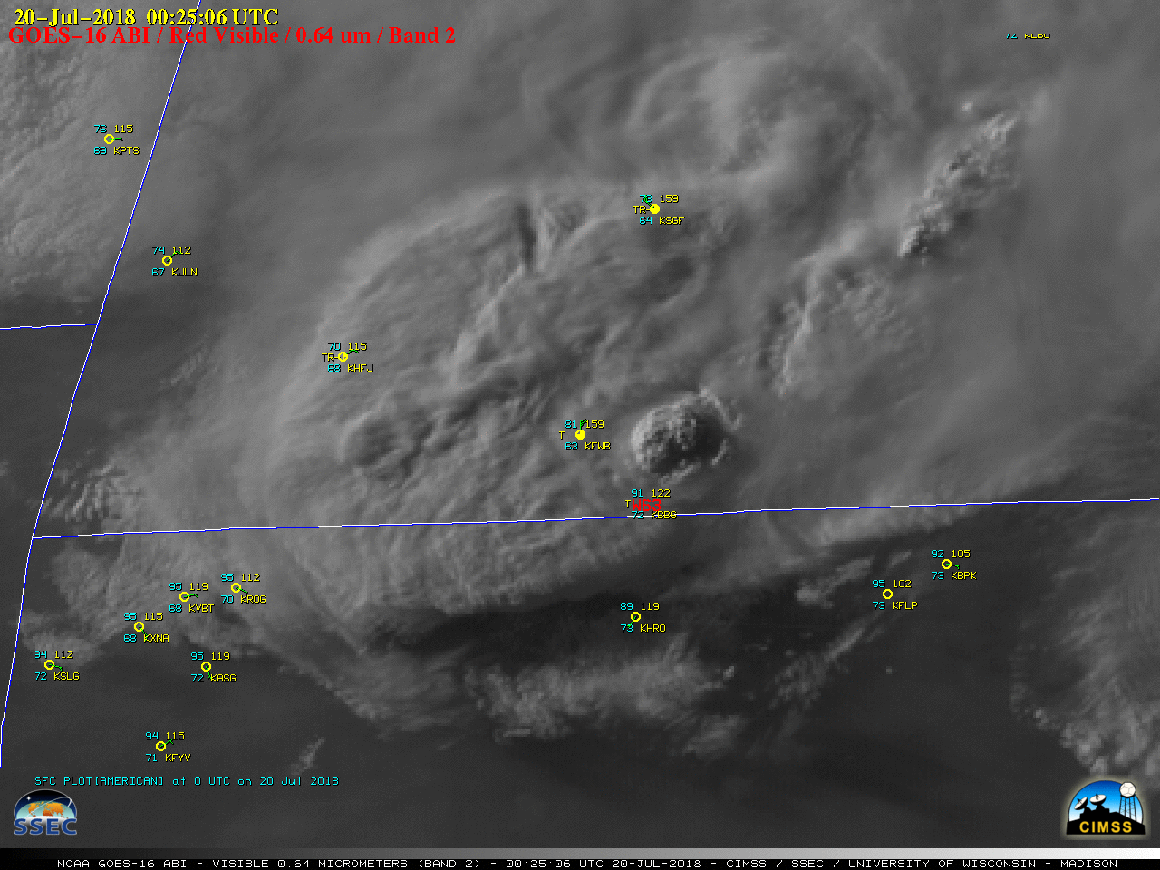
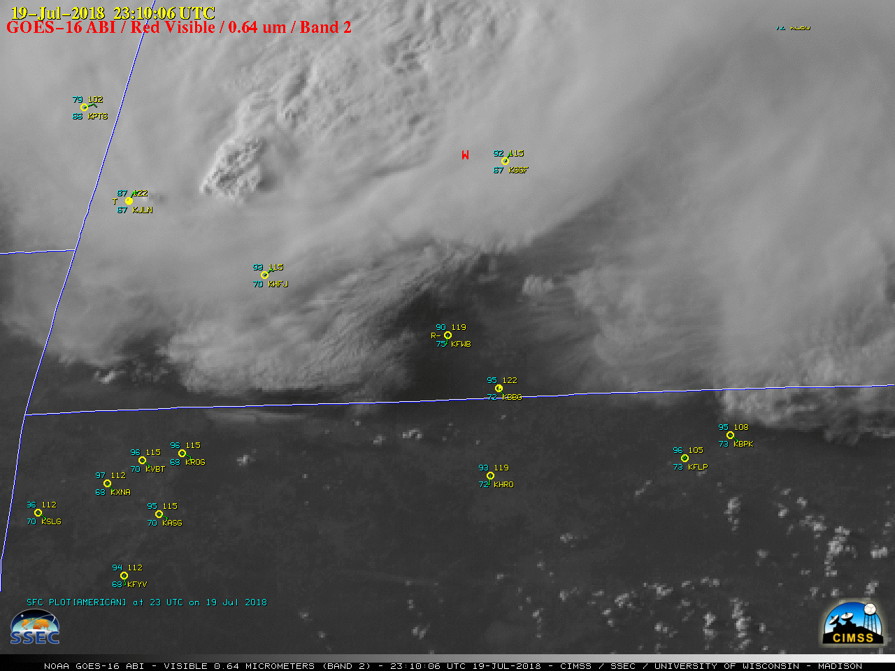
GOES-16 “Red” Visible (0.64 µm), with hourly surface plots plotted in cyan/yellow and SPC storm reports plotted in red [click to play MP4 animation | Animated GIF]
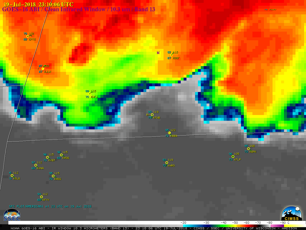
The overshooting tops of these intensifying storms began to penetrate the anvil debris of pre-existing convection after about 2330 UTC in the Monett KHFJ area, with an above-anvil cirrus plume becoming evident after 0000 UTC. The 0025 UTC image showed yet another new cell which had recently developed immediately northeast of Branson; its overshooting tops began rapidly penetrating the anvil debris of the aforementioned storms at 0018 UTC.
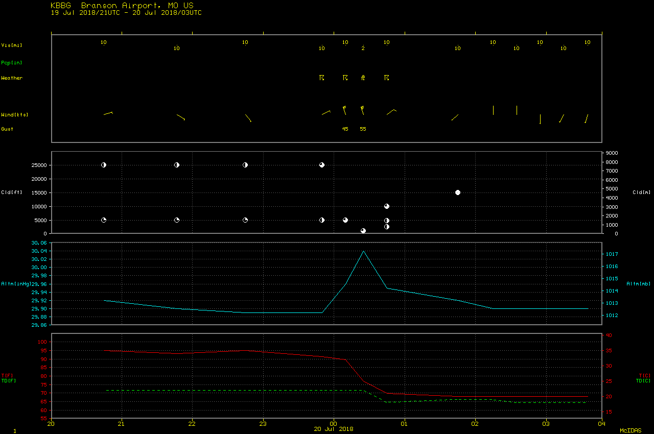
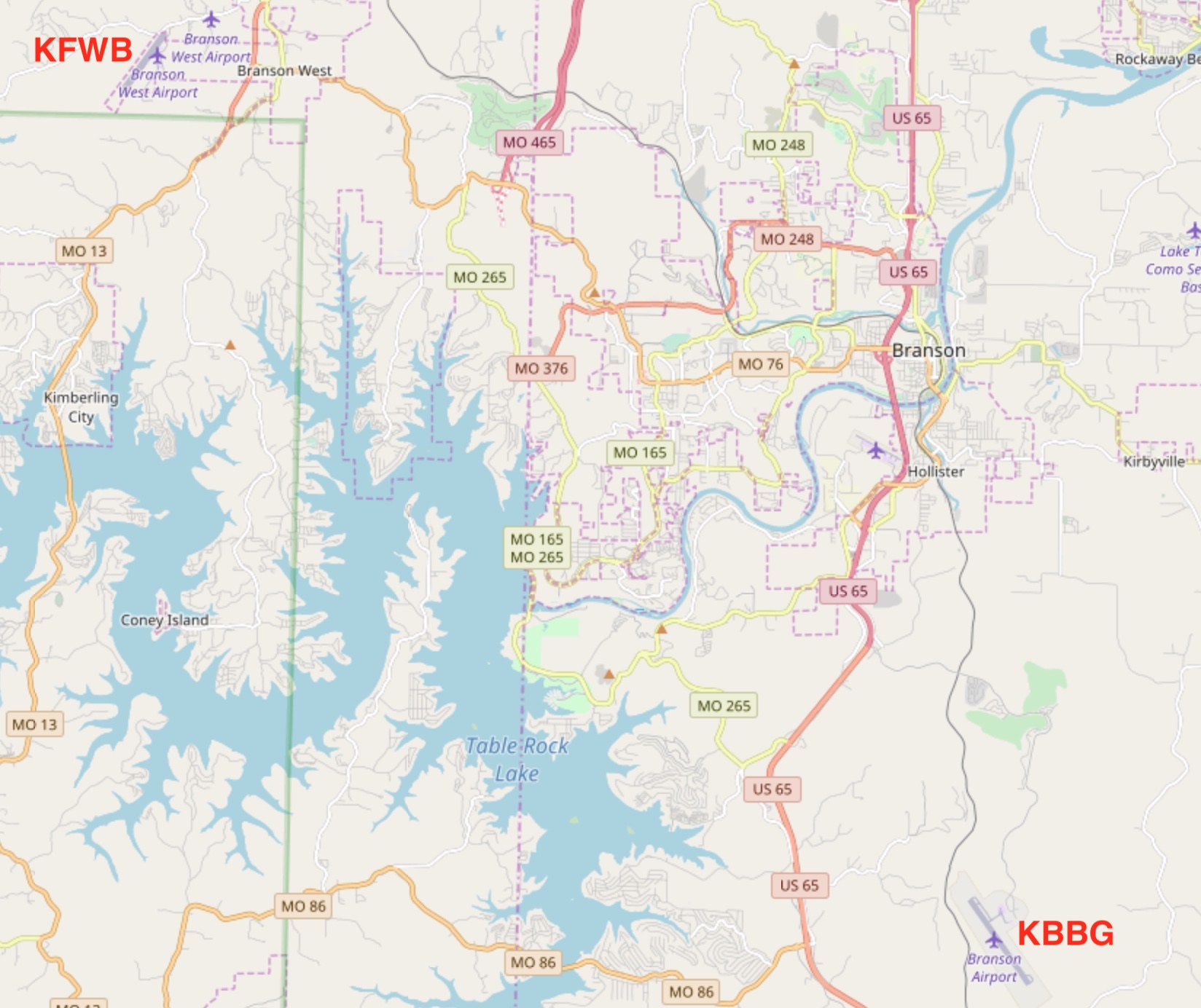
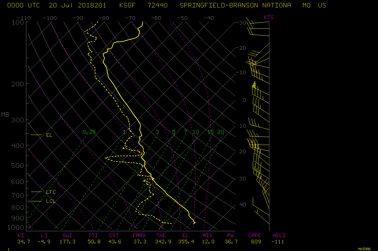
The corresponding GOES-16 “Clean” Infrared Window (10.3 µm) images (below) revealed cloud-top infrared brightness temperatures cooling to the -75 to -79ºC range (shades of light gray to white) with these thunderstorms, significantly colder than the -68.5ºC tropopause temperature on the 00 UTC Springfield MO rawinsonde report (plot | text).
![GOES-16 "Clean" Infrared Window (10.3 µm), with hourly surface plots plotted in cyan/yellow and SPC storm reports plotted in dark blue [click to play MP4 animation | Animated GIF]](https://cimss.ssec.wisc.edu/satellite-blog/wp-content/uploads/sites/5/2018/07/G16_IR_MO_SVR_19JUL2018_960x1280_B13_2018201_002506_0001PANEL_00056.GIF)
GOES-16 “Clean” Infrared Window (10.3 µm), with hourly surface plots plotted in cyan/yellow and SPC storm reports plotted in purple [click to play MP4 animation | Animated GIF]