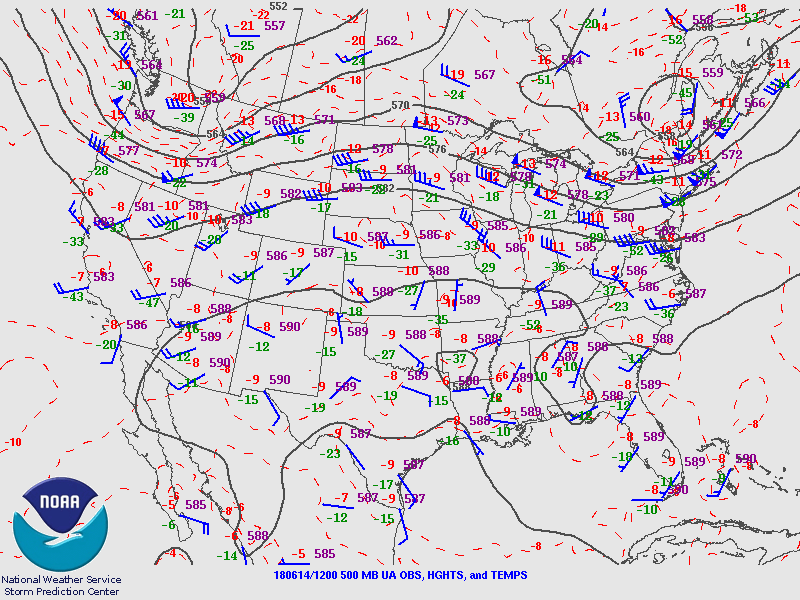
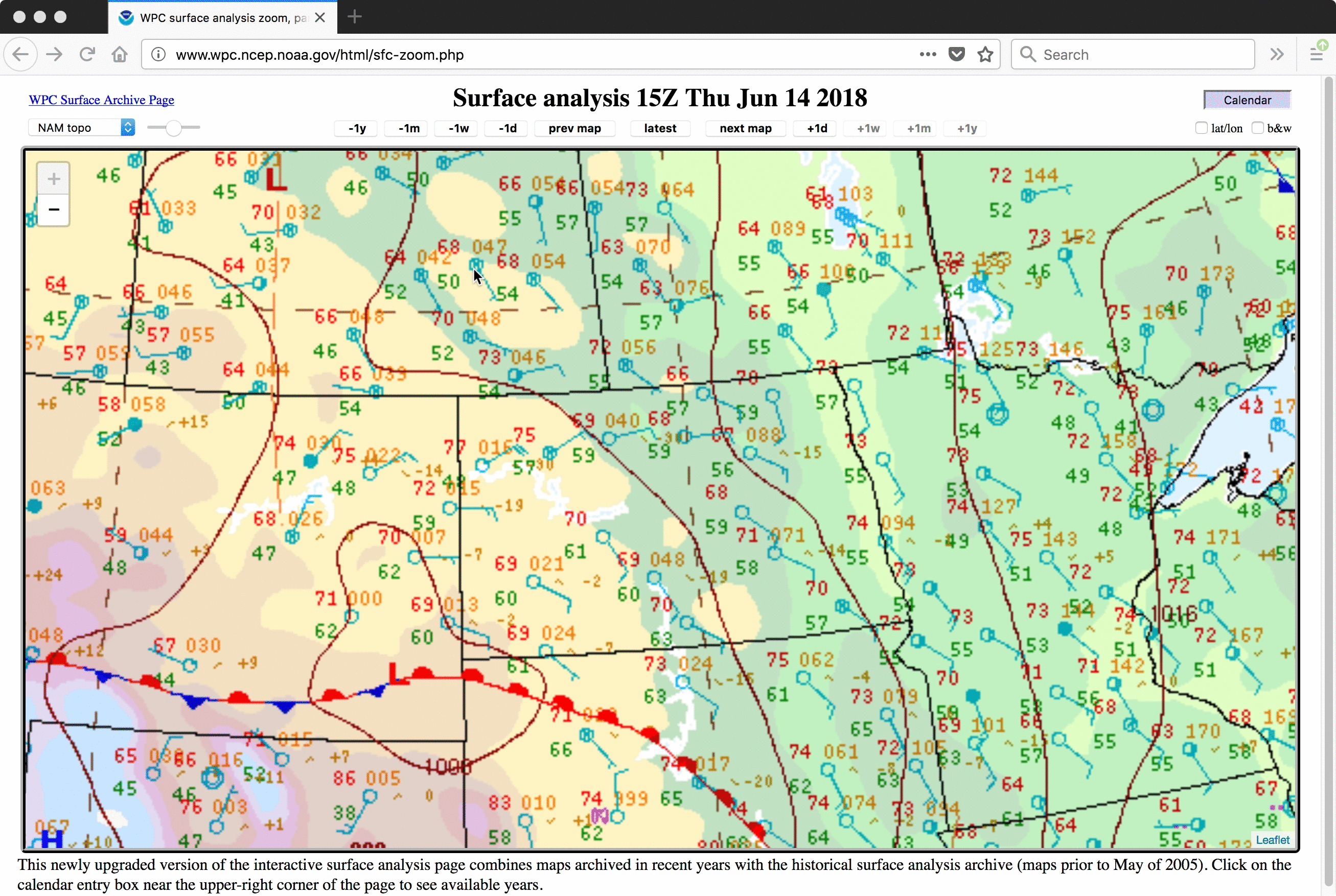
Severe thunderstorms in North Dakota
![GOES-16 Mid-level Water Vapor (6.9 µm) images, with SPC storm reports plotted in red [click to play MP4 animation]](https://cimss.ssec.wisc.edu/satellite-blog/wp-content/uploads/sites/5/2018/06/G16_WV9_NCUS_14JUN2018_960x1280_B9_2018166_023722_0001PANEL_00176.GIF)
GOES-16 Mid-level Water Vapor (6.9 µm) images, with SPC storm reports plotted in red [click to play MP4 animation]
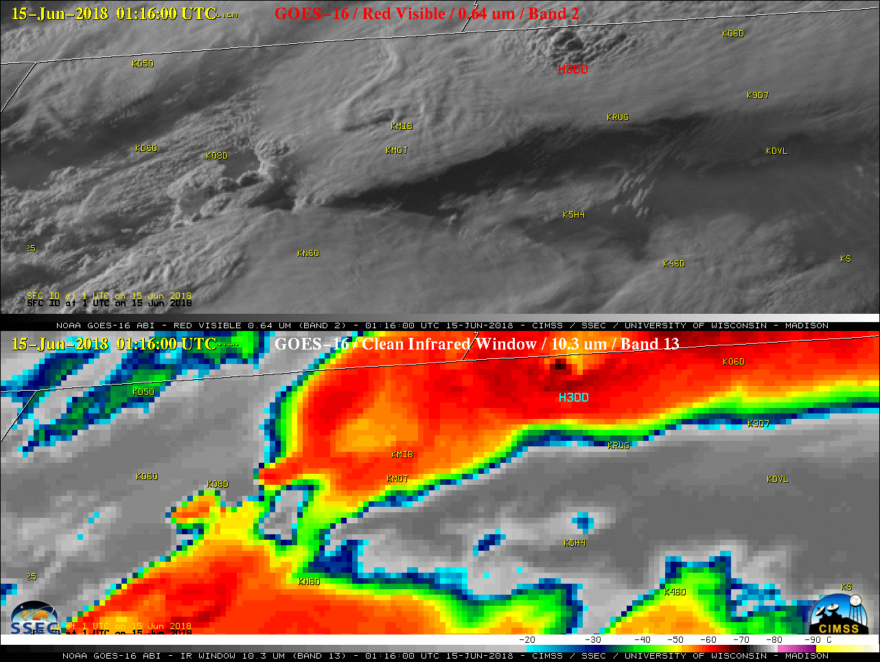
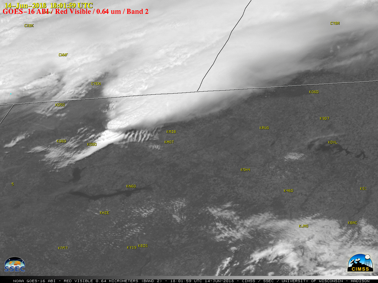
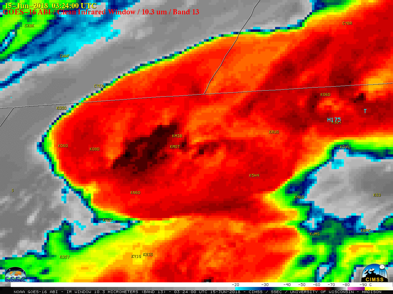
A Mesoscale Domain Sector was positioned over that region, providing images at 1-minute intervals; a comparison of “Red” Visible (0.64 µm) and “Clean” Infrared Window (10.3 µm) images (below) showed the development of this severe convection, which produced hail as large as 3.0 inches in diameter and 4 tornadoes (NWS Bismarck | NWS Grand Forks). The images include plots of SPC storm reports — just across the US/Canada border, storm reports in southern Saskatchewan/Manitoba can be seen here. Some of these storms exhibited very high radar reflectivity values, as shown here and here.
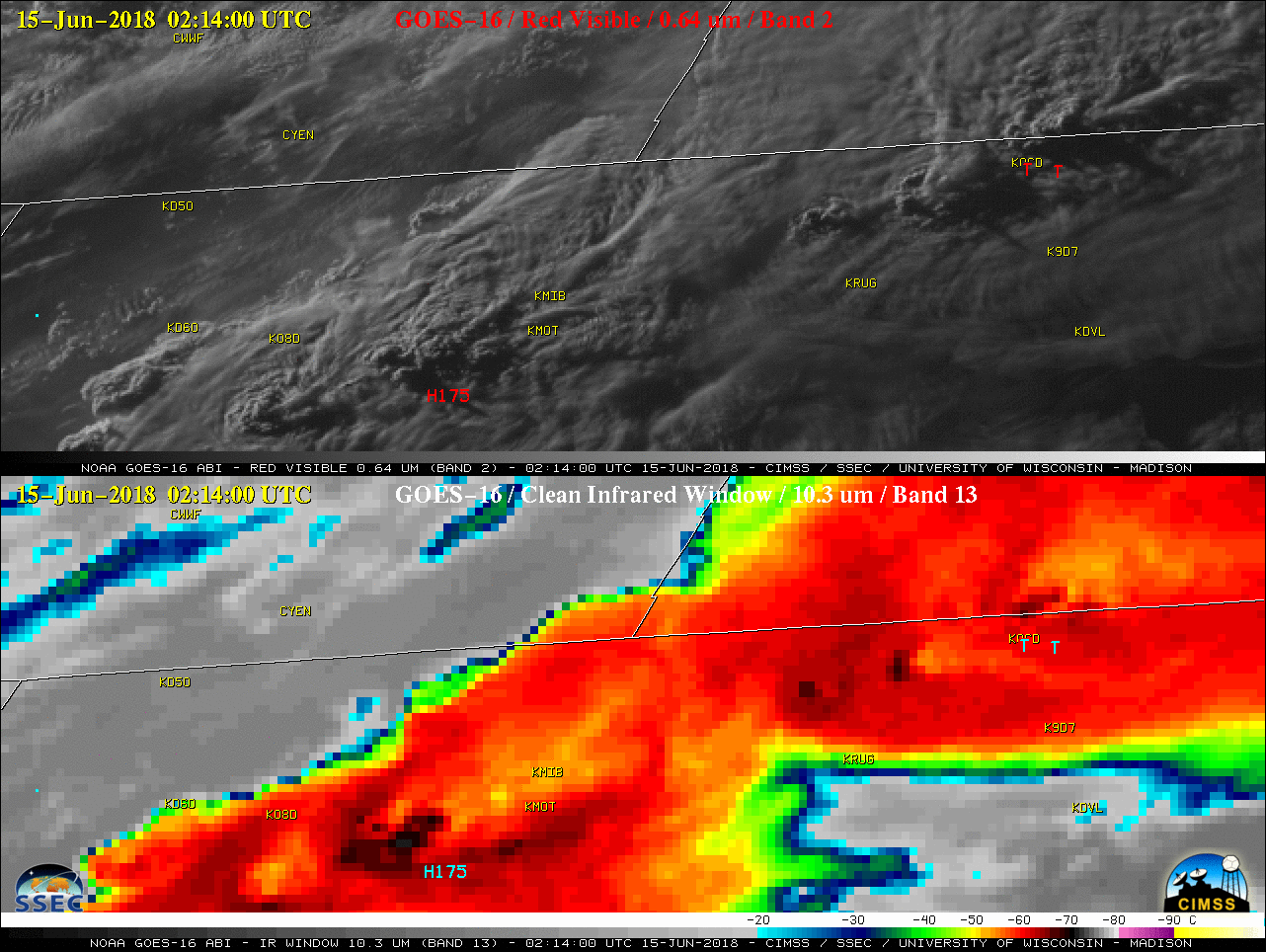
1-minute GOES-16 “Red” Visible (0.64 µm, top) and “Clean” Infrared Window (10.3 µm, bottom) images, with SPC storm reports plotted in red/cyan [click to play MP4 animation]
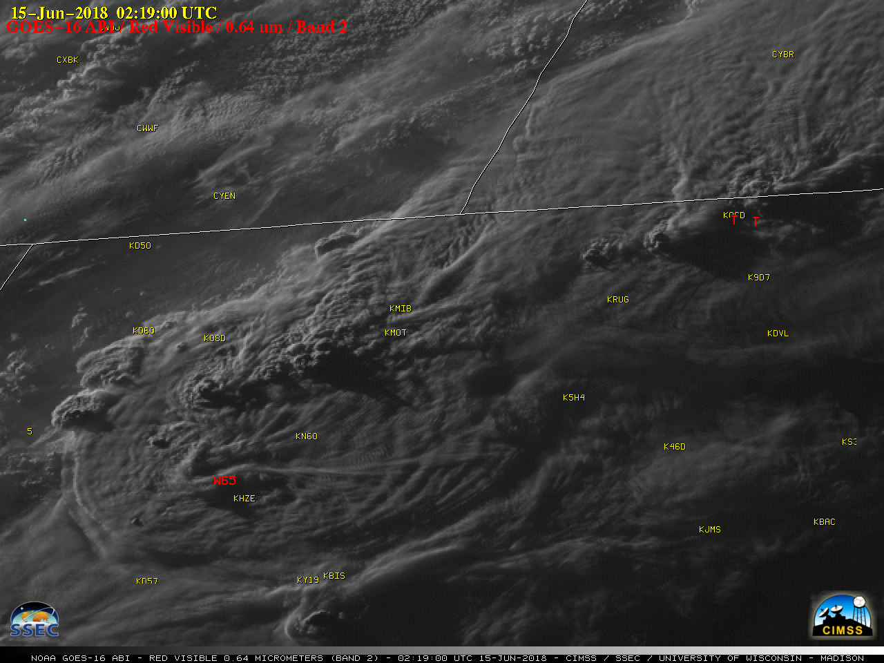
1-minute GOES-16 “Red” Visible (0.64 µm) images, with SPC storm reports plotted in red [click to play MP4 animation]
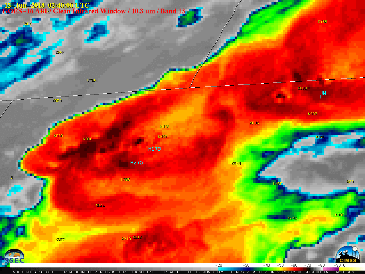
1-minute GOES-16 “Clean” Infrared Window (10.3 µm) images, with SPC storm reports plotted in cyan [click to play MP4 animation]