Ice dam in Lake Erie
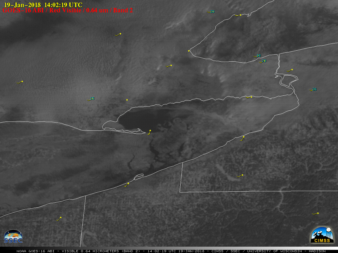
GOES-16 “Red” Visible (0.64 µm) images, with hourly surface wind barbs plotted in yellow and wind gusts (knots) plotted in cyan [click to play animation]
A toggle between 250-meter resolution Terra MODIS True-color and False-color Red-Green-Blue (RGB) images from the MODIS Today site (below) provided a more detailed view of the Lake Erie ice dam and upwind drift ice at 1615 UTC. Snow and ice appear as shades of cyan in the False-color image, in contrast to supercooled water droplet clouds which are shades of white.
![Terra MODIS True-color and False-color RGB images [click to enlarge]](https://cimss.ssec.wisc.edu/satellite-blog/wp-content/uploads/sites/5/2018/01/180119_1615utc_terra_modis_truecolor_falsecolor_anim.gif)
Terra MODIS True-color and False-color RGB images; red arrows denote the location of the ice dam [click to enlarge]
![Terra MODIS Visible (0.65 µm) image with surface METAR reports and RTMA surface winds [click to enlarge]](https://cimss.ssec.wisc.edu/satellite-blog/wp-content/uploads/sites/5/2018/01/180119_1607utc_terra_modis_visible_metars_rtma_surface_winds_Lake_Erie_anim.gif)
Terra MODIS Visible (0.65 µm) image with surface METAR reports and RTMA surface winds [click to enlarge]
![Terra MODIS and Suomi NPP VIIRS Visible images, with METAR surface reports [click to enlarge]](https://cimss.ssec.wisc.edu/satellite-blog/wp-content/uploads/sites/5/2018/01/180119_modis_viirs_visible_Lake_Erie_anim.gif)
Terra MODIS and Suomi NPP VIIRS Visible images, with METAR surface reports [click to enlarge]