GOES-16 ABI Mesoscale Sector imagery and GLM data with strong thunderstorms over Wisconsin
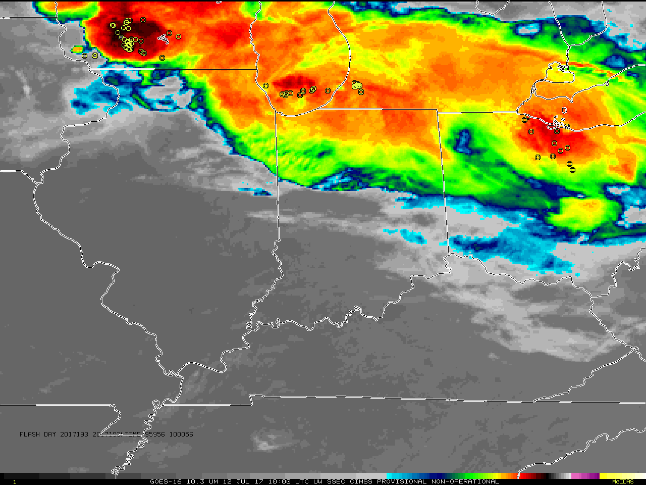
GOES-16 ABI Band 13 (“Clean Window”) 10.3 µm Imagery, every minute from 1000 – 1359 UTC on 12 July 2017, with GLM Lightning Flash locations for each minute (yellow circles) superimposed (Click to animate)
GOES-16 ABI and GLM data posted on this page are preliminary, non-operational and are undergoing testing
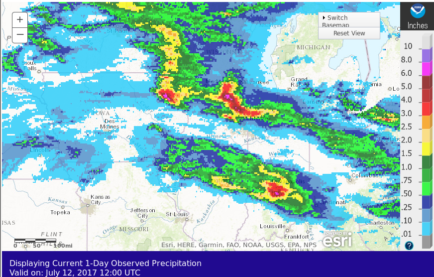
Strong morning thunderstorms with a few severe weather reports, and abundant heavy rain (24-h totals ending 1200 UTC on 12 July 2017, from here), spread over the northern part of the GOES-16 default western Mesoscale Sector on the morning of 12 July 2017. The animation above shows the GOES-16 Advanced Baseline Imager (ABI) 10.3 µm imagery with Geostationary Lightning Mapper (GLM) Lightning Flash event locations superimposed, at 1-minute timescales. The top of the default Mesoscale Sector cuts through central Wisconsin.
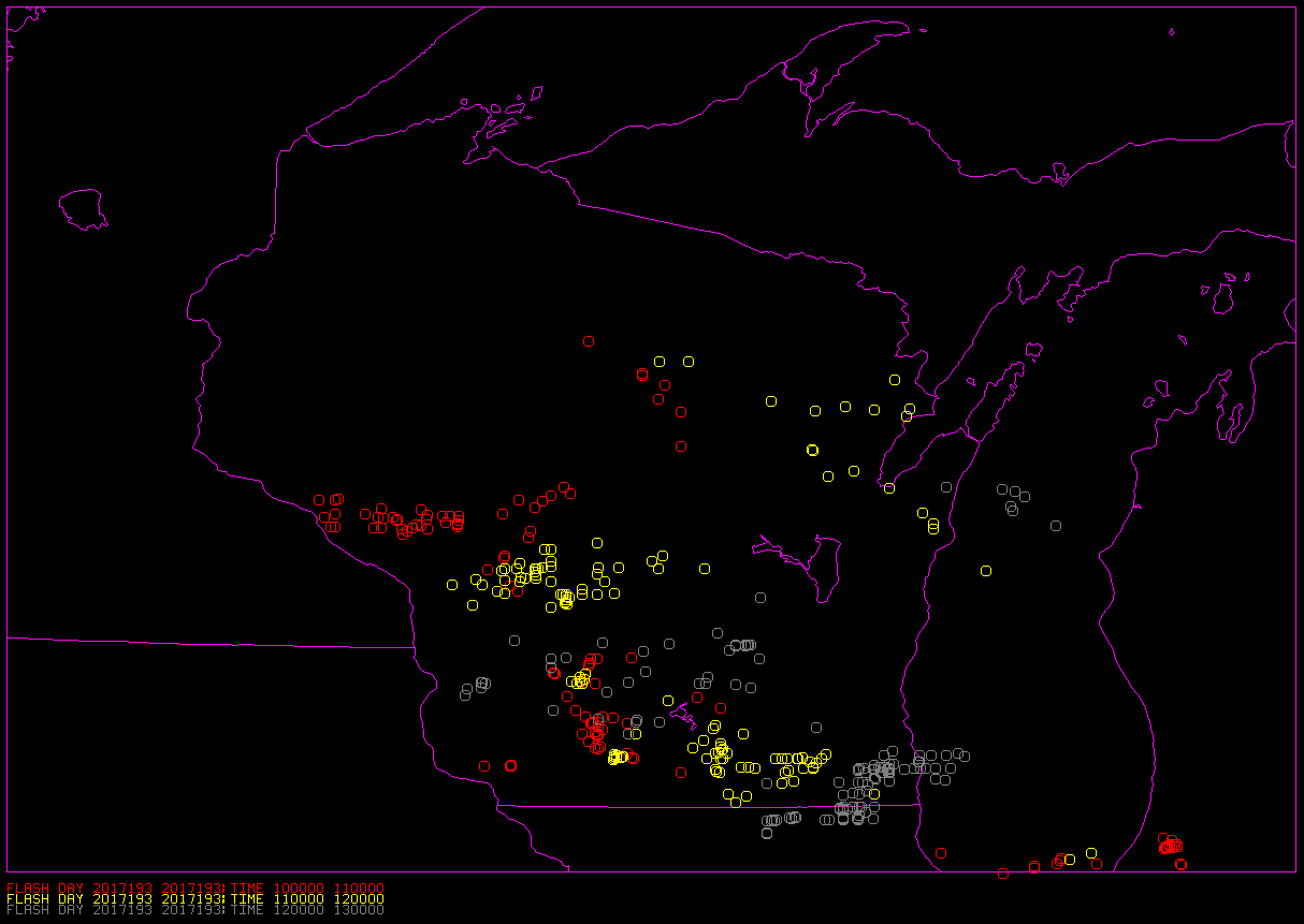
Click here to see a graphic with the GLM Flashes for the 3 different hours.