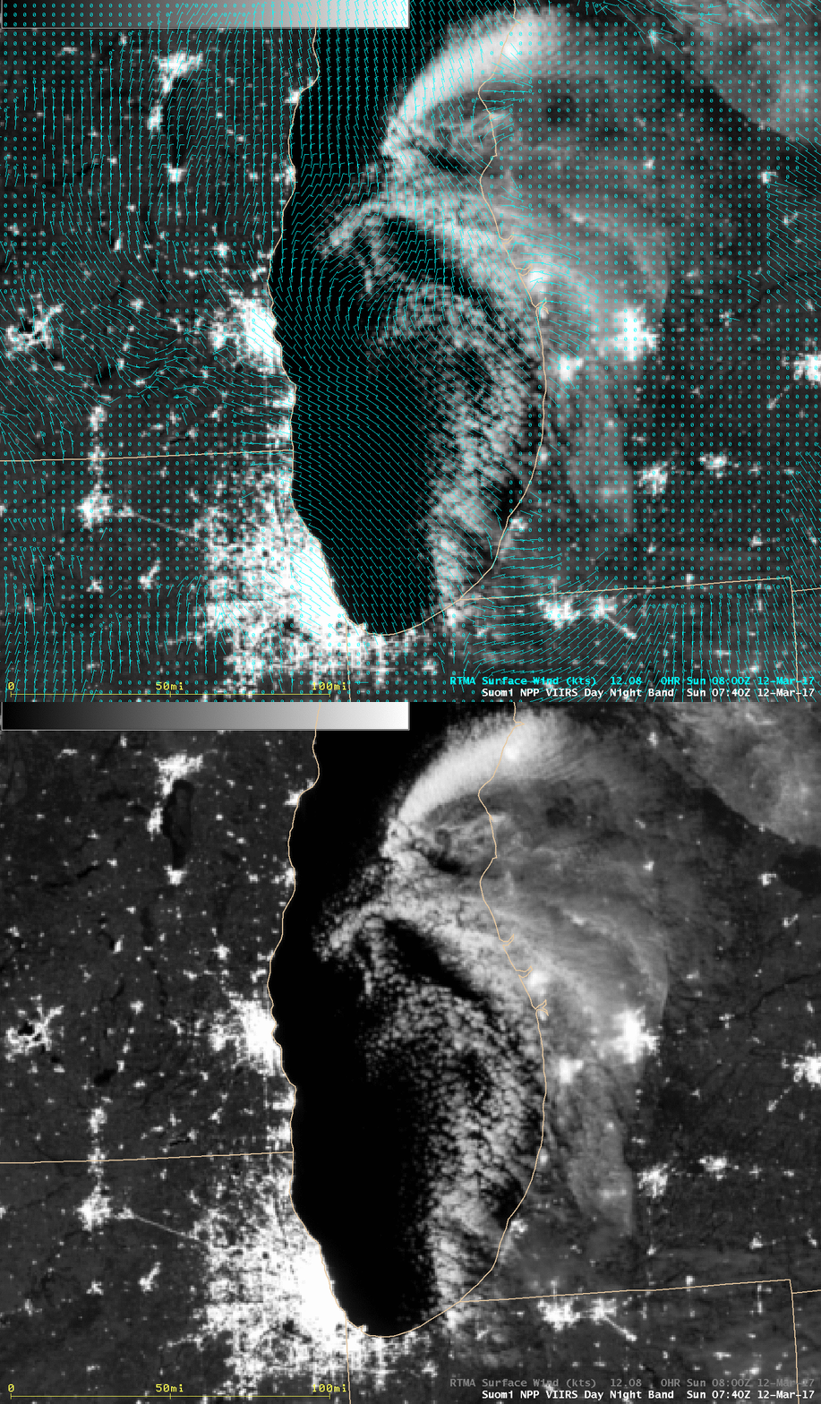
Mesovortex over Lake Michigan
** The GOES-16 data posted on this page are preliminary, non-operational data and are undergoing testing. **A Suomi NPP VIIRS Day/Night Band (0.7 µm) image (above) revealed the formative stage of a mesoscale vortex over Lake Michigan at 0740 UTC or 2:40 AM Central time on 12 March 2017.
During the subsequent daylight hours, GOES-16 Visible (0.64 µm) images (below) showed the continued development and motion of the mesovortex.
.
2.5hr GOES-16 1min resolution animation of a meso-low over southern Lake MI this morning (Data is preliminary & non-operaitonal). pic.twitter.com/mJrmphY6SD
— NWS Marquette (@NWSMarquette) March 12, 2017
As was shown in a Tweet from NWS Marquette (above), beginning at 1741 UTC one of the GOES-16 Mesoscale Sectors was moved far enough northward to provide 1-minute imagery of the mesovortex (below; also available as an MP4 animation).
At South Haven, Michigan (KLWA), the surface visibility was reduced to 5 miles with light snow at 2014 UTC (below) as one of the more well-defined cloud elements associated with the mesovorex moved inland over that location.

