Tropical Storm Joaquin off the East Coast of the United States
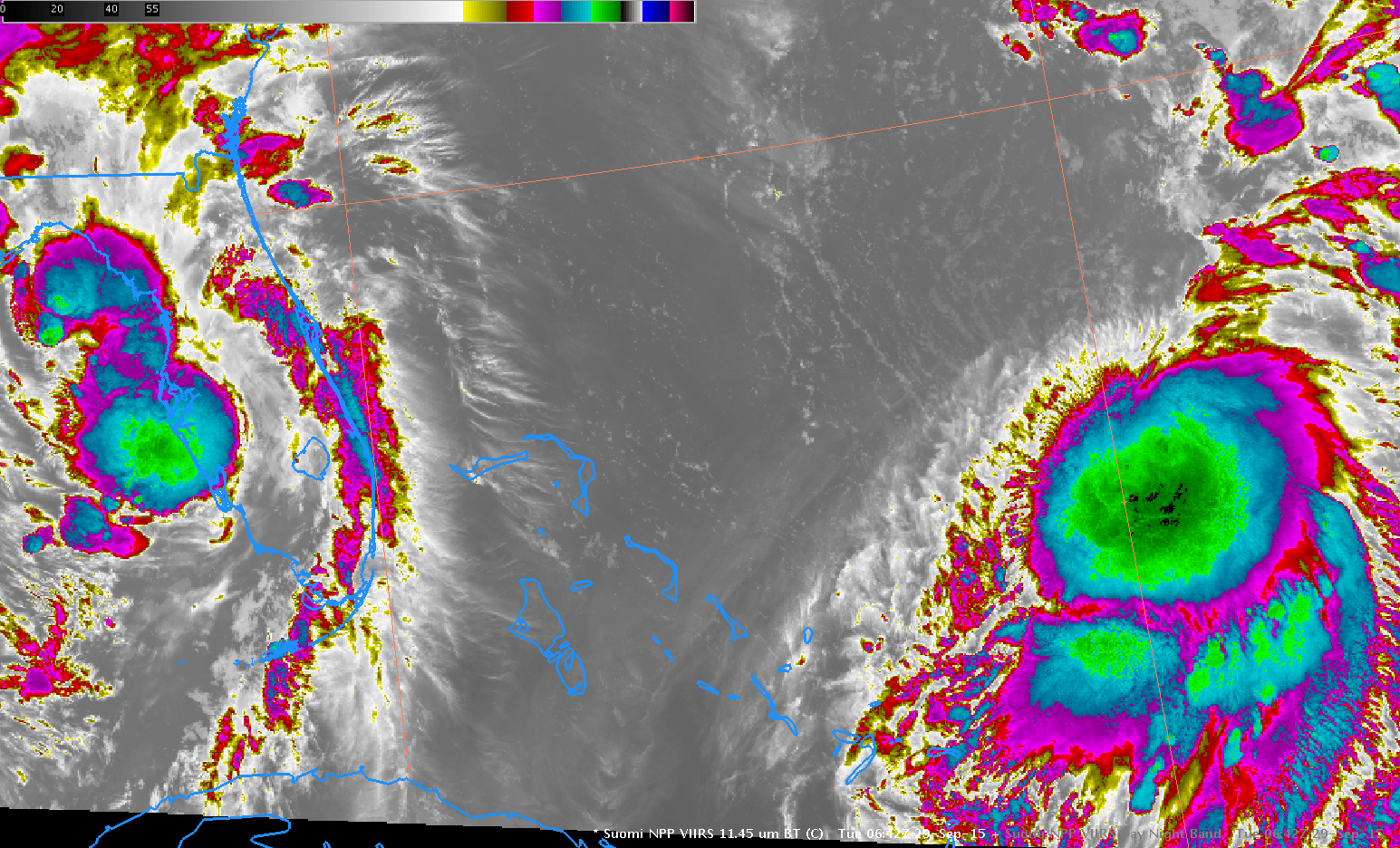
![Suomi NPP VIIRS 11.45 µm Infrared and Day/Night Band 0.70 µm Visible images [click to enlarge]](https://cimss.ssec.wisc.edu/satellite-blog/wp-content/uploads/sites/5/2015/09/SNPP_DNB_1145_0p7_0629_29September2015toggle.gif)
Suomi NPP VIIRS 11.45 µm Infrared and Day/Night Band 0.70 µm Visible images [click to enlarge]
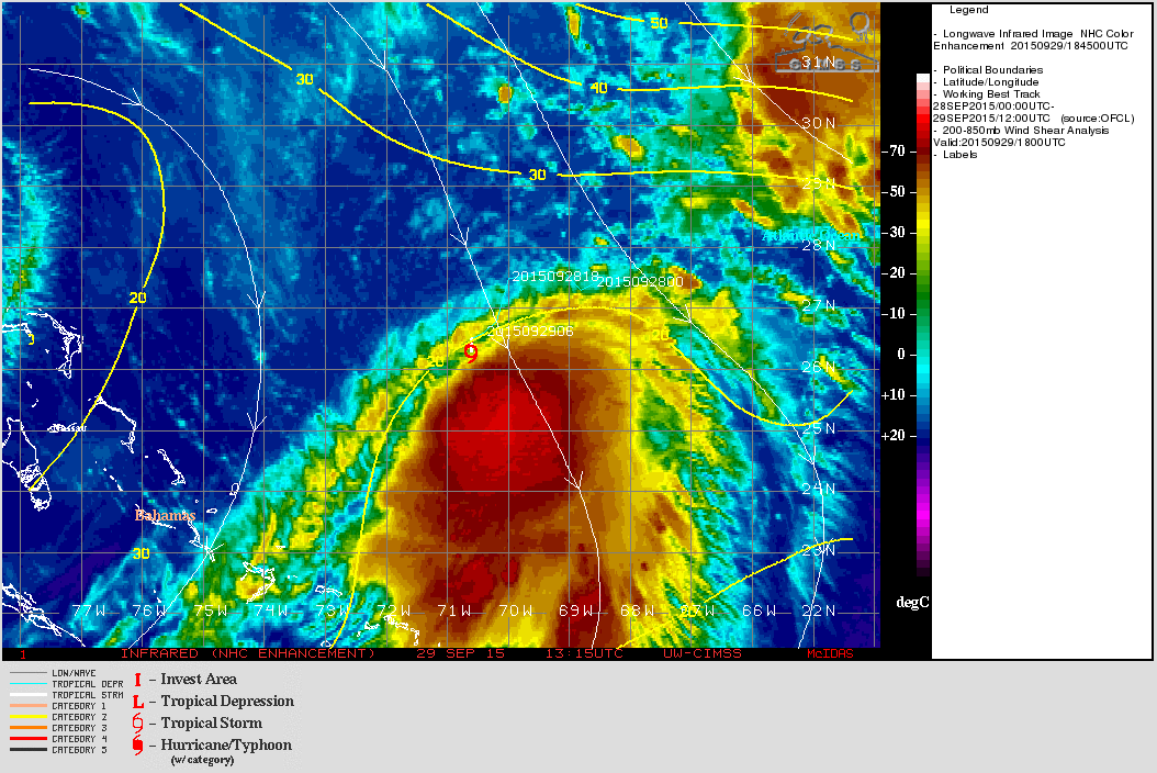
Tropical Storm Joaquin over the Tropical Atlantic is forecast to move northward off the East Coast of the United States during the week of 28 September to 3 October. The toggle above shows Suomi NPP VIIRS 11.45 µm Infrared imagery and Day/Night Band 0.70 µm visible imagery (illuminated by a near-Full moon) at 0642 UTC or 1:42 am local time on 29 September. The presence of northerly deep-layer wind shear (image below from the CIMSS Tropical Cyclones site; animation of GOES-13 IR images) causes the strongest convection to be displaced to the south of the surface circulation, and a small cloud swirl (the low-level circulation center of Joaquin: magnified image) is apparent in the night-time visible imagery near 26.7º N, 70.3º W, northwest of the strongest convection.
![850-200 hPa Wind Shear Analysis, 1500 UTC 29 September 2015 [click to enlarge]](https://cimss.ssec.wisc.edu/satellite-blog/wp-content/uploads/sites/5/2015/09/WindShear1500UTC_29Sept2015.gif)
850-200 hPa Wind Shear Analysis, 1500 UTC 29 September 2015 [click to enlarge]
Analyses of Total Precipitable Water, below, from Morphed Microwave Data, show the storm forming in an environment rich in moisture. Note also the generous moisture amounts in the northeastern Gulf of Mexico. Joaquin is forecast to move northward off the East Coast of the United States. As it moves, the storm will draw with it abundant moisture.
![Total Precipitable Water, 1500 UTC 26 September - 1400 UTC 29 September 2015 [click to enlarge]](https://cimss.ssec.wisc.edu/satellite-blog/wp-content/uploads/sites/5/2015/09/MIMIC_TPW_1500_26September_1400_29September.gif)
Total Precipitable Water, 1500 UTC 26 September – 1400 UTC 29 September 2015 [click to enlarge]
![GOES-13 Water Vapor Infrared (6.5 µm) Imagery [click to Play Animation]](https://cimss.ssec.wisc.edu/satellite-blog/wp-content/uploads/sites/5/2015/09/1000x1600_AGOES13_B3_JOAQUIN_WV1_animated_2015265_024500_180_2015272_174500_180_WVCOLOR35.gif)
GOES-13 Water Vapor Infrared (6.5 µm) Imagery [click to Play Animation]
A week-long animation of GOES-13 Water Vapor imagery, above, shows Joaquin developing over the tropical Atlantic in a region that was initially a large upper-level low pressure system.
![GOES-13 Storm-Centered Infrared Window Channel (10.7 µm) Imagery [click to Play Animation]](https://cimss.ssec.wisc.edu/satellite-blog/wp-content/uploads/sites/5/2015/09/GOES13_IR4_28-29SEP2015animMAP.gif)
GOES-13 Storm-Centered Infrared Window Channel (10.7 µm) Imagery [click to Play Animation]
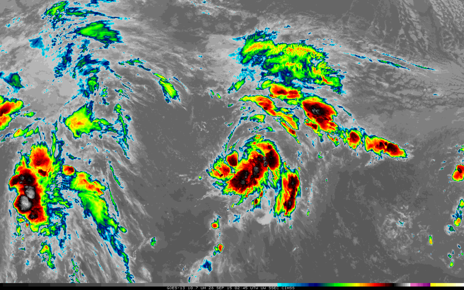
The animation above shows GOES-13 10.7 µm Infrared imagery centered on the latitude/longitude point for each of the 6-hour-interval advisories issued by the National Hurricane Center during Joaquin’s first two days (click here for an animation without a map). The slow increase in organization, symmetry and high cold cloud tops is apparent. Note also that outflow to the north is occurring at the end of the animation, suggestive of a relaxation in northerly wind shear.
For the latest information on Joaquin, consult the National Hurricane Center and the CIMSS Tropical Cyclones site.