Significant rainfall event in California
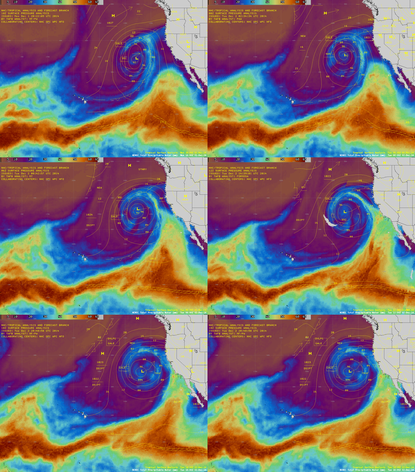
As of 25 November 2014, much of the state of California was experiencing extreme to exceptional drought conditions. However, the development of a large occluded mid-latitude cyclone over the far eastern Pacific Ocean during the 01 December – 02 December time period began to draw high values (up to 60 mm or 2.4 inches, darker red color enhancement) of total precipitable water (TPW) northward from the Inter-Tropical Convergence Zone (ITCZ), as seen on AWIPS images of the MIMIC TPW product (above). While the rainfall was beneficial in terms of drought mitigation, amounts of up to 12 inches did cause flooding and mudslide problems in some locations.
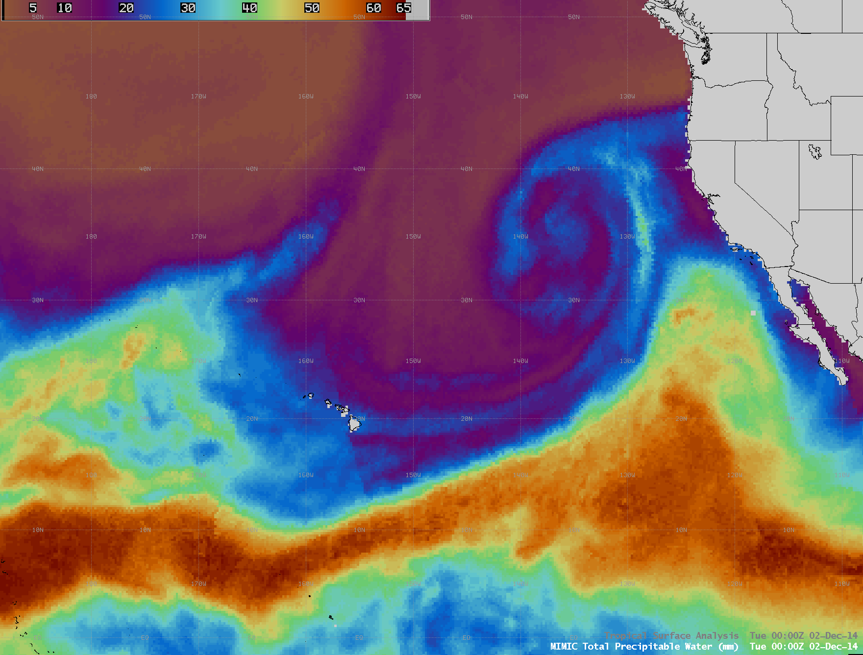
An animation of hourly MIMIC TPW images from 30 November – 02 December (below; click image to play animation) showed the northward surge of moisture toward the California coast, and also hinted at a complex inner structure associated with the occluded low.
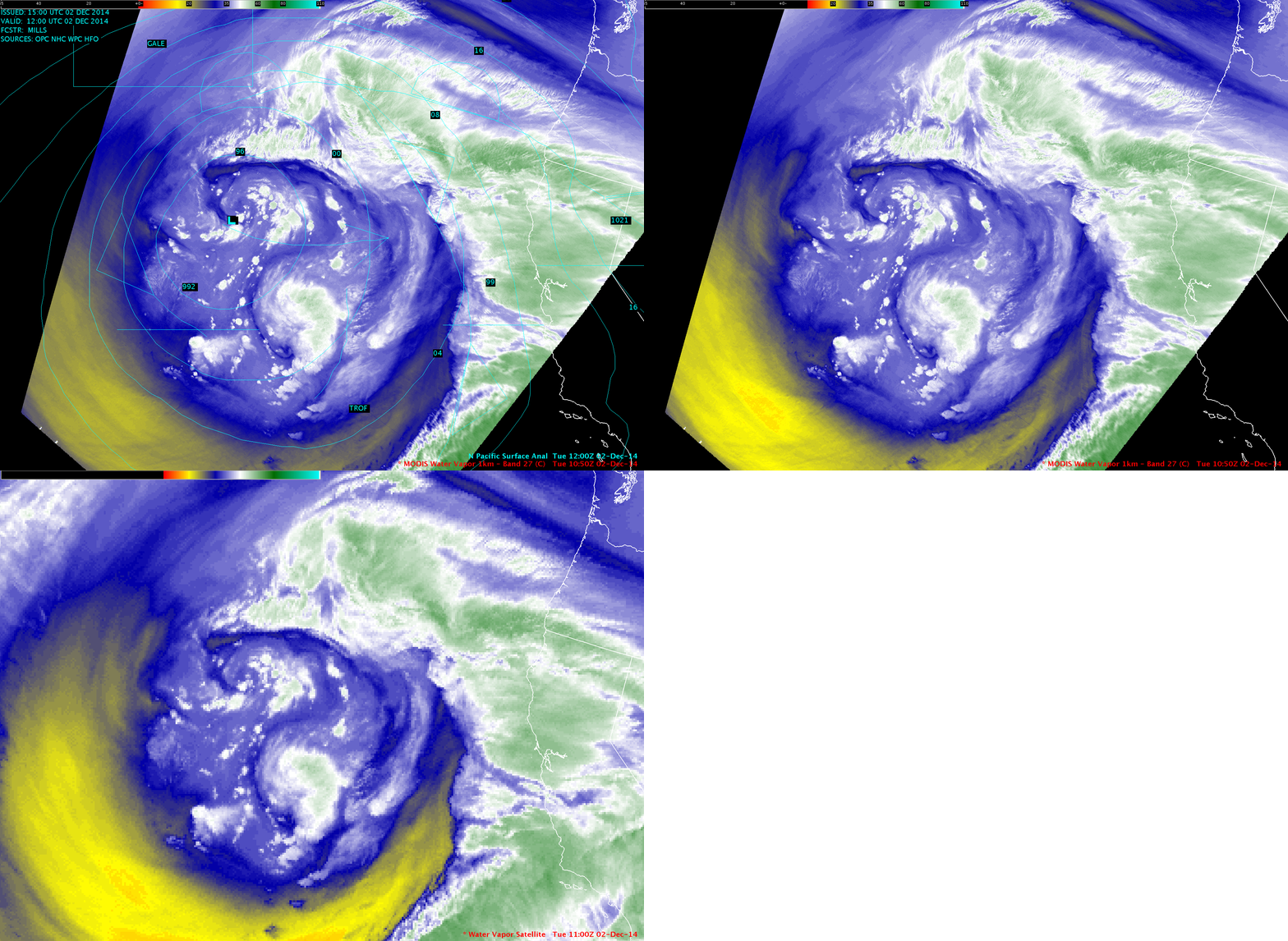
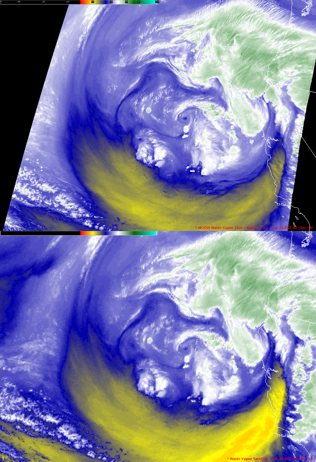
On 02 December, comparisons of AWIPS II images of 1-km resolution MODIS 6.7 µm and 4-km resolution GOES-15 6.5 µm water vapor channel data around 11 UTC (above) and around 22 UTC (below) demonstrated the importance of improved spatial resolution for more clearly identifying some of the smaller-scale structure features within the core of the occluded low.
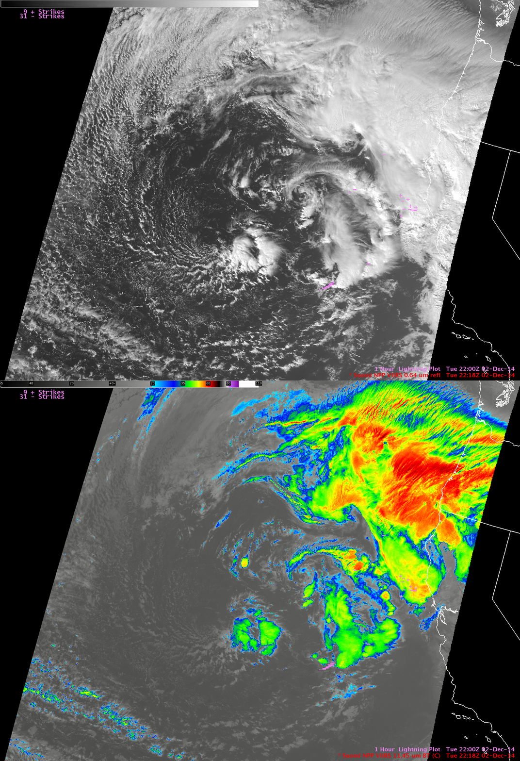
A comparison of Suomi NPP VIIRS 0.64 µm visible channel and 11.45 µm IR channel images at 22:18 UTC (below) shows a few areas of embedded convection, some of which had produced cloud-to-ground lightning strikes in the hour preceding the images.


