Upper Midwest ice storm
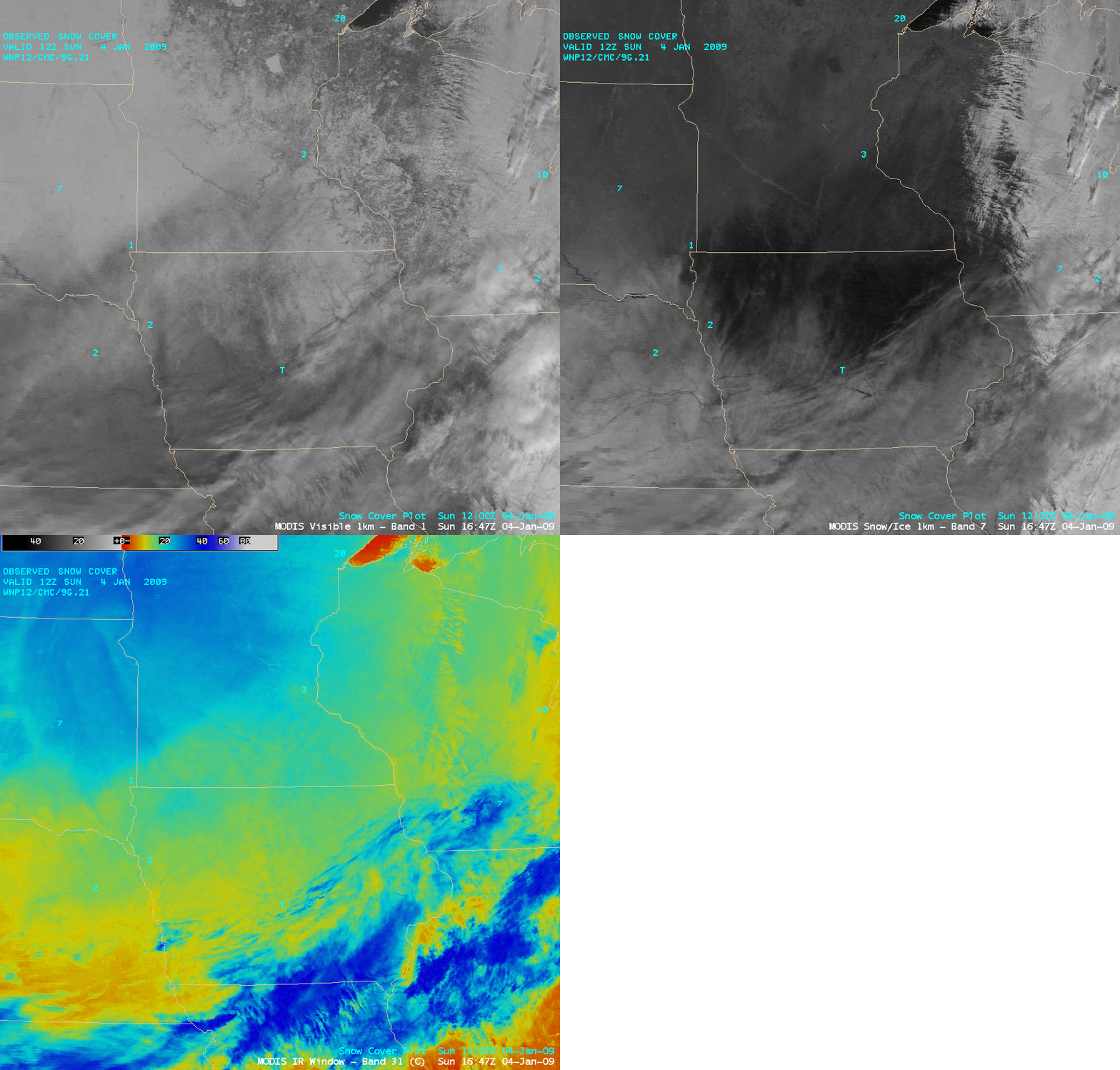
A freezing drizzle / light freezing rain event occurred across parts of the Upper Midwest on 03 January – 04 January 2009 — an ice accrual of 0.1 to 0.2 inch was reported at some locations in northern Iowa, southern Minnesota, and southern Wisconsin. Post-event AWIPS images of the 1-km resolution MODIS visible channel, the 2.1 µm “snow/ice” channel, and the 11.0 µm “IR window” channel (above) demonstrated the utility of using the snow/ice channel imagery to depict the areal coverage of significant ice accrual. Snow (and especially ice) are strong absorbers at the near-IR 2.1 µm wavelength, so those show up as much darker features on the MODIS snow/ice image (in contrast to supercooled water droplet clouds, which show up as much brighter features).
A mixture of low and high clouds covered the southern, southeastern, and eastern portions of satellite images shown above — but most of the MODIS image scene on 04 January was cloud-free snow cover. Even though there was generally more snow cover in place across the northern half of the image area (from eastern South Dakota to northern Minnesota), the ice-glazed snow pack farther to the south across norther Iowa and southern Minnesota appeared even darker on the snow/ice image.
The National Weather Service forecast office at Milwaukee/Sullivan, Wisconsin posted an excellent discussion of the classic thermal profile for ice for this particular event.
— 05 JANUARY UPDATE —
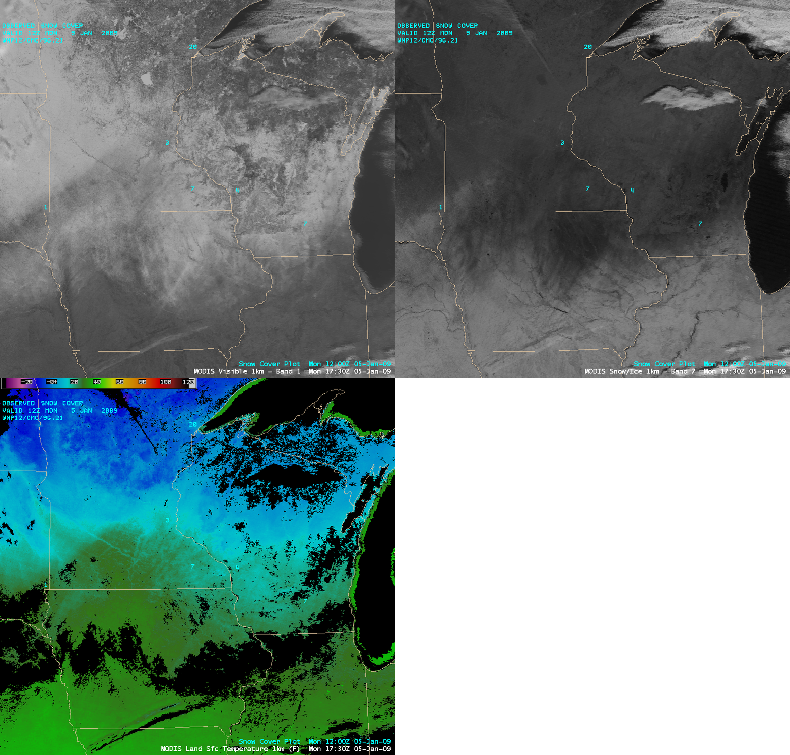
On the following day (05 January), conditions were relatively cloud-free over most of the region, allowing a view of the ice accrual farther to the east across southern Wisconsin (below). The western half of the darker “ice accrual signal” over western Iowa seemed to be diminishing, due to full sunshine and brisk southwesterly winds helping to erode the thickness of the surface ice glaze somewhat. MODIS Land Surface Temperatures were in the upper 20s to around 30 F (darker green colors) across the ice-covered areas of northern Iowa at 17:30 UTC (11:30 am local time).


