Iselle approaches the island of Hawai’i
GOES-15 visible imagery from after sunrise on 7 August 2014 shows the approach of Pacific Hurricane Iselle towards the ‘Big Island’ of Hawai’i. Orographically-forced clouds are apparent on the northern shores of the entire Island chain, and significant rains are possible as the storm passes — Flash Flood Watches are up for the entire state until 6 AM (HST) Saturday.
There are products available to assess how much rain could potentially fall. For example, the Orographic Rain Index (ORI) uses Total Precipitable Water, 850-mb winds from the Global Forecasting System (GFS) Model and high-resolution topography to determine how much rain might occur if winds are orthogonal (or nearly so) to topography. A real-time display of the product is here.
The moisture environment surrounding Iselle appears to be less hostile today. The water vapor imagery from 1200 UTC, 6 August, showed significant dry air between the storm and Hawaii. That dry air is not so pronounced today (above). Both images cover the same domain and use the same enhancement. Hurricane Julio is apparent in the eastern part of the image from 7 August, above; that storm is forecast to remain north of the island chain.
GOES-15 Infrared Channel (10.7 µm) imagery from 7 August shows periodic deep convection forming in the northern half of Iselle’s circulation, north of an eye-like structure in the infrared. The plot of overshooting tops around Iselle (here) shows that overshoots are being detected again after a relatively quiescent period yesterday and the day before.
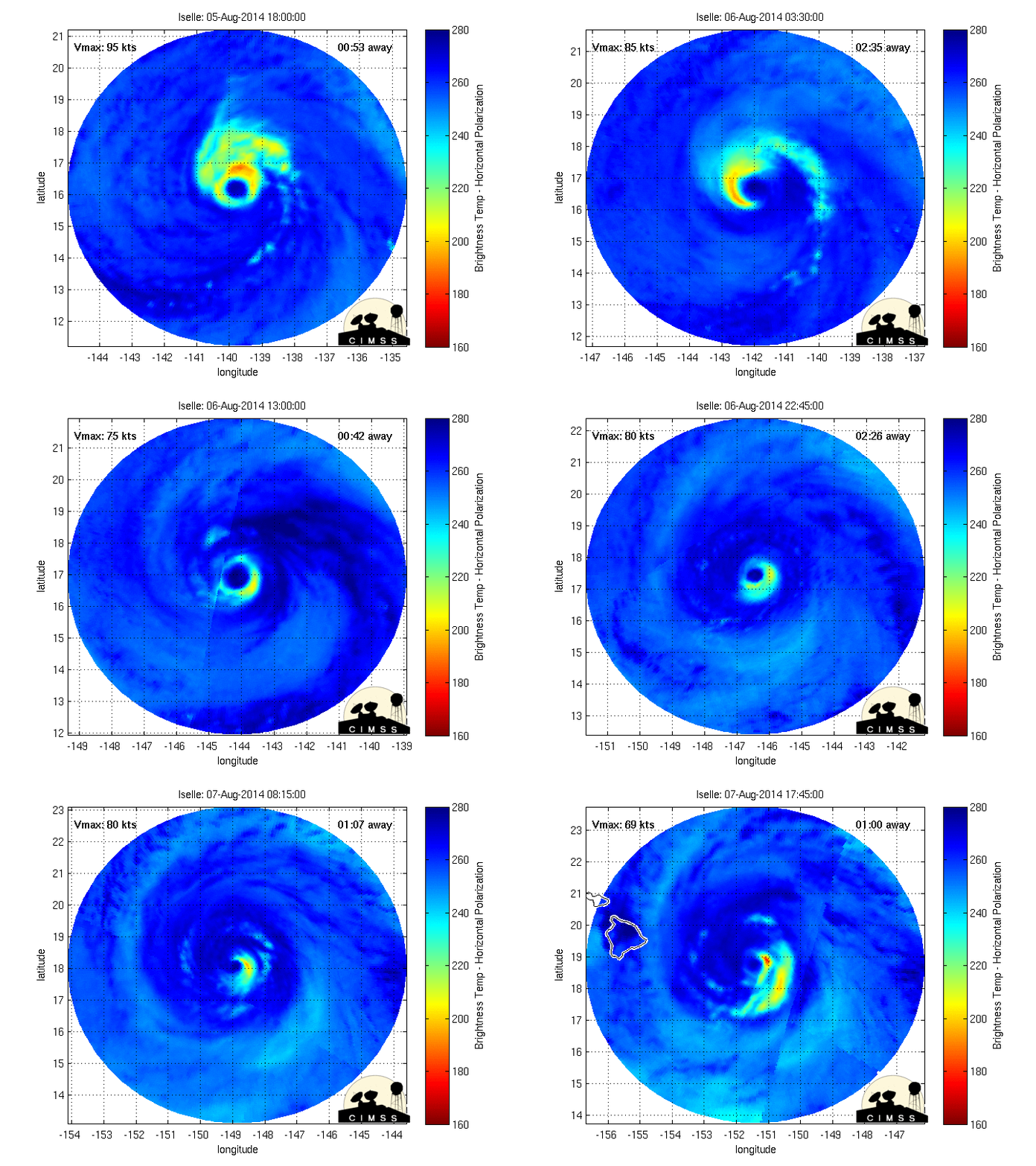
Microwave data can be used to measure the intensity of precipitation in/around a tropical cyclone, and the MIMIC-TC pages show animations for active storms. The animation above shows Iselle’s slow weakening — as measured by the intensity of the precipitation in the eyewall.


