Severe convection at 1-minute intervals
A 200-image animation (29 MB QuickTime movie, above) of Super Rapid Scan Operations (SRSO) GOES-10 visible channel imagery shows the development of supercell thunderstorms at 1-minute intervals across northern Arkansas and southern Missouri between 17:00 and 22:07 UTC (12:00 Noon and 5:07 PM local time) on 22 September. During that time period, this particular convection produced softball-size hail (4.25 inches in diameter) and multiple tornadoes across southern Missouri (including one producing F4 damage near Crosstown), and 3.0 inch diameter hail in northern Arkansas (SPC storm reports). Heavy rainfall and flash flooding was also reported, with 10.16 inches of rain falling at Myrtle, Missouri (near the Missouri/Arkansas border). Additional details on these storms are available from the St. Louis MO and Springfield MO NWS offices.
.
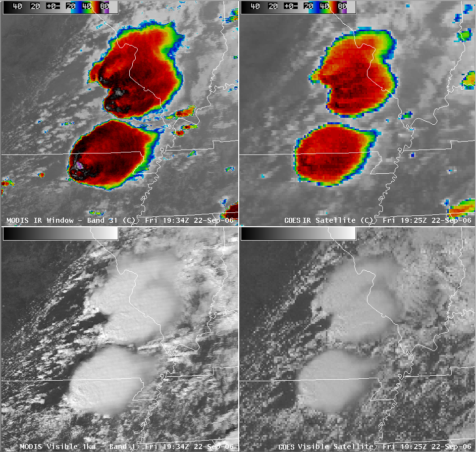
An AWIPS MODIS/GOES comparison of the InfraRed (IR) and visible channel images around 19:30 UTC (below) shows well-defined enhanced-v signatures on the IR “window channel” imagery. At that time, the IR cloud top temperatures in the vicinity of the overshooting tops over northern Arkansas were as cold as -86 C on the 1-km resolution MODIS IR data, versus -68 C on the 4-km resolution GOES IR data. A 100-image QuickTime animation of the GOES-10 IR window channel imagery shows the evolution of the various enhanced-v signatures during the 17:45-20:19 UTC time period (12:45-3:19 PM local time).


