Fog/stratus along the central California coast
The San Francisco Bay Area National Weather Service forecast office made use of a variety of satellite images and products to monitor the development of fog and stratus clouds along the central California coast during the pre-dawn hours of 30 April 2013. From their forecast discussion:
AREA FORECAST DISCUSSION
NATIONAL WEATHER SERVICE SAN FRANCISCO BAY AREA
451 AM PDT TUE APR 30 2013
.DISCUSSION…AS OF 3:20 AM PDT TUESDAY…SATELLITE AND SURFACE OBS INDICATE ONLY SOME MINOR POCKETS OF LOW CLOUDS AND PATCHY FOG.
RIGHT NOW HALF MOON BAY IS THE ONLY SPOT REPORTING REDUCED VISIBILITIES WHILE MONTEREY NOW HAS A CEILING. DETAILS FROM THE OVERNIGHT
SATELLITE FOG PRODUCT ARE A BIT DIFFICULT TO MAKE OUT ALTHOUGH LOOKS LIKE THE AREAS ARE VERY SMALL IN NATURE.
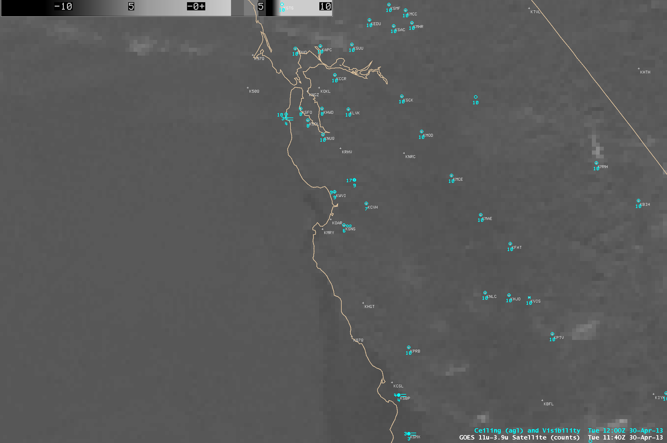
Using the 4-km resolution GOES-15 11-3.9 µm IR brightness temperature difference (BTD) “fog/stratus product” with the default gray-scale enhancement applied (above; click image to play animation), it was indeed difficult to unambiguously determine the motion and areal coverage of the darker fog and stratus features (especially in the Monterey Bay area). Applying a tailored color enhancement to that same GOES-15 BTD fog/stratus product does help a little to highlight some of the more well-defined fog and stratus features (with a darker orange color), but there is also a tendency to produce large areas of noisy “false alarm” fog/stratus signals (yellow color enhancement) over much of the inland areas of central California.
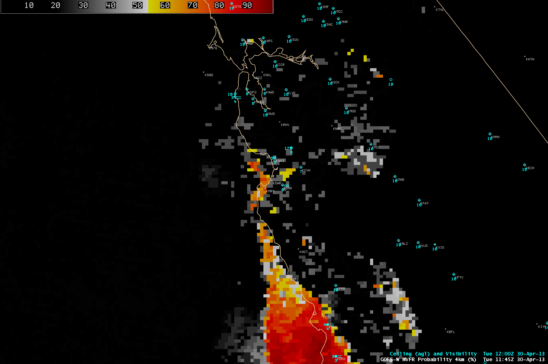
In the Aviation section of their forecast discussion, mention was made of the GOES-R Marginal Visual Flight Rules (MVFR) product, which is produced using an algorithm designed for the upcoming GOES-R satellite (but applied to current GOES-15 data):
MONTEREY BAY AREA TERMINALS…SHORT LIVED MVFR THIS MORNING. VIIRS DAY NIGHT SATELLITE AND GOES-R MVFR PROBABILITIES INDICATE CLOUD DECK IS PATCHY.
This GOES-15Â product (below; click image to play animation) did indeed show that the areas of 50-80% MVFR Probability were patchy in nature in the vicinity of Monterey Bay.
Other GOES-R Fog/Low Stratus products (produced as part of the GOES-R Proving Ground activities at CIMSS/ASPB) include an Instrument Flight Rules (IFR) Probability product, a Low Instrument Flight Rules (LIFR) Probability product, and a Low Cloud Thickness product.
Mention was also made of the Suomi NPP VIIRS 0.7 µm Day/Night Band, which provided a high spatial resolution (750 meters, re-mapped onto a 1-km AWIPS grid) “visible image at night” (below), helping to confirm the spotty nature of the coverage of fog/stratus in the Monterey Bay area.
Meanwhile, fog and stratus were more widespread across the southern California coast and adjacent offshore waters – for more details, see the GOES-R Fog Product Examples site.


