Mid-latitude cyclone over the Canadian Maritimes and Newfoundland

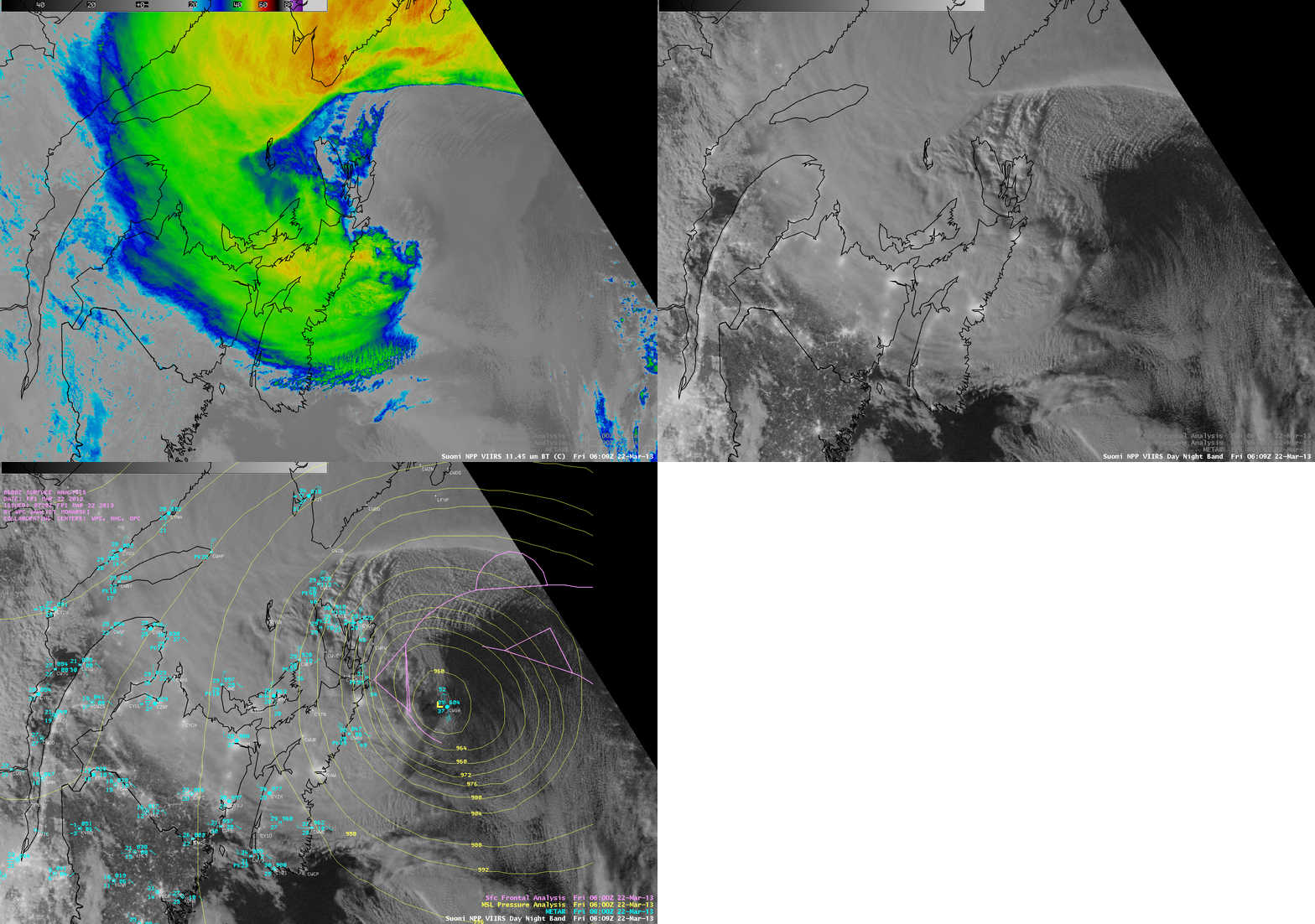
Suomi NPP VIIRS 11.45 µm IR channel and 0.7 µm Day/Night Band images (with overlays of surface reports and surface analysis)
AWIPS images of Suomi NPP VIIRS 11.45 µm IR channel and 0.7 µm Day/Night Band images (above) showed a night-time view of an intense mid-latitude cyclone that was centered just east of the Canadian Maritimes at 06:09 UTC or 2:09 AM local time on 22 March 2013. The strongest surface wind gust seen at that time was 59 knots, west of the storm center along the eastern coast of Nova Scotia.
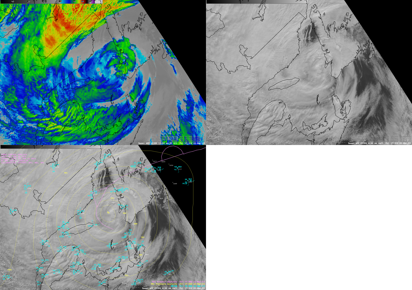
A similar daytime view using Suomi NPP VIIRS 11.45 µm IR channel and 0.64 µm visible channel images at 17:31 UTC or 1:51 PM local time is shown below. The highest surface wind gust seen was 60 knots, north of the storm center at Blanc Sablon, Quebec.

Suomi NPP VIIRS 11.45 µm IR channel and 0.64 µm visible channel images (with overlays of surface reports and surface analysis)
The temporal evolution of the storm could be seen on 15-minute interval GOES-13 0.63 µm visible channel images (above) and 6.5 µm water vapor channel images (below). Note the formation of parallel cloud bands over the Gulf of Saint Lawrence, due to the interaction of the strong easterly to southeasterly winds with the higher terrain of the western portion of Newfoundland. A signature of these lee wave clouds immediately downwind of Newfoundland was also seen on the water vapor images — in addition to the formation of a standing wave over the far southwestern part of the island.

