Thunderstorms producing heavy rain and flooding in Puerto Rico
Deep moisture and an unstable atmosphere were in place across the island of Puerto Rico on 27 September 2012, creating an environment favorable for the development of strong thunderstorms during the afternoon hours (in response to sea breeze convergence and local terrain effects). 1-km resolution GOES-14 0.63 µm visible channel images (above; click image to play animation) and 4-km resolution GOES-14 10.7 µm IR channel images (below; click image to play animation) showed the development of large thunderstorms which produced very heavy rainfall (as much as 3-4 inches within a 1-2 hour period) which caused flooding problems.
Due to the fact that the the radar at San Juan, Puerto Rico had suffered an outage, the National Weather Service forecast Office in Miami, Florida was called upon to perform back-up duties during the outage (which included the issuance of Area Forecast Discussions and Flood Advisories). To obtain more frequent satellite images during the radar outage, Miami also called for GOES-14 to be placed into Rapid Scan Operations (RSO) — but unfortunately the default CONUS RSO scan sector was used, which did not extend far enough eastward to cover Puerto Rico. Just 3 days earlier, GOES-14 had been activated to replace GOES-13 as the operational GOES-East satellite (since GOES-13 instrument problems caused it to go into standby mode on 23 September)
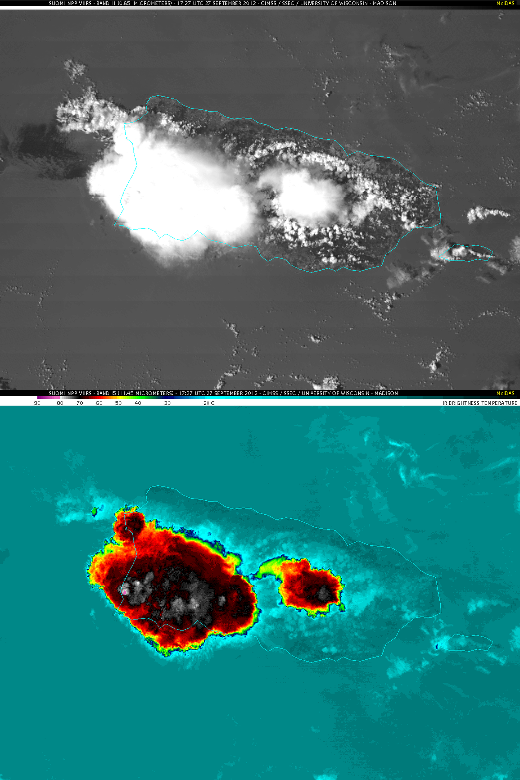
A closer view using 374-meter resolution Suomi NPP VIIRS 0.65 µm visible channel and 11.45 µm IR channel images (below) showed the strongest thunderstorm located over the southwestern portion of the island at 17:27 UTC. The coldest cloud top IR brightness temperature on the VIIRS images was -83º C (compared to -65º C around that same time on GOES-14 IR imagery).


