Satellite Views of Unusual Pre-dawn Temperature Rise

METARS over south-central Wisconsin
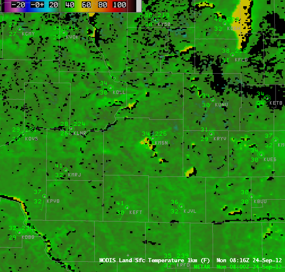
The animation above shows three hours of METAR plots, with the first one — 0900 UTC — overlaying a MODIS Infrared image. Note how the temperature at Madison (KMSN) in the center of the image rises from 34 with calm winds at 0900 UTC to 37 with light southwest winds at 1000 UTC to 47 at 1100 UTC.

MODIS Estimates of Lake Surface Temperature
Madison’s Truax airport is northeast of Lake Mendota, a lake with a surface area of approximately 40 square miles. MODIS SSTs esimates, above, show surface temperatures near 60 degrees Fahrenheit, in agreement with in situ observations (Click here for real-time observations). Land surface temperature estimates, below, show that most of the Wisconsin is near freezing, although a pocket of low 20s (Fahrenheit) exists in northeast Dane County. The elevated terrain of the Military Ridge in Iowa County shows up nicely as somewhat warmer. (Click here for a toggle between Land Surface Temperature and Topography). Land-surface temperatures over Lake Mendota (yellow) are in the low 60s. Both land-surface and lake-surface temperature estimates are warmer than the 11-µm brightness temperature because those algorithms consider more than just the 11-µm brightness temperature.

MODIS Estimates of Land Surface Temperature
The southwest winds that developed in the early morning hours were able to move warmer lake-modified air to the observating station at the airport, resulting in the dramatic temperature rise. The National Weather Service in Sullivan also noted this temperature rise. GOES-West imagery in that plot (GOES-West is used because GOES-East at the time had shut down due to an anomaly) suggests that the airport warmth was sub-pixel scale.