Hail-producing thunderstorms in the Fairbanks, Alaska area
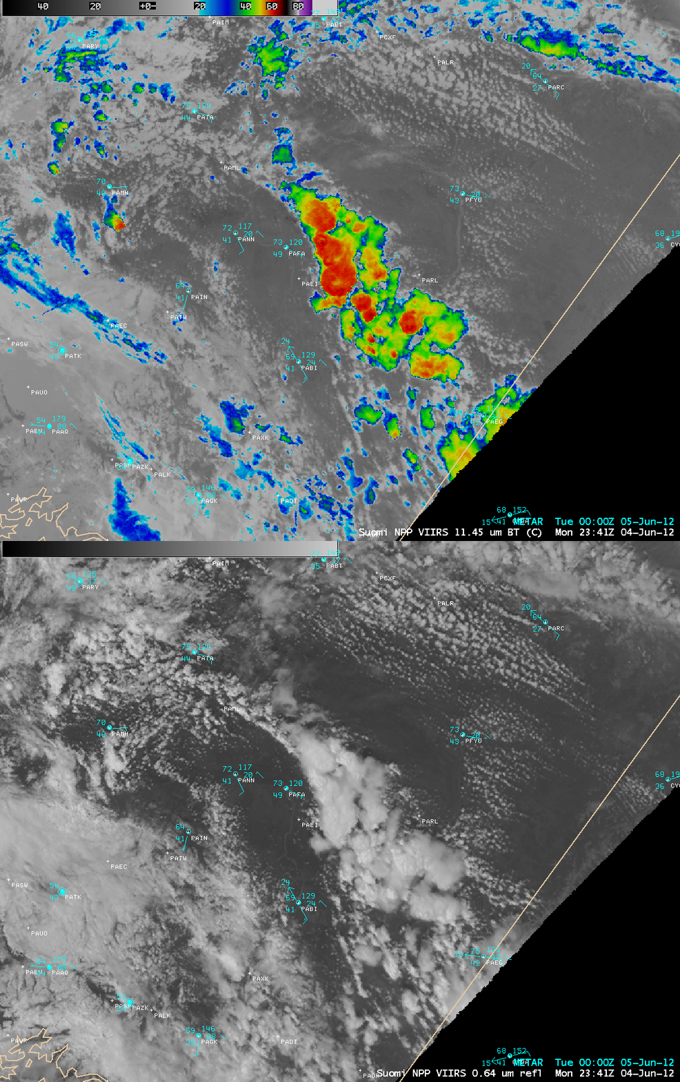
A cluster of thunderstorms developed over the interior of Alaska during the afternoon hours on 04 June 2012, and moved westward across the region — one of the stronger storms produced half-inch size hail in the Fairbanks area. AWIPS images of 375-meter resolution (projected onto a 1-km resolution AWIPS grid) Suomi NPP VIIRS 11.45 µm IR and 0.64 µm visible channel images (above) showed these storms before they moved over Fairbanks (station identifier PAFA); the coldest cloud-top IR brightness temperatures were -64º C, and the larger storm actually exhibited an “enhanced-V” signature (with a cold/warm thermal couplet differrence of 11º C).
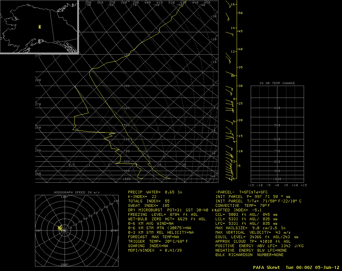
A Fairbanks National Weather Service Special Weather Statement mentioned that the tops of the thunderstorms were around 40,000 feet. That height, along with the minimum VIIRS IR brightness temperature of -64º C suggests that the highest thunderstorm tops were overshooting the tropopause that was seen on a plot of the 00 UTC Fairbanks rawinsonde data (below).


