Thunderstorm causes a power blackout in Oahu, Hawaii?
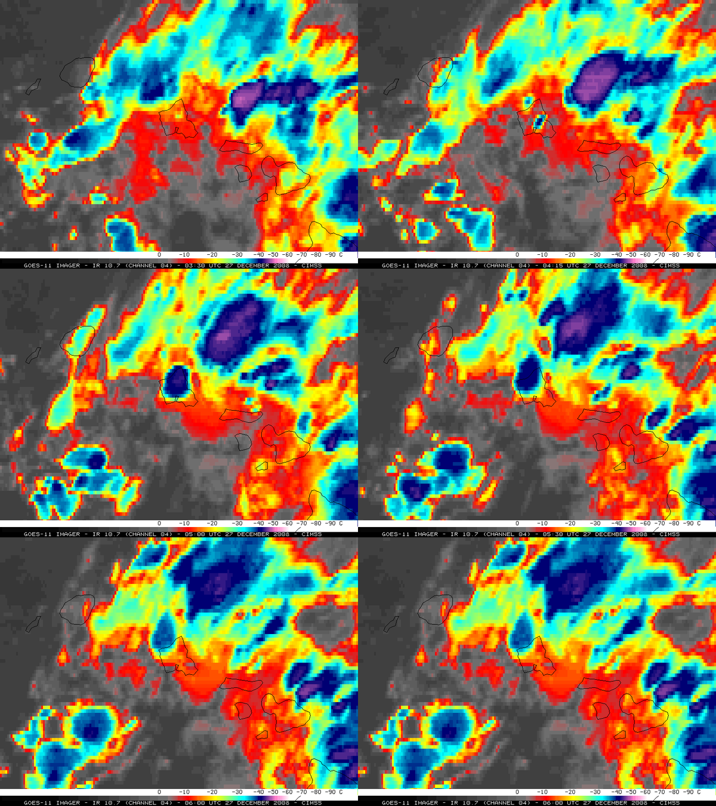
A strong thunderstorm which produced heavy rain and frequent lightning was apparently a factor in triggering a power blackout that affected the Hawaiian island of Oahu for at least 12 hours, beginning on the evening of 26 December 2008 — in fact, this was the first time all of Oahu had lost power since October 2006, when a 6.7 magnitude earthquake shook the Hawaiian Islands and knocked out power on Oahu and parts of other islands for up to two days. GOES-11 10.7 µm IR images (above) showed the rapid development — and the subsequent rapid dissipation — of this thunderstorm over Oahu (the island located at the center of the images), which formed around 04:00 UTC on 27 December (6 PM local time on 26 December). The IR cloud top brightness temperatures quickly cooled to a minimum value of -45º C (violet color enhancement) at 04:30 UTC, but then cloud top temperatures increased to values warmer than -40º C as the storm moved northwestward away from the island of Oahu by 06:00 UTC.
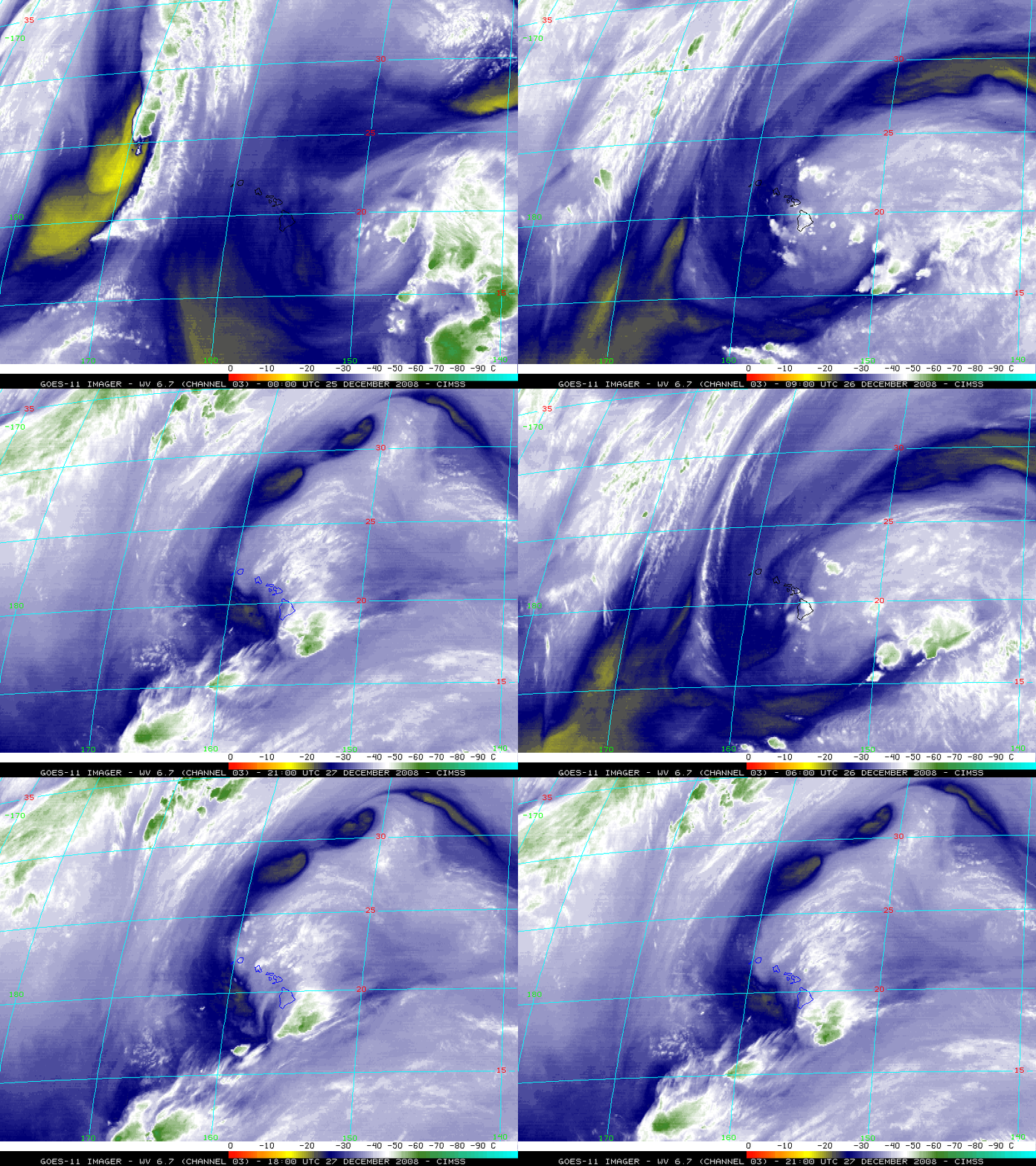
An upper-level low had been located to the east of the Hawaiian Islands for several days, and GOES-11 6.7 µm water vapor images (below) showed that this low moved slowly westward during the 25-27 December period. Also note the roll-up of smaller cyclonic “vorticies” along the northern edge of the moisture field of the upper low — CIMSS water vapor winds products indicated that these vorticies were forming in an environment of low wind shear that existed over the northern periphery of the low (and the wind shear tendency product showed that shear had been decreasing over that region during the previous 24 hours).
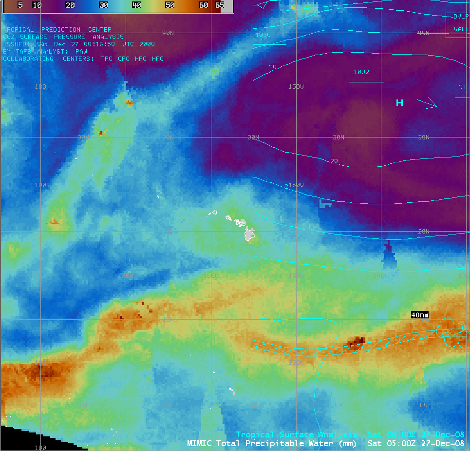
An AWIPS image of the CIMSS MIMIC Total Precipitable Water product (below) indicated that TPW values were certainly not as high over the Hawaiian Islands as those seen farther to the south in the region of the Inter-Tropical Convergence Zone (ITCZ), but PW values in excess of 40 mm (green to yellow color enhancement) were in place as the upper low moved westward across the region. Over the Big Island of Hawaii, several locations had received more than 10 inches of rainfall in 24 hours, with Waiakea Uka reporting 13.15 inches (and about a foot of snow fell at the higher elevations of Mauna Kea and Mauna Loa).
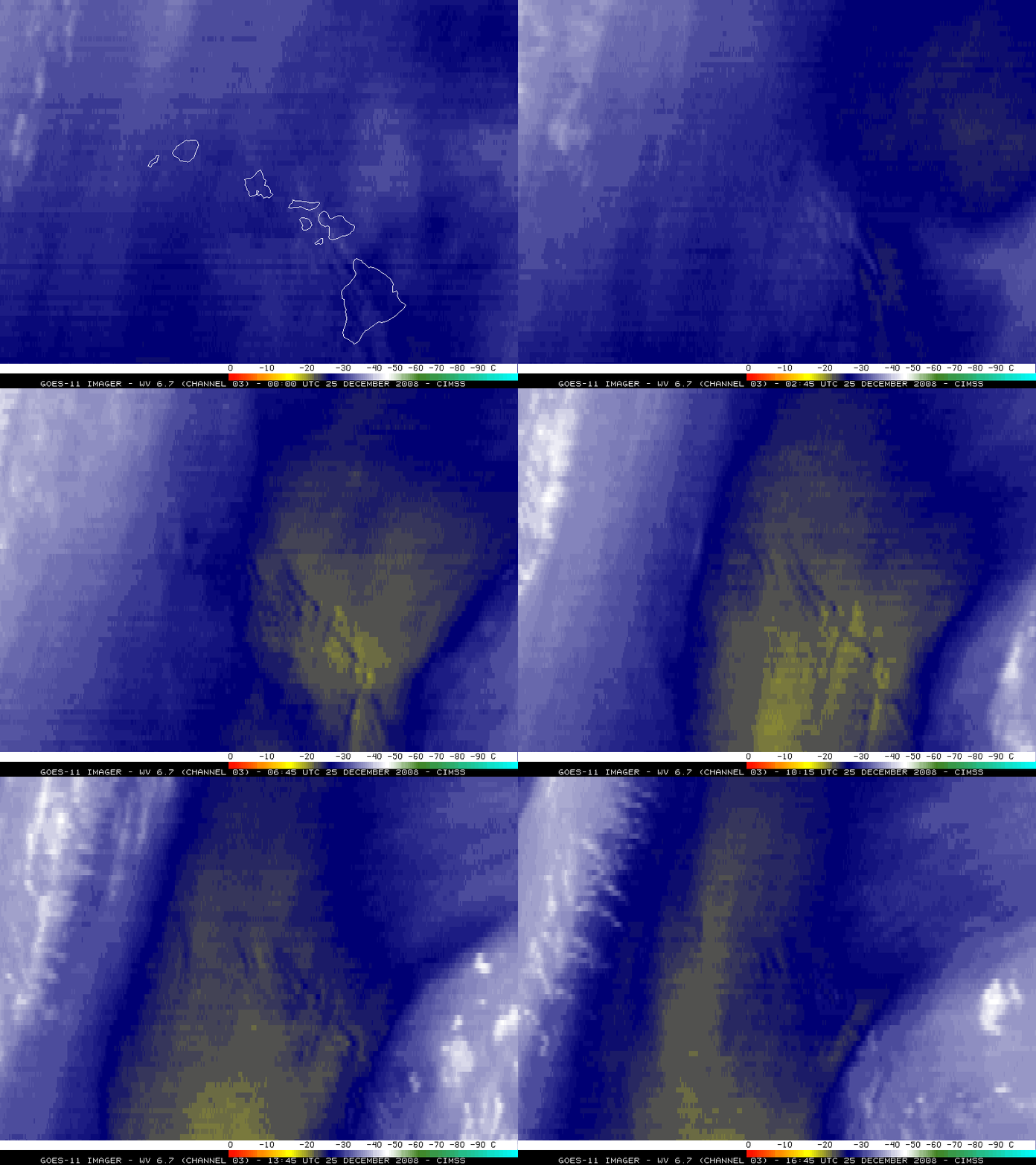
In advance of the arrival of the higher TPW values associated with the upper-level low, a pocket of dry air had been moving southwestward across the Hawaiian Islands on 25 December. It is interesting to note that GOES-11 water vapor images (below, with the map overlay removed) revealed the presence of “standing waves” due to the strong northeasterly winds interacting with the high terrain of the island chain.
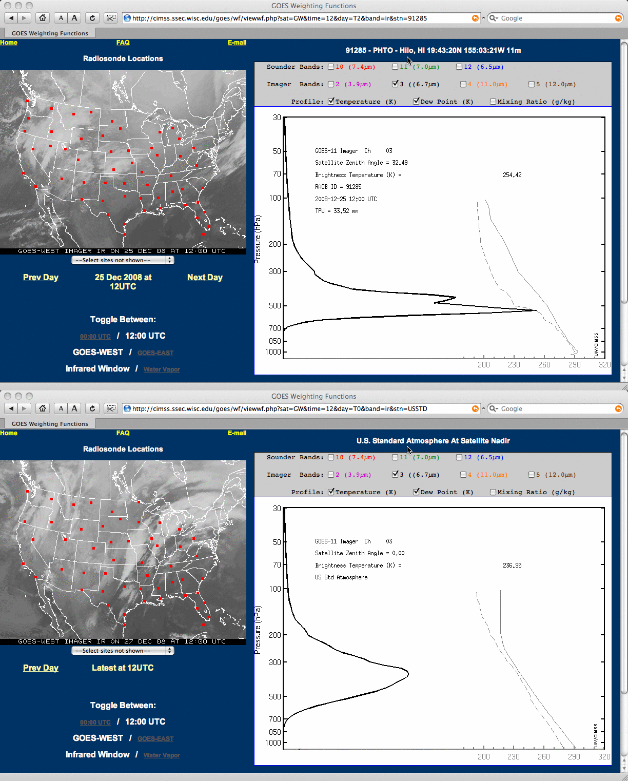
The GOES-11 water vapor channel weighting functions (below) showed that the mid-tropospheric dry air present over Hilo, Hawaii at 12:00 UTC on 25 December had the effect of shifting the peak of the water vapor weighting function downward, allowing features at a lower altitude to be resolved on the water vapor imagery (compared to what would be viewed at that location if a slightly cooler but more moist “US Standard Atmosphere” were in place).


