Comments, questions on this web page? Send e-mail to: |
Spatial Coverage
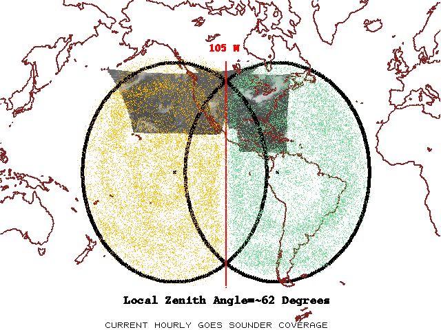
The above figure shows the approximate arcs of 62 degrees local zenith angle from both the GOES-East and GOES-West sub-satellite points. The threshold coverage rate calls for the region within the 62-degree arc, excluding half of the overlap region, to the scanned each hour. For information only, an image for one houe of the infrared window from the current generation instruments is shown. |