|
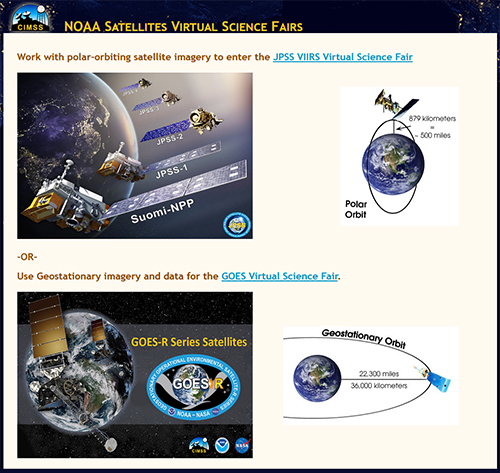
The GOES-R Education Proving Ground features the design and development of
pre- and post-launch lesson plans and activities for G6-12 teachers and students. A key element
of this effort is a core group of educators working with CIMSS Education & Outreach staff in
close coordination with NOAA scientists stationed at the
Cooperative Institute of Meteorological Satellite Studies (CIMSS). Our initial goal was to ensure that the
education community was launch ready for new satellite imagery and
improved products from the GOES-R Satellite Series
( R, S, T & U). Once data became readily available the focus shifted to student STEM engagement through the NOAA Satellites Virtual Science Fair. |
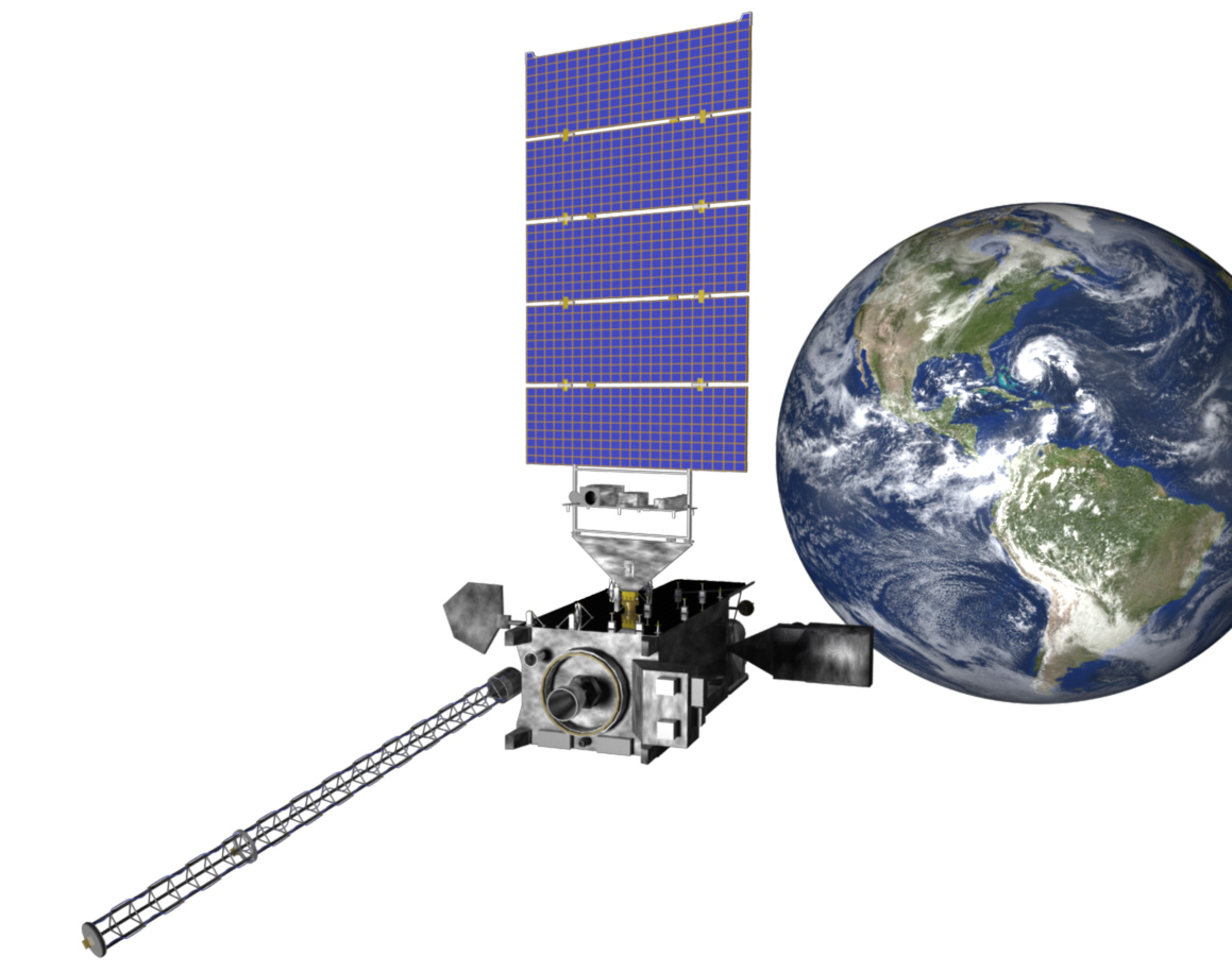
GOES-R launched
in November 2016 and renamed GOES-16 in orbit.
GOES-S launched
in March 2018 and renamed GOES-17 in orbit.
|
ANNOUNCING the 2024 NOAA Satellites Virtual Science Fair Top Projects!
GOES projects / JPSS projects
|
GOES-T launched
in March 2022 and renamed GOES-18 in orbit.
GOES-U launched
in June 2024 and was renamed GOES-19 in orbit. |
Here are two of the many exciting improvements ...
Advanced Baseline Imager (ABI)
The ABI on the GOES-R satellite series has 16 spectral bands, (compared to 5 on the legacy GOES Imager),
resulting in three times more spectral information and four times the
spatial resolution. The frequency of images, or temporal coverage, is more than
five times faster than the previous GOES imager!
Geostationary Lightning Mapper (GLM)
The all new GLM on GOES-R measures total lightning activity continuously over the
Americas and adjacent ocean regions with spatial resolution of approximately 10 km!
|
 |
|
New GOES-R WebApps
Working with G6-12 science teachers, CIMSS and ASPB developed several Next-Generation
WebApps to explore GOES-R ABI capabilities.
Try the new Webapps!
GOES-R Spectral Band Webapp
GOES-R Temporal & Spatial Resolution Webapp
GOES-R What's This? Image Resolution Webapp
GOES-R RGB Webapp
