The classic classification scheme for clouds involves reference the height of the base of a cloud. From a satellite view point, however, we’re referring to cloud tops. In general, low cloud tops are warmer and grayer than high cloud tops in both visible and infrared imagery, although there are a few exceptions. High cloud tops are colder and almost always brighter.
Low Level Cloud TopsTwo common low level clouds are stratus and cumulus clouds, and they undergo very different processes to become clouds.
Cumulus Clouds
 click on the picture
to learn more
Cumulus clouds develop when air is heated up by the
sun and rises a bit faster than the surrounding air. This process is called
convection. At a certain level in the atmopshere the air cools and the water
vapor condenses out to form a cloud.
How they look from the ground: Convective cumulus clouds develop puffy cotton
shaped profiles.
How they look on satellite images: Cumulus clouds are easy to pick out on
visible satellite images due to their textured bumpy appearance. While less
texture is noticeable on infrared images, there is still regular spacing
between the individual convectively formed clouds.
 click on the picture
to learn more
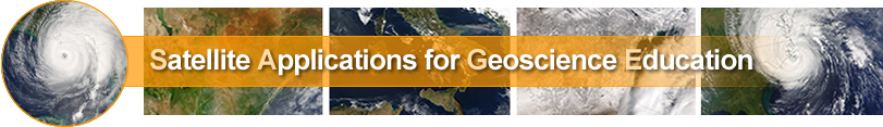
Stratus clouds commonly form when two air masses collide
and mild, moist air is forced up over cooler, dense air until the moisture
condenses out to form a thick blanket of clouds.
How they look from the ground: Stratus clouds are gray and flat and continuous
like a blanket.
How they look on satellite images: The main identifying feature for stratus
clouds is their continuous, blanket-like appearance. They appear white in
visible images because they reflect so much sunlight and gray in infrared
images because the low cloud tops are not very cold.
High Level Cloud Tops
We will focus on two main high level cloud tops: cumulonimbus and cirrus clouds. A big difference between these two types of clouds is that the base of cumulonimbus clouds is significantly lower than cirrus clouds.
Cirrus Clouds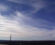 click on the picture
to learn more
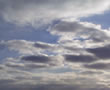
Cirrus clouds form high in the sky where it is very cold so they are made up primarily of ice crystals rather than water droplets.
Typically they result when mild air is lifted over a large area of cooler air. Cirrus clouds are often the forerunner of stormy weather.
How they look from the ground: Cirrus clouds often occur as thin wisps aligned in the same direction and generally do not completely cover the sky.
How they look on satellite imagery: Because cirrus clouds are thin they dont reflect much sunlight and therefore look gray in visible satellite images, even though they are high in the sky. They appear brighter in infrared imagery due to their altitude and cold tops.
|
Cirrostratus Clouds | |
 click on the picture click on the pictureto learn more |
Cirrostratus clouds are like sheets of cirrus, high, thin and continuous.
They are responsible for halos and other beautiful atmospheric phenomena because the thin blanket of ice
crystals cause sunlight to refract (bend) and spread out into colors of the rainbow. (a "sundog" can be seen in these cirrostratus clouds )
|
Cumulonimbus
to learn more
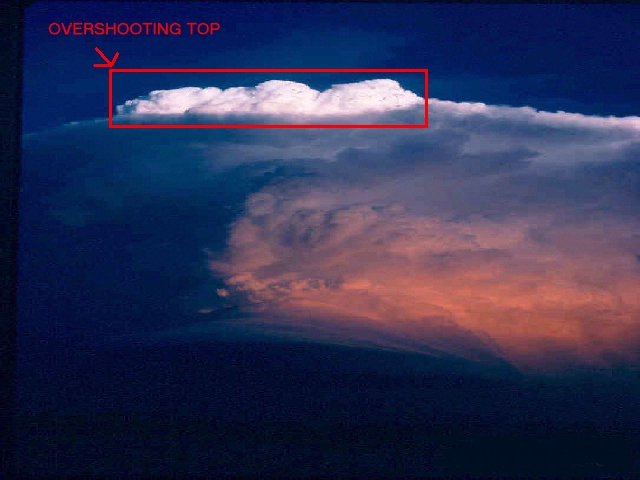
Another cloud with high cloud tops is a mature thunderstorm, or cumulonimbus cloud. How they look from the ground: Cumulonimbus clouds often look like a blacksmiths anvil with a tall and relatively narrow base and a top that spreads out across the sky like a mushroom cap.
And even though the base of a cumulonimbus cloud may be as low as 3 or 4000 feet, the anvil tops spread out when they hit the tropopause, frequently 50 or 60,000 feet high in the summer. These are big storms!
How they look on satellite images: Powerful cumulonimbus clouds with bright white overshooting tops (that punch through the tropopause) are especially easy to track on visible satellite images because they frequently cast shadows on the surrounding clouds. They are typically the brightest clouds on infrared imagery due their height.
Mid-Level Cloud Tops
Mid-level cloud tops are frequently the hardest to differentiate so scientists rely heavily on computers and additional information to identify mid-level clouds on satellite imagery.
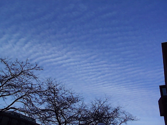 Altocumulus clouds |
We use the prefix "alto" to indicate mid level clouds. Mid-level clouds provide information about the middle part of the troposphere. Recall that the troposphere is the lowest part of the Earths atmosphere where conditions support living organisms. To the left is a picture of altocumulus clouds. You can click on the picture to fade between it and two satellite images from the same time and location. |