Improve your understanding of satellite applications in climate studies through the following activities.
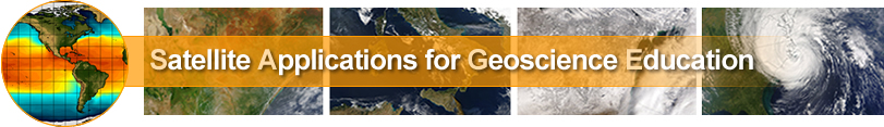
 1. Northern Hemisphere Snow Cover
Satellite data is used routinely to monitor the snow cover extent in the northern hemisphere important for climate studies and water management.
Click on the image to the right to begin the activity.
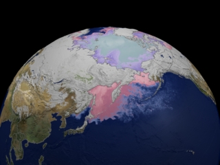
 2. Urban Heat Islands
Infrared imagery is an excellent tool to locate cities because they are warmer than the surrounding rural areas. Some studies suggest that urban heat islands result in increased rainfall amounts in and around the cities.
Click on the image to the right to view the thermal pattern cities create.
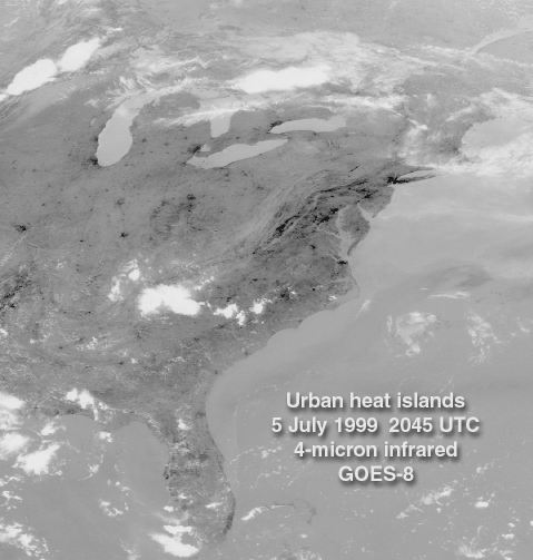
 3. Visualizations of sea surface heights and water temperatures
Satellite data supplies details of sea surface height and temperatures that can be incorporated into educational animations.
Click on the image to begin the activity.