“Groundhog Day” Blizzard of of 01-02 February 2011
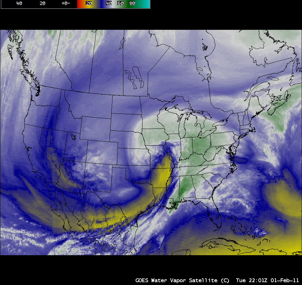
AWIPS images of GOES-13 6.5 µm water vapor channel data (above; click image to play an animated GIF; also available as a QuickTime movie) showed the evolution of the “Groundhog Day Blizzard” of 01 February – 02 February 2011. This was a particularly large storm, impacting a swath of the US over 2500 miles long and 700 miles wide with snow, sleet, and ice from New Mexico to Maine — snowfall amounts were as high as 27.0 inches at Antioch, Illinois (HPC storm summary). As the storm developed, the water vapor imagery displayed a very pronounced dry slot, along with an extensive cloud shield.
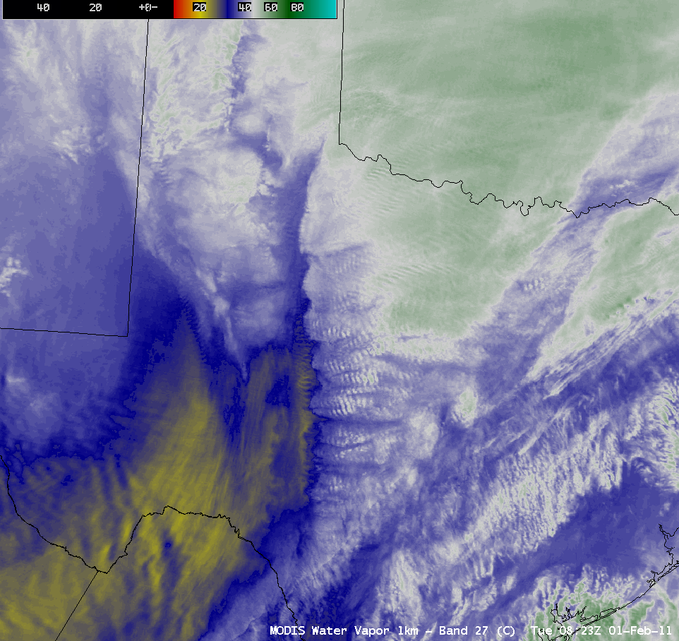
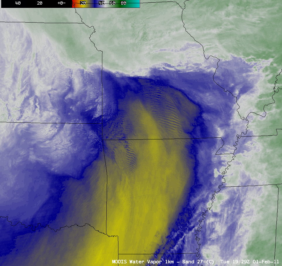
With higher spatial resolution (1 km) MODIS water vapor imagery, several interesting details could be seen, such as bands of convection in Texas (above) and “lee waves” within the dry slot, downwind of the areas of higher terrain on northern Arkansas and southern Missouri (below).
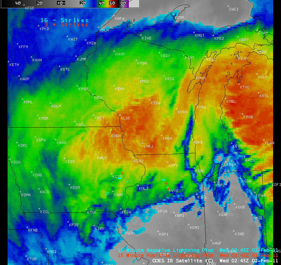
One area that was hit particularly hard with heavy snow and blizzard conditions was northern Illinois (NWS Chicago summary) and southeastern Wisconsin (NWS Milwaukee summary) — in the Chicago area, the 20.1 inches of snow at O’Hare airport and 20.9 inches at Midway airport were the third largest snowfall amounts on record. Thundersnow was reported at a number of locations, where accompanying snowfall rates were several inches per hour; much of the lightning was likely in-cloud and/or cloud-to-cloud, but there were several cloud-to-ground lightning strikes seen overlaid on GOES-13 10.7 µm IR images (below; click image to play animation).
=========== 03 February Update ==========
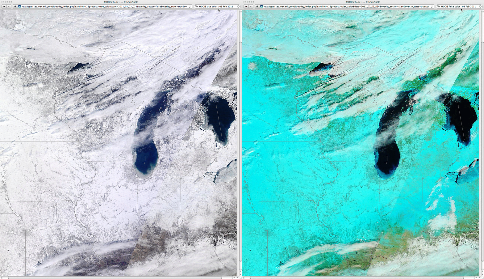
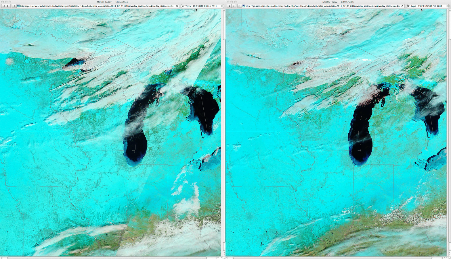
In the aftermath of the winter storm, a comparison of MODIS true color and false color images from the SSEC MODIS Today site (above) showed extensive snow cover across the Upper Midwest region, along with ice forming in parts of Lake Michigan, Lake Huron, and most of Lake Erie (snow and ice appear as shades of cyan on the MODIS false color image, in contrast to supercooled water droplet clouds which are brighter white features). In fact, some movement of the ice features in the Great Lakes could be seen — especially in Lake Erie –Â in a comparison of MODIS false color images from the Terra satellite overpass at 16:03 UTC and the Aqua overpass at 19:23 UTC (below), due to brisk southwesterly surface winds across the region.


