Hot temperatures in the central Plains
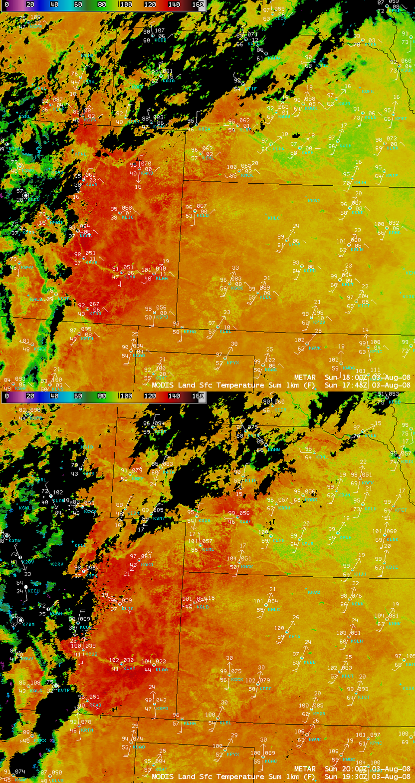
03 August 2008 marked the 22nd consecutive day of daily high temperatures of 90º F or higher at Denver, Colorado (the old record was 18 consecutive days, set back in 1874 and 1901). AWIPS images of the MODIS Land Surface Temperature (LST) product (above) revealed daytime LST values as high as 140º F in southeastern Colorado and 134º F in southwestern Nebraska — while the surface “skin temperatures” were quite warm, the actual air temperatures (measured within shaded instrument shelters located about 5 feet above the surface) were only the in upper 90s to low 100s F.
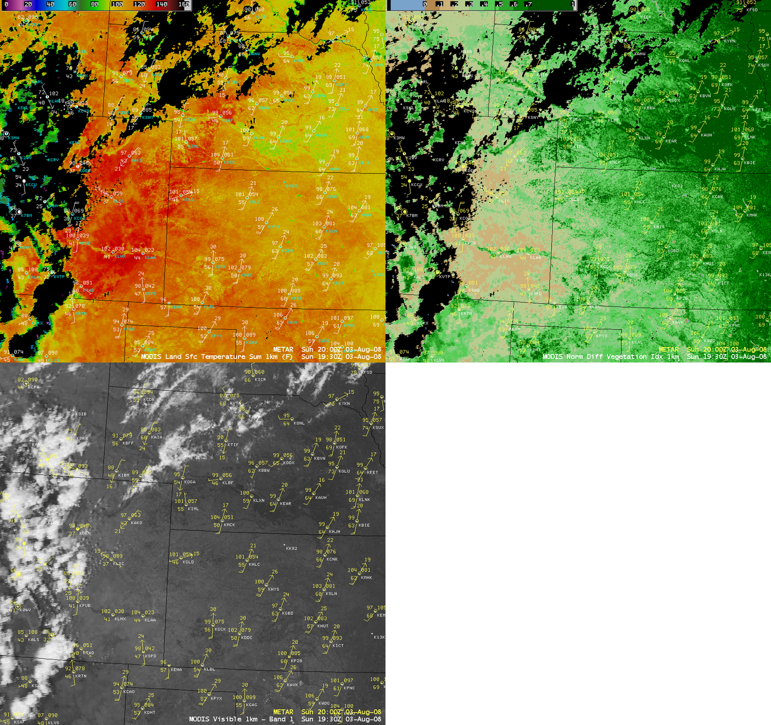
It is interesting to note that the LST values were significantly lower across much of southcentral and southeastern Nebraska (in the upper 80s to low 90s F, green to yellow colors), even though the air temperatures were similar to those seen in eastern Colorado at that time (in the upper 90s to low 100s F). These lower LST values were due to a much higher density of vegetation in eastern Nebraska, as shown by a comparison with the MODIS Normalized Difference Vegetation Index (NDVI) product (below) — NDVI values were greater than 0.7 in Nebraska, compared to 0.1 to 0.3 across much of eastern Colorado. In addition, very dry conditions had prevailed across eastern Colorado — Denver had only received 3.28 inches of precipitation so far in the year (the normal is 10.25 inches for the 01 January – 31 July period) — in contrast with Hastings in eastern Nebraska, which had received 6.77 inches of precipitation so far in the year (the normal precipitation is 3.81 inches for the 01 January – 31 July period). The combination of drier soils and sparse vegetation helped contribute to such high MODIS LST values.
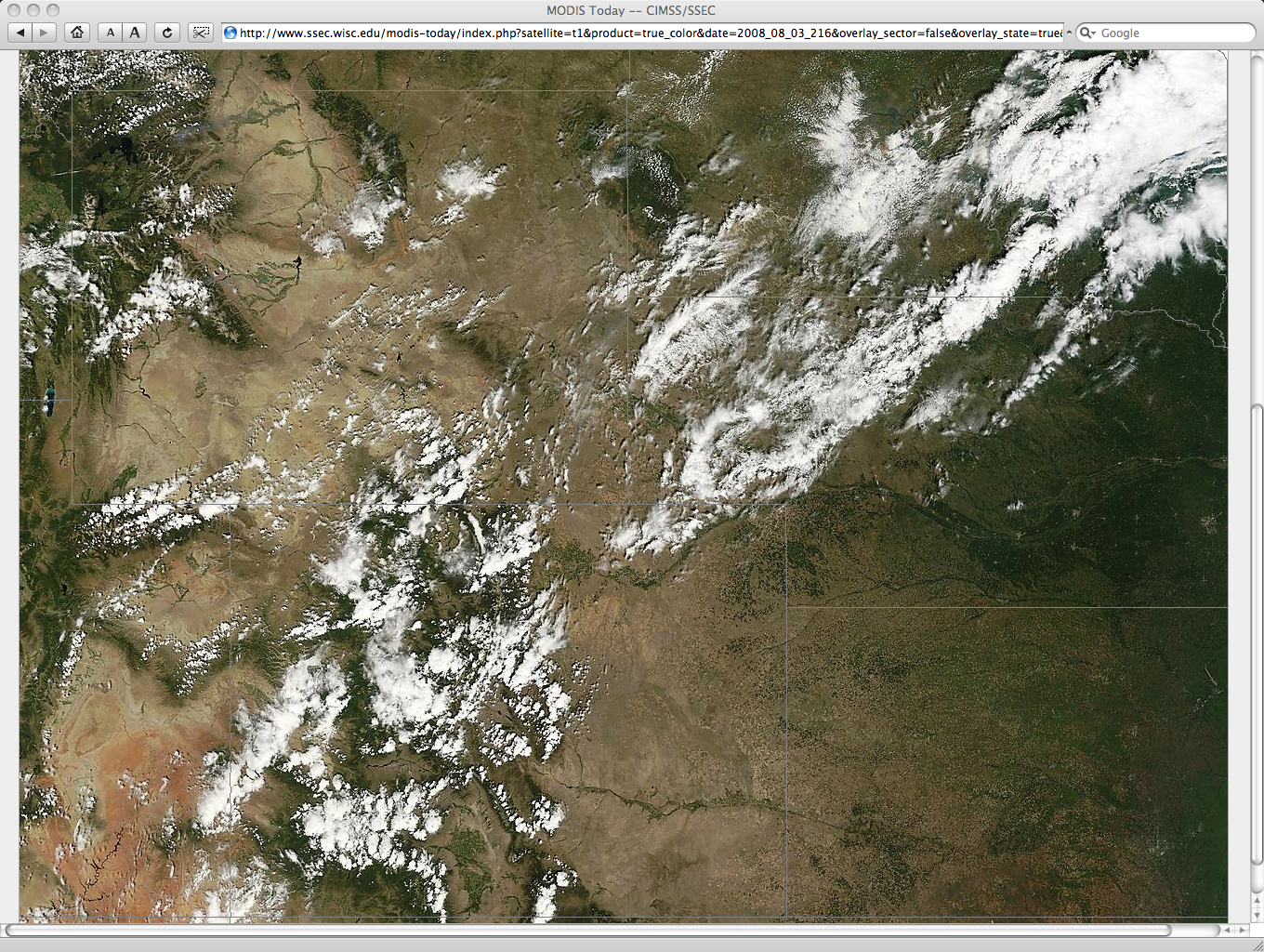
MODIS true color imagery from the SSEC MODIS Today site (below) confirmed the presence of a much higher density of vegetation (denoted by darker green colors) across eastern Nebraska, compared to that found across eastern Colorado.


