Category 4 Hurricane Igor: Super Rapid Scan Operations (SRSO) imagery
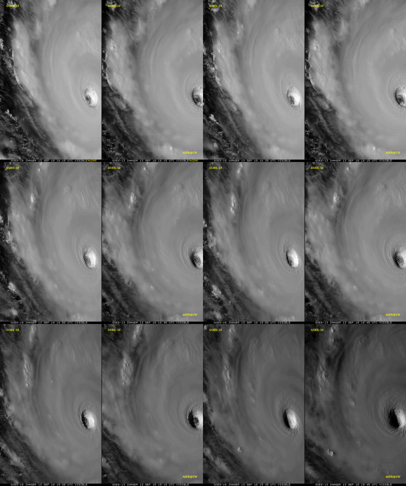
As part of the GOES-15 Post Launch Science Test, the satellite was placed into Super Rapid Scan Operations (SRSO) mode on 13 September 2010, providing images as frequently as every 1 minute during the day. GOES-15 0.63 µm visible channel images (above; also available as a QuickTime movie) showed the well-defined eye of Hurricane Igor, with SRSO images during a 4 hour period (from 16:39 – 20:39 UTC). The visible images were brightened a bit after 19:26 UTC to help detect the presence of any mesoscale vortices within the eye.
A comparison of 1-minute interval GOES-15 SRSO images with the normal operational 15-minute interval GOES-13 visible images (below) clearly demonstrates the advantage of higher temporal resolution for monitoring the evolution of the eye structure of the hurricane (courtesy of Tim Schmit, NOAA/ASPB).
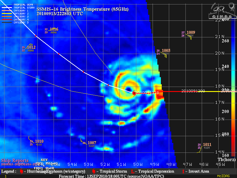
While Hurricane Igor maintained a Category 4 intensity for more than 24 hours, an SSMI/S 85 GHz microwave brightness temperature image from the CIMSS Tropical Cyclones site (below) suggested that the storm might be entering an eyewall replacement cycle (ERC) late in the day on 13 September, which would signal a likely decrease of the storm’s intensity during the ERC process.
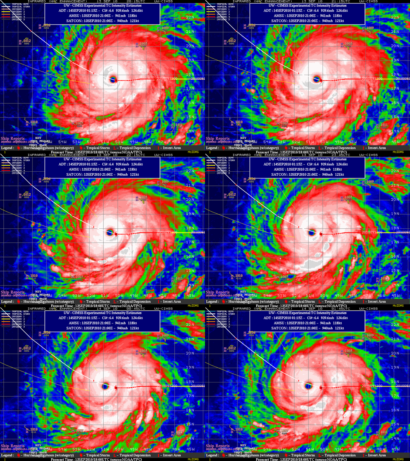
A large eye was also evident on GOES-13 10.7 µm IR imagery (below).


