Severe thunderstorms over the Front Range and the central Plains
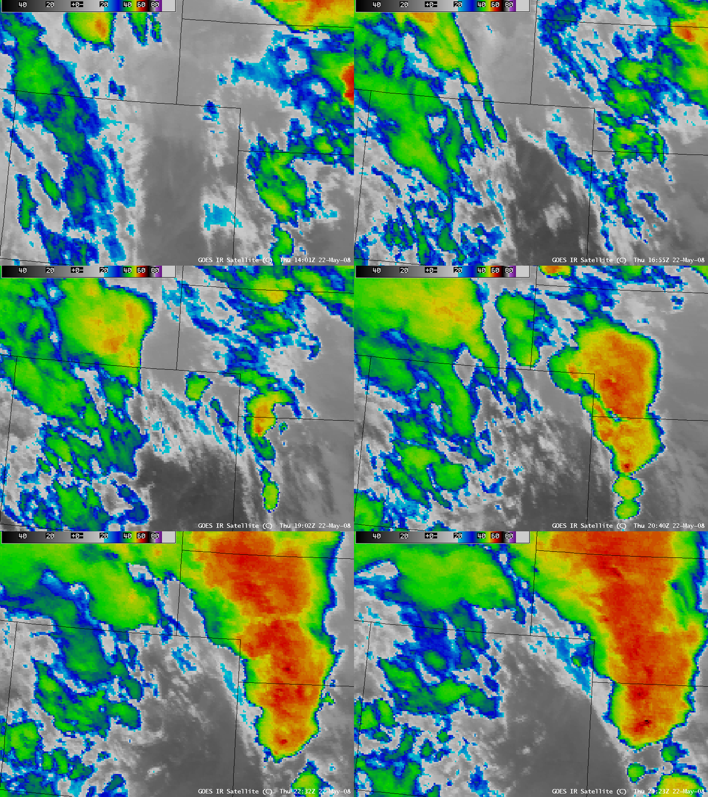
AWIPS images of the GOES 10.7 µm IR channel (above) showed the development of severe thunderstorms across parts of Colorado, Wyoming, Nebraska, and Kansas on 22 May 2008 (see also: CIRA RAMMB Satellite Case Study). According to the SPC storm reports, a number of tornadoes were produced by these storms (one tornado-related fatality was reported near Greely, Colorado), along with large hail (up to 2.75 inches in diameter near Windsor, Colorado and 3.00 inches in diameter near Grinnell, Kansas).
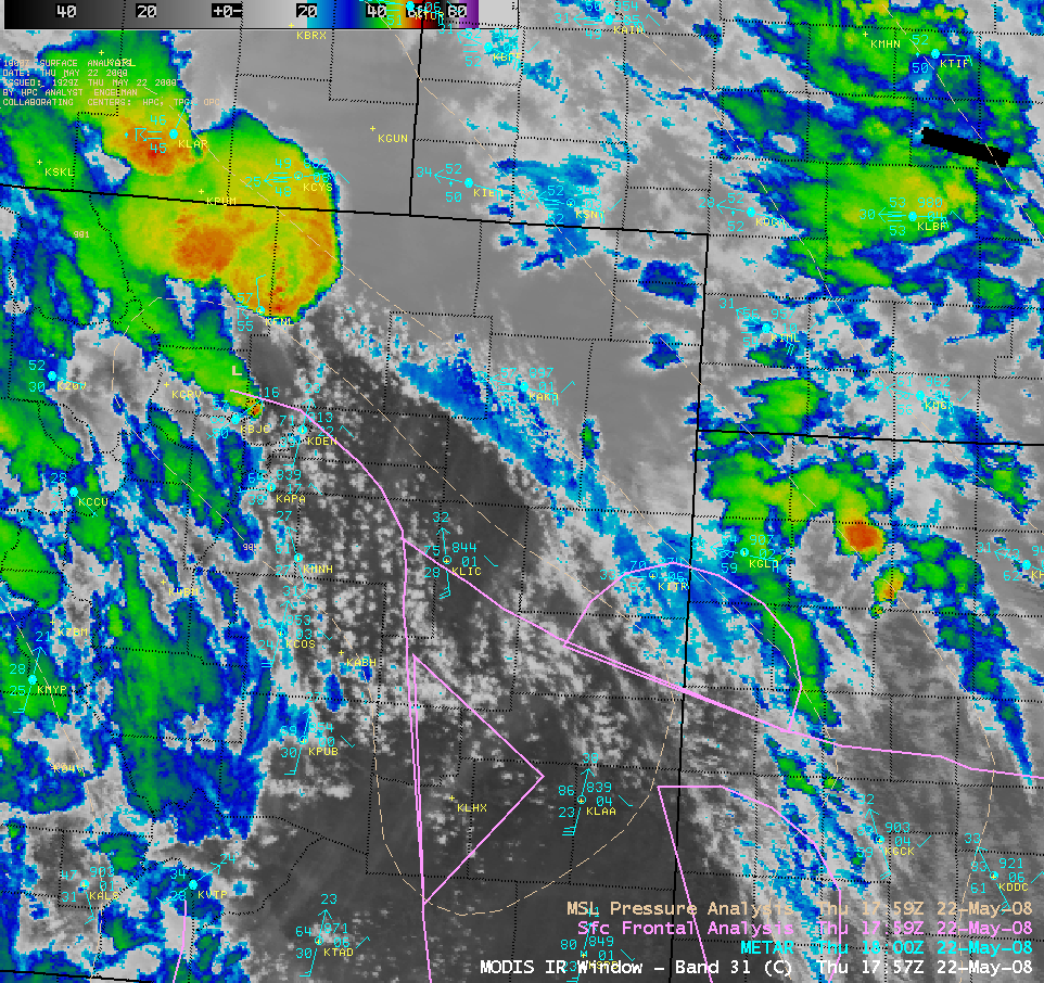
A closer view using the 1-km resolution MODIS 11.0 µm IR channel (above) from around 17:57 UTC (11:57 am local time) revealed a rather diffuse “enhanced-v” signature just east/northeast of Fort Collins, Colorado (station identifier KFNL). This storm went on to produce tornadoes and large hail in southeastern Wyoming, with one tornado doing extensive damage in the Laramie area.
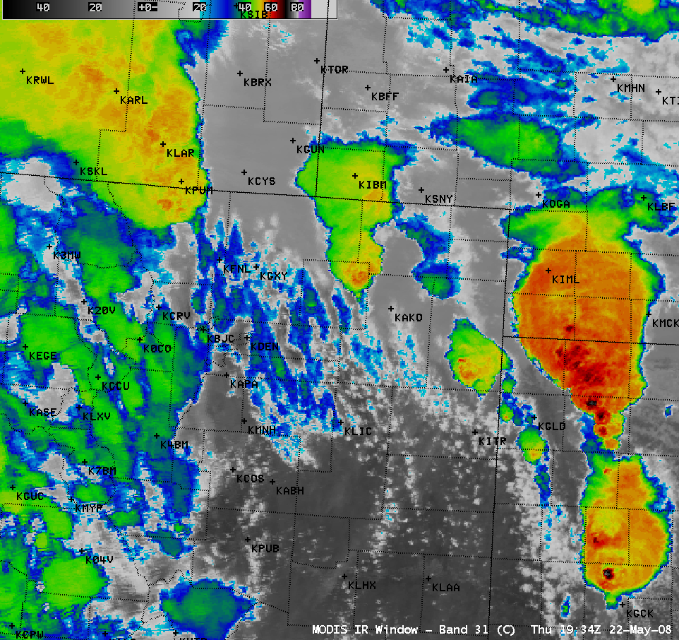
Another MODIS IR image from around 19:34 UTC (1:34 pm local time) displayed impressive detail in the overshooting top structure of the storms developing over western Kansas and far southwestern Nebraska (below), with the coldest cloud top brightness temperatures in the -70º to -80º C range (black to while enhancement).
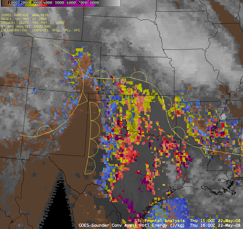
The GOES sounder derived Convective Available Potential Energy (CAPE) product (below) indicated that the pre-convective environment across northeastern Colorado during the morning hours was becoming unstable, with CAPE values in the 2000-4000 J kg-1 range (yellow to red enhancement) at 16:00 UTC (10 am local time). The air mass south of the warm front and east of the dryline (from southern Kansas into Texas) was also very unstable, with CAPE values in some areas over 4000 J kg-1 (purple enhancement).


