Outflow boundaries, storm top signatures, and swaths of rain-cooled ground
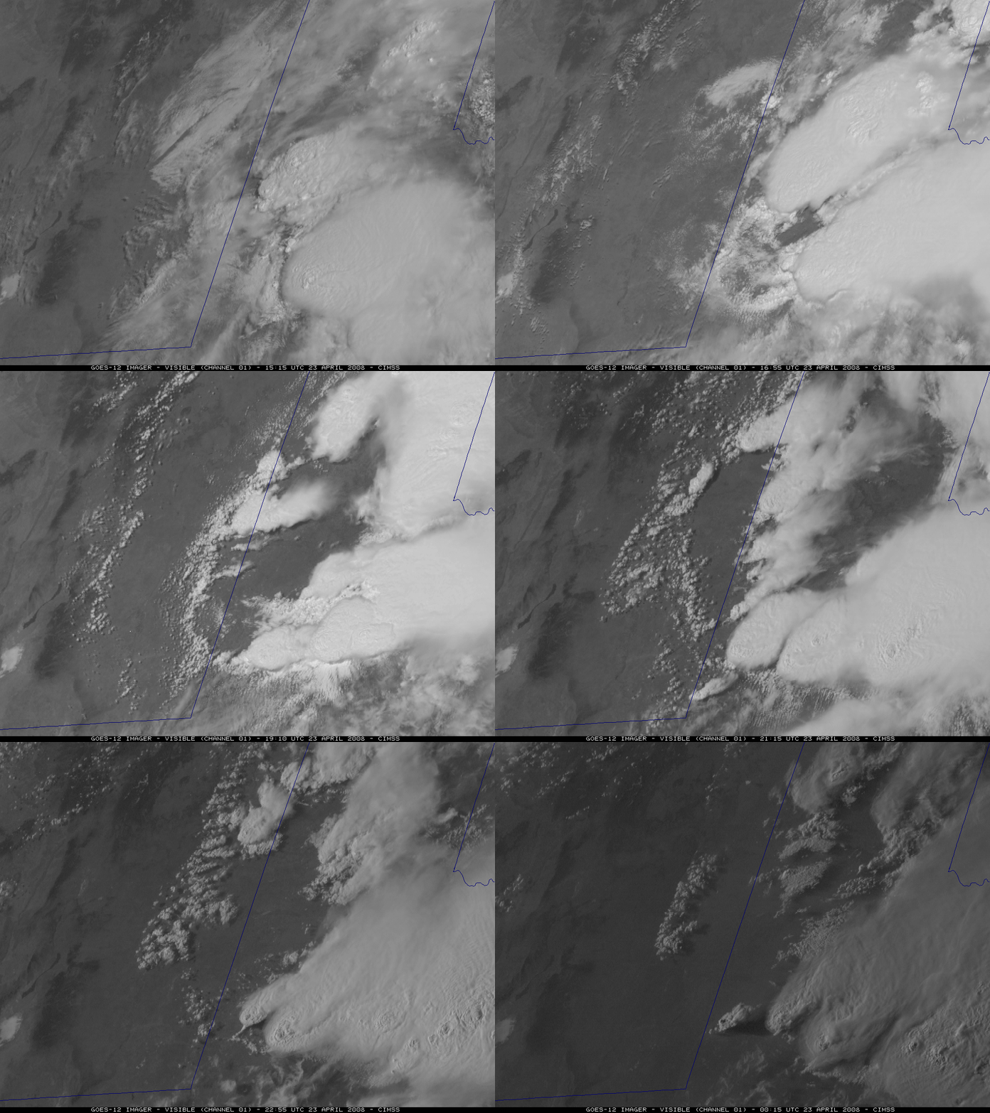
Clusters of severe thunderstorms developed along the Texas / New Mexico border region during the late morning and afternoon hours on 23 April 2008. GOES-12 visible images (above) showed multiple low-level convective outflow boundaries that moved westward — and these outflow boundaries then played a role in subsequent convective development later in the day. The GOES-12 satellite had been placed into Rapid Scan Operations (RSO) mode, allowing images to be available as frequently as every 5-10 minutes during the daylight hours.
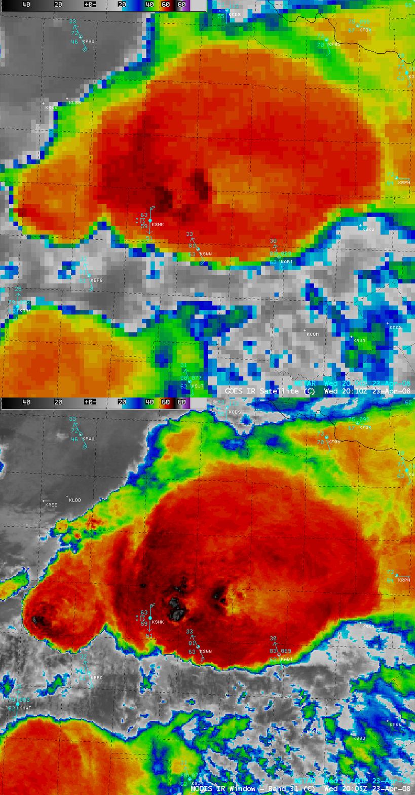
A comparison of 1-km resolution MODIS and 4-km resolution GOES-12 IR images (below) demonstrated the superior storm top temperature detection capability of the MODIS data — the largest storm over northwest Texas (located in the center of the image, between Abilene KABI and Lubbock KLBB) exhibited a well-defined “enhanced-v” signature on the MODIS imagery, in addition to a “warm trench” signature surrounding an area of overshooting tops just to the west of the enhanced-v. Note that the features on the GOES-12 IR image appear to be displaced a bit to the north/northwest compared to the MODIS IR image — this is a result of “parallax error” due to the large viewing angle of the GOES-12 satellite (which is positioned over the Equator at 75º W longitude).
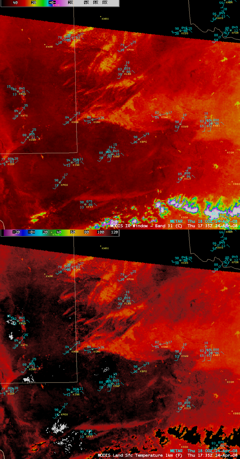
These thunderstorms produced heavy rainfall, and were also responsible for a number of reports of tornadoes, large hail, and damaging winds (SPC storm reports). Isolated locations reported rainfall of 2 inches or more, creating several large swaths of wet ground which were very evident on MODIS IR and Land Surface temperature (LST) images (below) from the next day (24 April 2008). While the swaths of wet ground remained relatively cool during the following day (yellow to orange to light red colors), the surrounding dry ground areas were able to heat up much more quickly, exhibiting significantly warmer IR brightness temperature and LST values (darker red to black colors). In addition, a burn scar from a large fire that burned back in February 2008 could still be seen, with slightly warmer IR temperatures and LST showing up in the area of the burn scar (located just northwest of San Angelo, KSJT).


