Springtime flooding in the central US
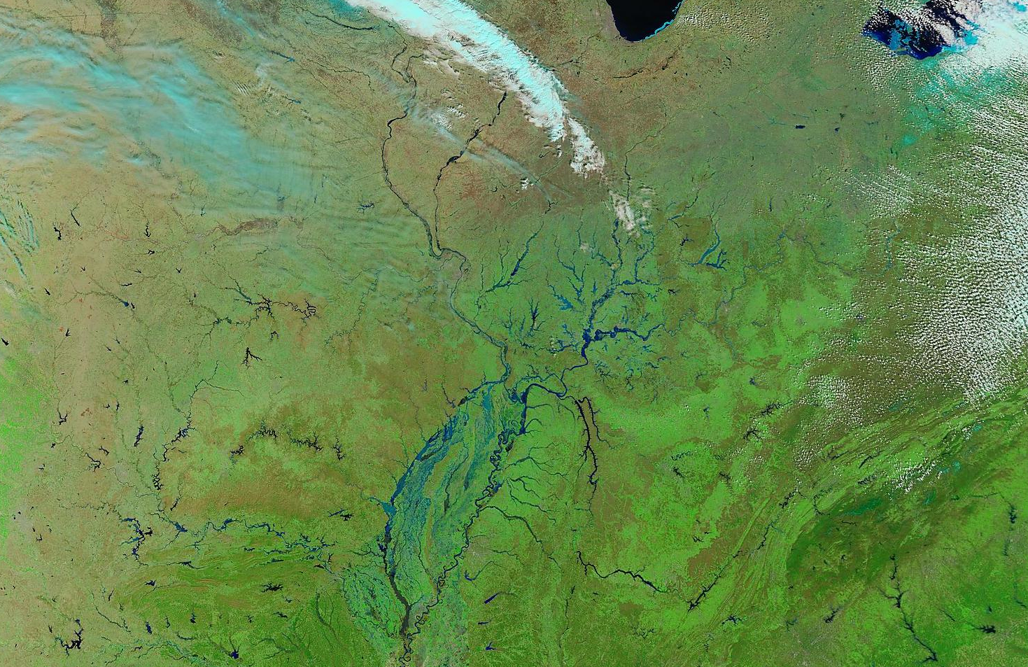
A MODIS false color image from the SSEC MODIS Today site (above) shows the extent of river flooding across much of the Mississippi River and Ohio River valley regions in the central US on 20 March 2008. This image is a 3-channel Red/Green/Blue (RGB) combination using MODIS band 7 (2.1µm), band 2 (0.8µm), and band 1 (0.7µm) — healthy vegetation appears as varying shades of green; water appears dark blue to black; supercooled water droplet clouds appear as white; ice crystal clouds as well as snow or ice on the ground appear as varying shades cyan.
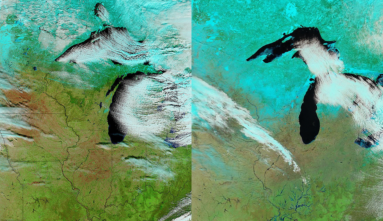
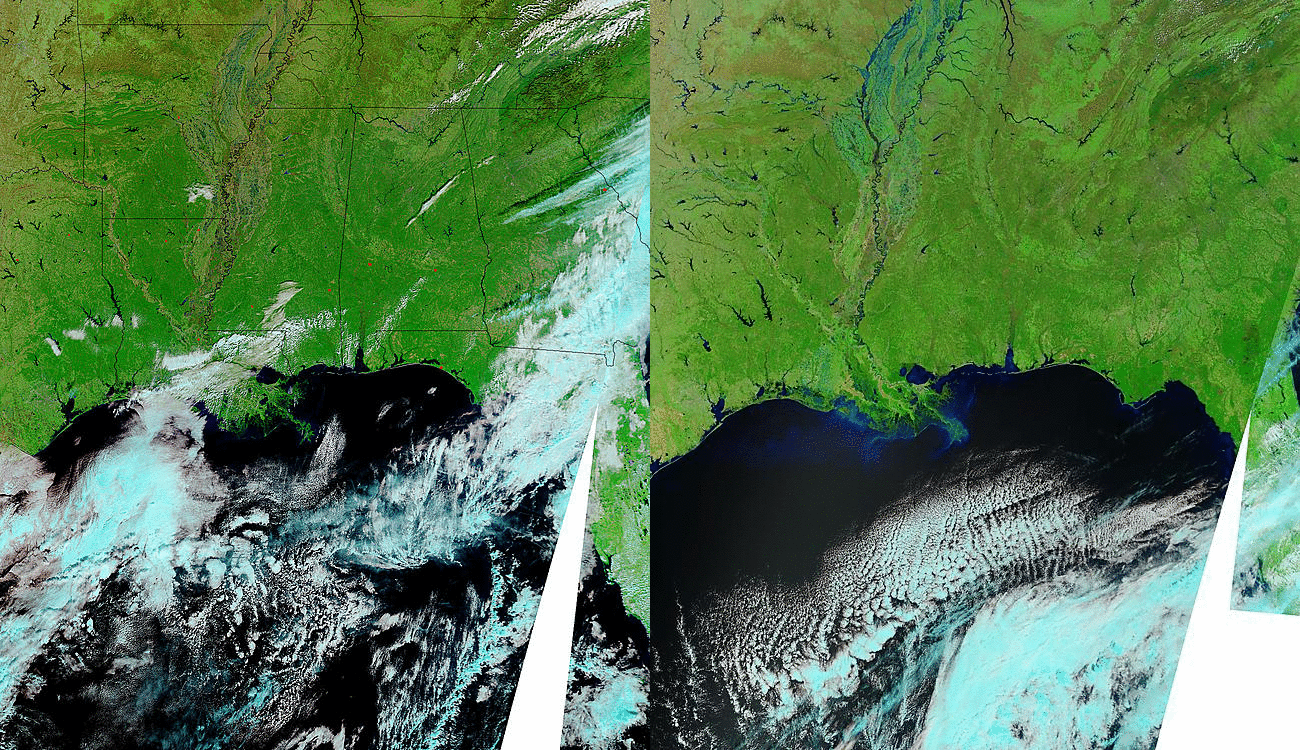
Comparisons of MODIS false color images “before flooding” (29 November 2007; sourced from the NASA MODIS Rapid Response site) and “after flooding” (20 March 2008) appear below, covering the northcentral and the southcentral US — note the swollen appearance of many the rivers on 20 March, due to a combination of springtime snowmelt and recent heavy precipitation (widespread reports of 5-10 inches of rainfall in a 7-day period, which was 400-600% above normal). A total of 16.93 inches of rainfall was reported at Clearwater, Missouri, and Cape Girardeau, Missouri set a new 48-hour precipitation record with 11.48 inches falling from 18-19 March.
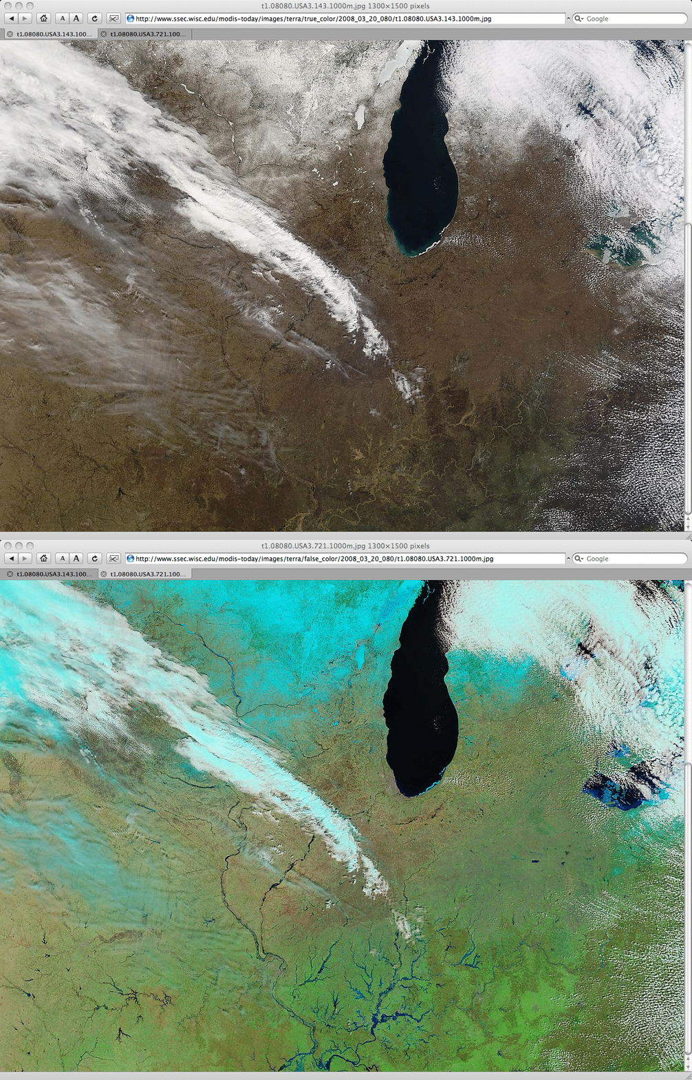
In the comparison of MODIS “true color” and “false color” images (below), note how many of the flooded areas across southern Illinois and Indiana show up very unambiguously (as medium to dark shades of blue) on the false color image, while they appear more vague (as lighter brown colored areas, due to their high sediment content) on the true color imagery. Even though it was the first full day of the Spring season, much of Minnesota, Wisconsin, and Michigan still had a significant snow cover remaining on the ground, and a number of lakes and rivers were still frozen; small patches of lake ice could still be seen in southern Lake Michigan (both along the southern shore, and floating near the center of the lake).
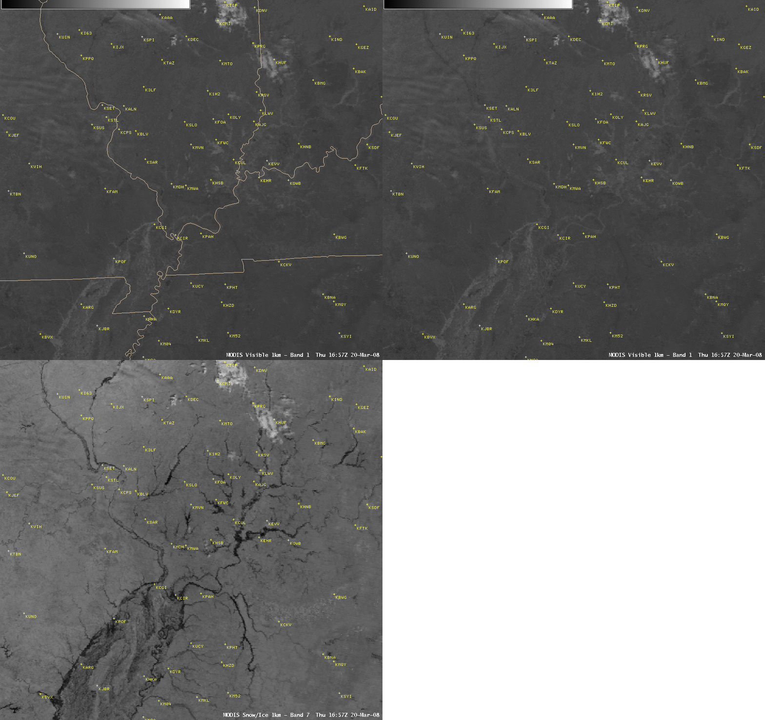
The CIMSS MODIS Imagery in D-2D project makes one component of the MODIS RGB false color imagery (the 2.1µm Band 7 or “snow/ice” channel) available on AWIPS via LDM subscription. AWIPS is restricted to 8-bit displays, so it cannot create the type of 24-bit “true color” and “false color” imagery shown above, but a simple comparison of the MODIS visible channel (Band 1) and snow/ice channel (Band 7) images (below) does help to highlight which of the rivers and tributaries were experiencing flooding on 20 March (water shows up as a very dark feature on the snow/ice channel imagery).
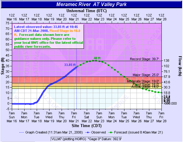
A hydrograph for the Meramec River near St. Louis (below) highlights the magnitude of this particular flooding event: the previous record floodstage of 39.7 feet is forecast to be exceeded at that location on 22-23 March.


