Canadian Fire and Ice
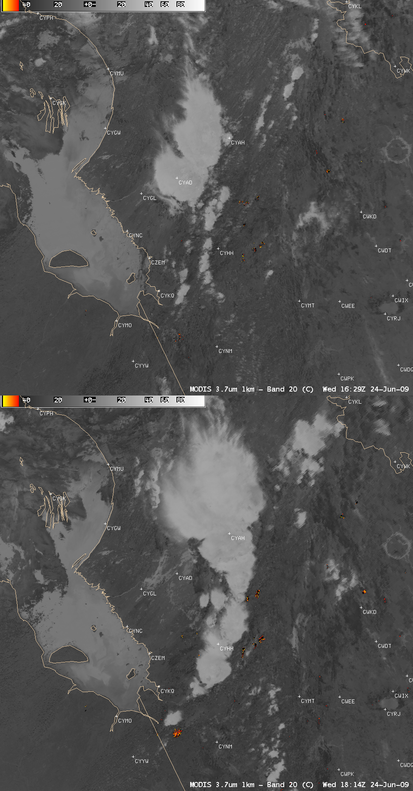
Wildfire activity was beginning to increase across parts of Quebec, Canada on 24 June 2009 — and AWIPS images of the MODIS 3.7 µm shortwave IR channel (above) revealed a number of large fire “hot spots” (red to yellow color enhancement) that were increasing in areal coverage between 16:29 UTC and 18:14 UTC.
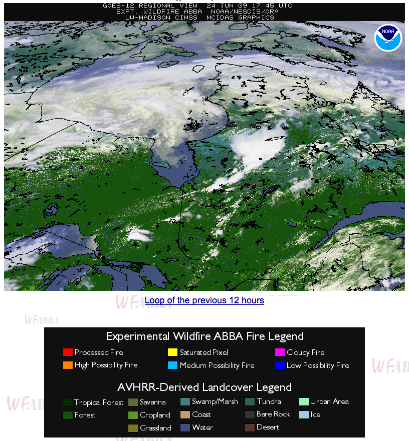
According to the CIMSS Wildfire ABBA product (below), some of these fires were hot enough to saturate the 3.9 µm shortwave IR sensor on GOES-12 (yellow fire pixels).
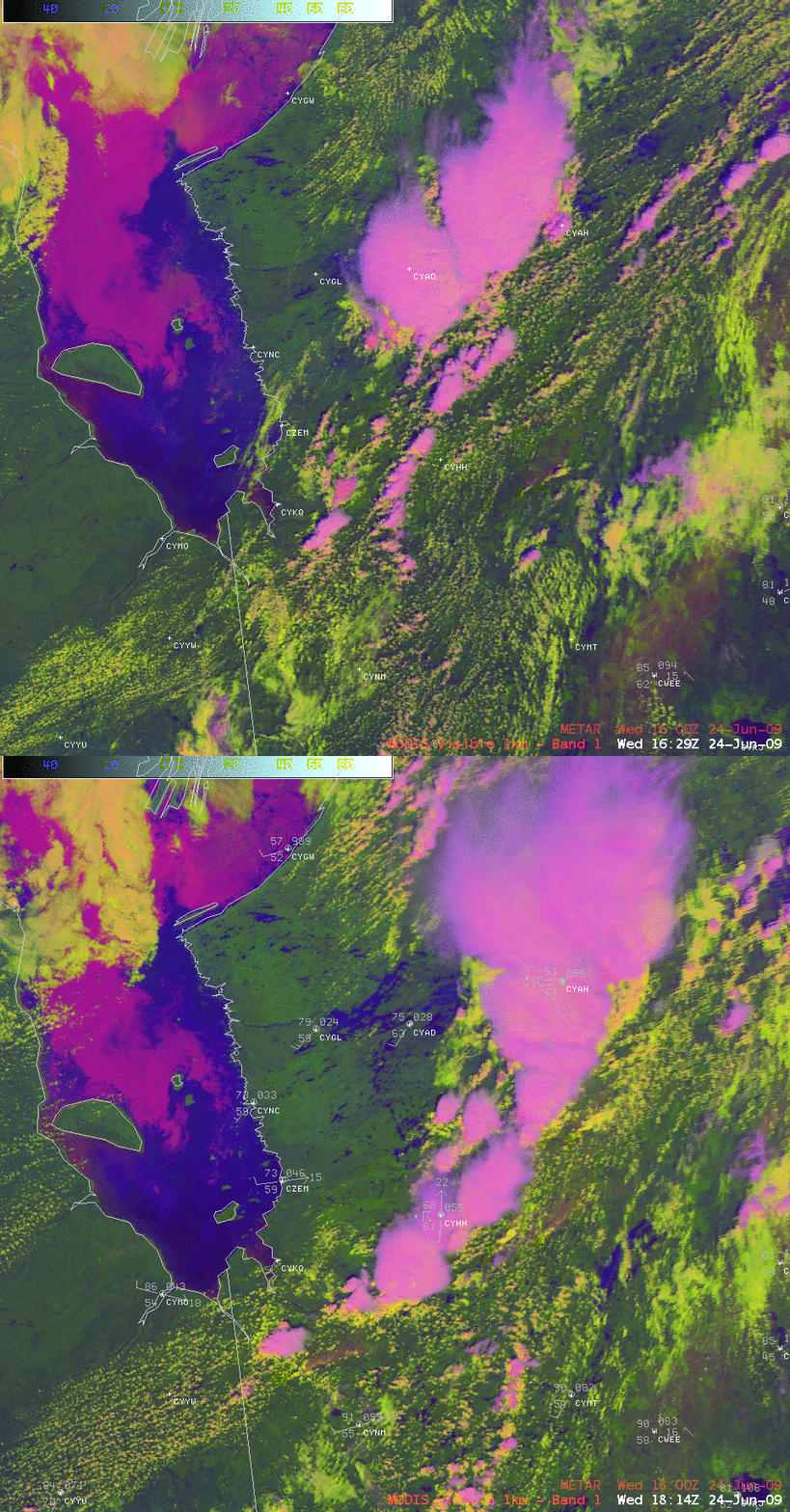
In addition, false color Red/Green/Blue (RGB) images using the MODIS visible channel, the 2.1 µm near-IR “snow/ice” channel, and the 3.7 µm shortwave IR channel (below) also showed that during the 105 minutes between the 2 MODIS images there was a significant amount of southward displacement to the ice that remained in the northern half of James Bay — ice in the bay (as well as glaciated ice crystal clouds) exhibited varying shades of pink in the RGB image, in contrast to areas of open water (darker blue colors) or supercooled water droplet clouds (varying shades of white).
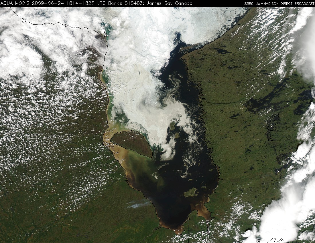
A 250-meter resolution MODIS true color image from the SSEC MODIS Direct Broadcast site (below) showed even more detail in the ice floes in James Bay, as well as some new smoke plumes from fires that had begun to burn in far eastern Ontario.


