Severe thunderstorms in South Florida
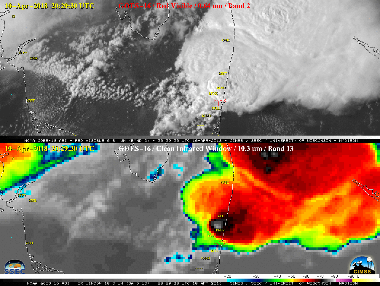
GOES-16 “Red” Visible (0.64 µm, top) and “Clean” Infrared Window (10.3 µm, bottom) images, with SPC storm reports plotted in red and airport identifiers plotted in yellow [click to play MP4 animation]
The NOAA/CIMSS ProbSevere All Hazards product (from this site) for the 1934 UTC tornado is shown below, at two-minute intervals from 1926-1946 UTC. ProbWind for this storm jumped as the tornado began, and the storm had the highest ProbWind values of those on the map.
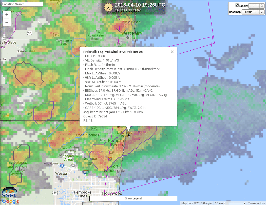
NOAA/CIMSS ProbSevere All Hazards read-out from 1926-1946 UTC on 10 April 2018 (Click to enlarge)
The NOAA/CIMSS ProbSevere All Hazards product (from this site) for the 2025 UTC tornado is shown below, at two-minute intervals from 2012-2034 UTC. ProbTor increased from 1% to 10% between 2020 UTC and 2028 UTC with this storm. ProbWind exceeded 90%.
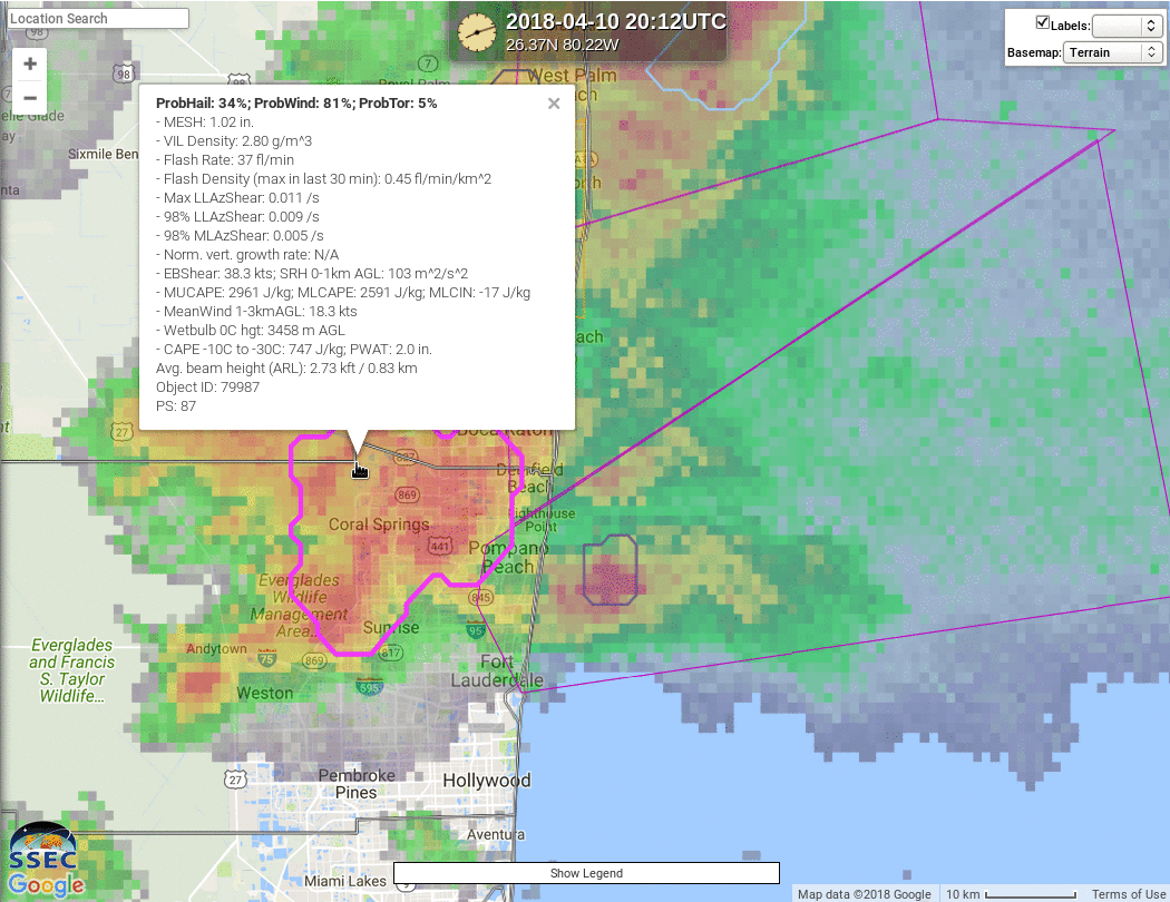
NOAA/CIMSS ProbSevere All Hazards read-out from 2012-2034 UTC on 10 April 2018 (Click to enlarge)