Southern California wildfires
With an ongoing extreme to exceptional drought, hot temperatures (daily high temperatures along the coastal areas as high as 106º F at John Wayne Airport) combined with strong offshore Santa Ana winds (gusting as high as 87 mph at Big Black Mountain) conspired to create an environment favorable for wildfires across southern California and northern Baja California on 14 May 2014. McIDAS images of GOES-15 0.63 µm visible channel data (above; click image to play animation) showed a number of smoke plumes streaming off the coast during the day. Note the brief appearance of a cluster of bright white pixels on the 18:00 UTC image, just north of the California/Baja California border — this a signal of sunlight being reflected off of large solar panel arrays in that area.
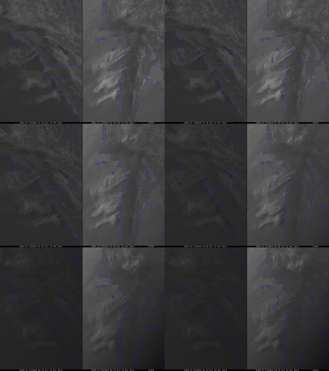
The side-by-side comparison of GOES-15 (GOES-West) and GOES-13 (GOES-East) 0.63 µm visible channel images (below) showed that with a lowering sun angle at the end of the day, the smoke plumes began to become more difficult to identify on GOES-15 images (left); on the other hand, thanks to the benefit of a favorable forward scattering angle, the areal coverage of the smoke plumes stood out very well on GOES-13 images (right). The enhancements are the same on both sets of images.
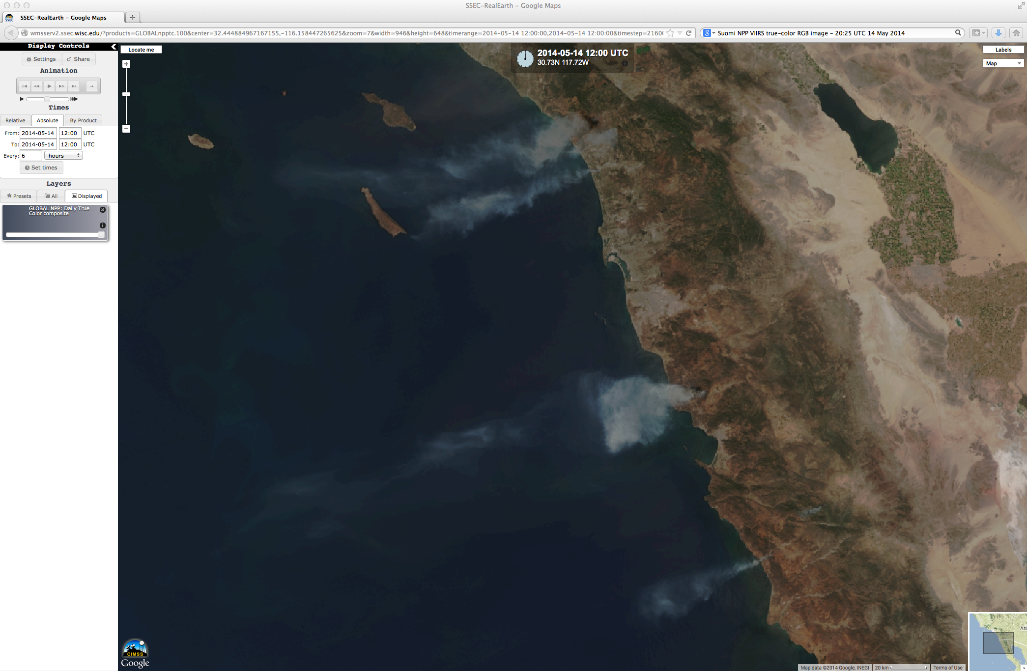
A 375-meter resolution Suomi NPP VIIRS true-color Red/Green/Blue (RGB) image visualized using the SSEC RealEarth web map server (below) showed these smoke plumes with great clarity at 20:25 UTC or 1:25 PM local time.
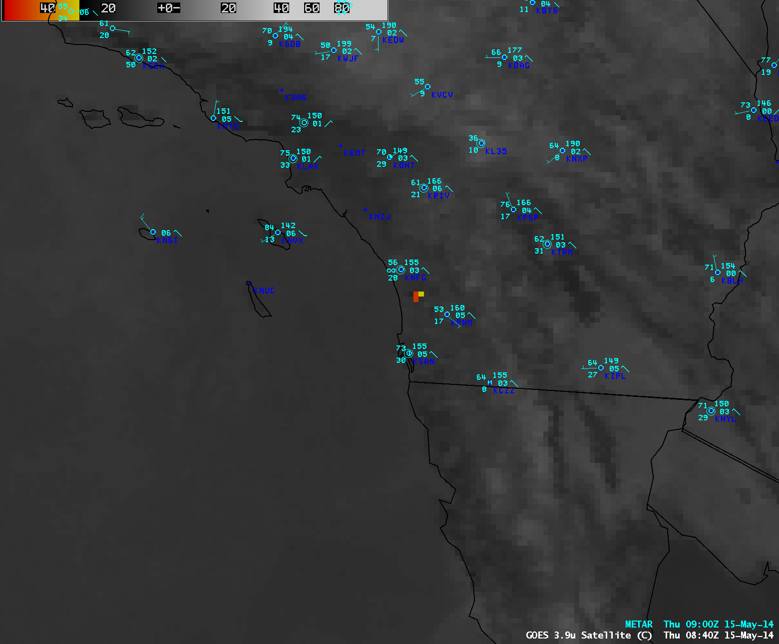
As the larger fires continued to burn into the subsequent overnight hours, their hot thermal signature could be detected on AWIPS images of 4-km resolution GOES-15 3.9 µm shortwave IR channel data (below; click image to play animation).
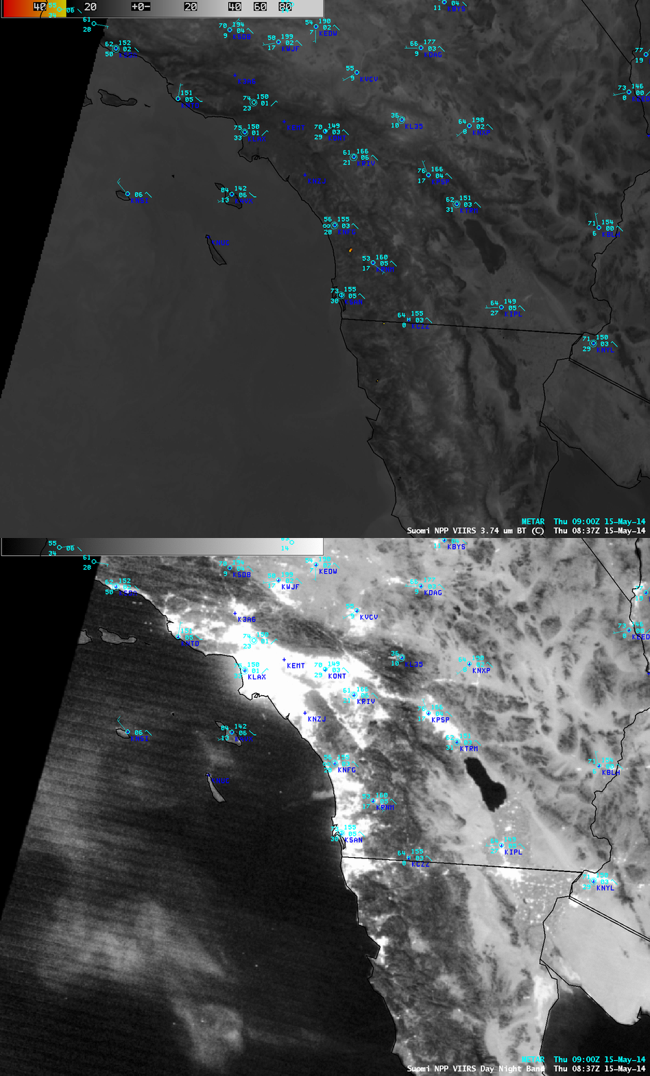
A nighttime comparison of a 375-meter resolution Suomi NPP VIIRS 3.74 µm shortwave IR image with the corresponding 750-meter resolution VIIRS Day/Night Band image (below) showed a prominent fire hot spot (yellow to red pixels) on the shortwave IR image between San Diego (KSAN) and Camp Pendleton (KNFG), along with light gray signature of the narrow, fresh smoke plume that was being blown off the coast from that fire on the Day/Night Band image. At the time of the image, smoke was restricting the surface visibility to 5 miles at Camp Pendleton. Farther offshore, reflected moonlight was helping to show the location of smoke that had spread out over the adjacent waters of the Pacific Ocean from the previous day of burning.
Finally, a demonstration of the importance of higher spatial resolution for accurate fire hot spot detection: on the comparison of 375-meter resolution Suomi NPP VIIRS 3.74 µm and 4-km resolution GOES-15 3.9 µm shortwave IR images (below), note that although the size of the fire “hot spot” was smaller on the VIIRS image, the highest IR brightness temperature was 54.5º C (compared to 48.0º C on the GOES-15 image). In addition, the two smaller fires burning in northern Baja California were not detected on the GOES-15 image.


