Super Typhoon Bopha
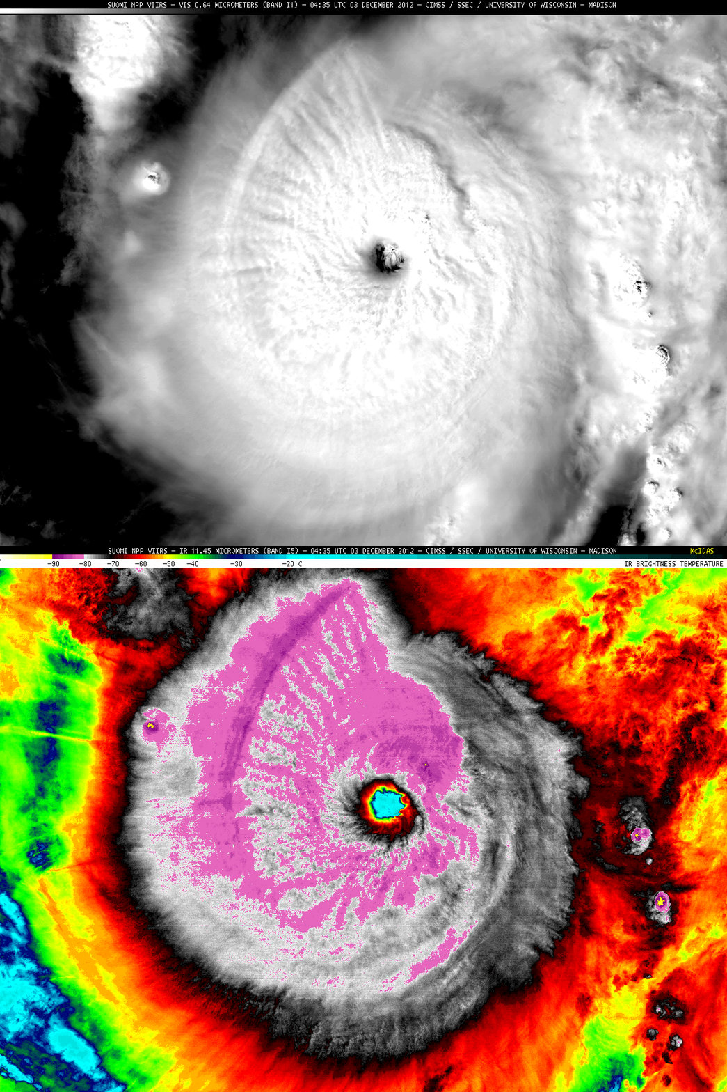
Super Typhoon Bopha reached peak intensity (ADT plot | Advisory text) just before making landfall in the island of Mindanao in the Philippines on 03 December 2012. Earlier in the day, a comparison of McIDAS-X images of 375-meter resolution Suomi NPP VIIRS 0.64 µm visible channel and 11.45 µm IR channel data (above) revealed detailed patterns of cloud top wave structure: (1) the formation of “transverse bands” oriented perpendicular to the flow (which is fairly common in strong tropical cyclones), and (2) an arc-shaped gravity wave train in the northwest quadrant, which was likely propagating outward, away from the storm center. There were also a number of convective overshooting tops which exhibited IR brightness temperatures of -90 to -95º C (yellow enhancement).
McIDAS-X images of MTSAT-1R 10.8 µm IR channel images (above; click image to play animation) showed Super Typhoon Bopha as the eye made landfall around 20 UTC or 4 AM local time. Media reports indicated that there were as many as 270 fatalities as a result of flooding, mudslides, and falling trees.
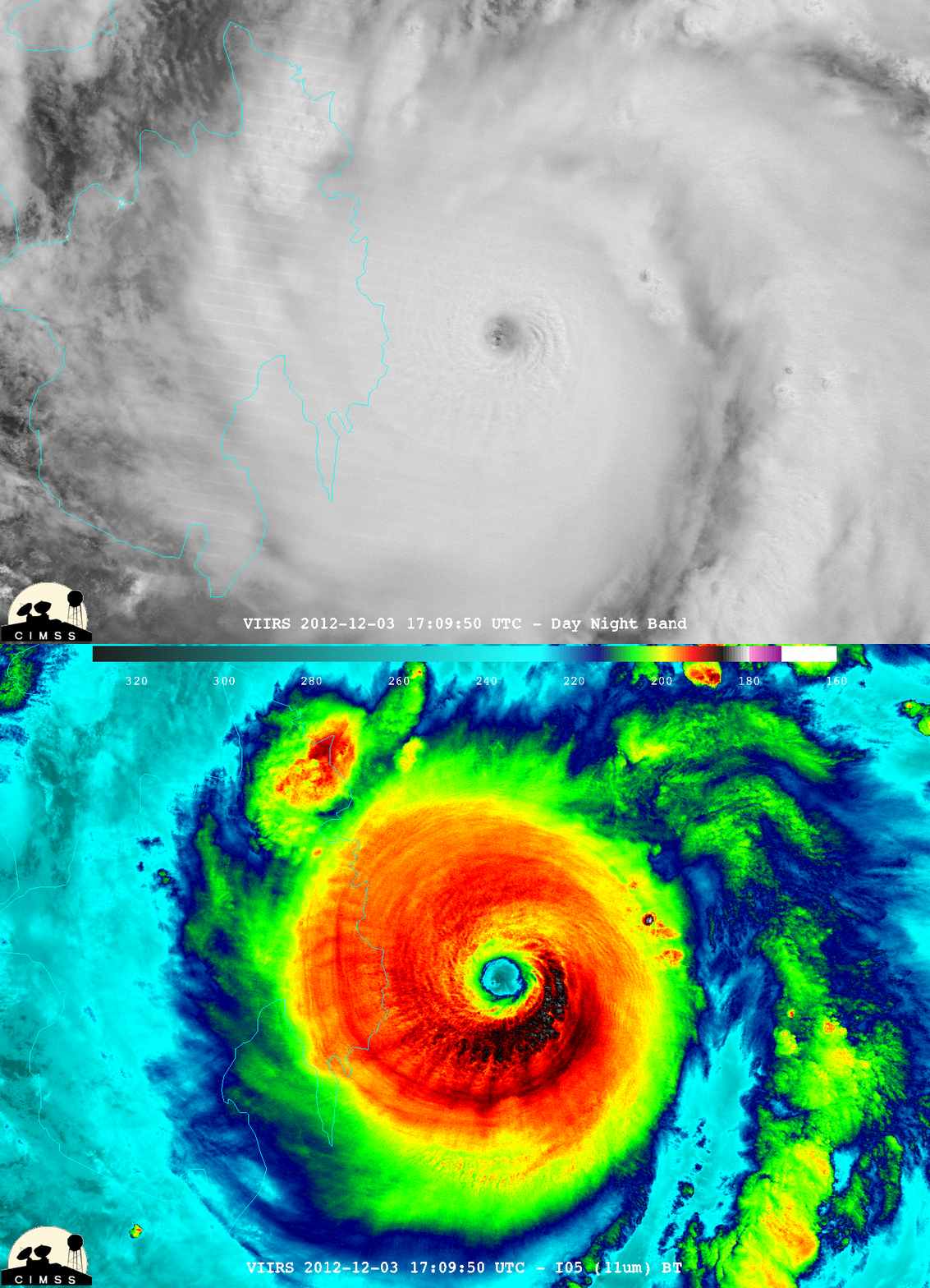
A few hours prior to landfall, a comparison of McIDAS-V images of Suomi NPP VIIRS 0.7 µm Day/Night Band and 11.45 µm IR data (below; images courtesy of William Straka, CIMSS) again showed a signature of gravity waves propagating outward from the storm center — at this time (17:09 UTC or 1:09 AM local time) these gravity waves could be seen in all four quadrants of the storm top. The eye was not entirely cloud-free, with the Day/Night Band image showing moonlight being reflected off of low-level stratus near the ocean surface.
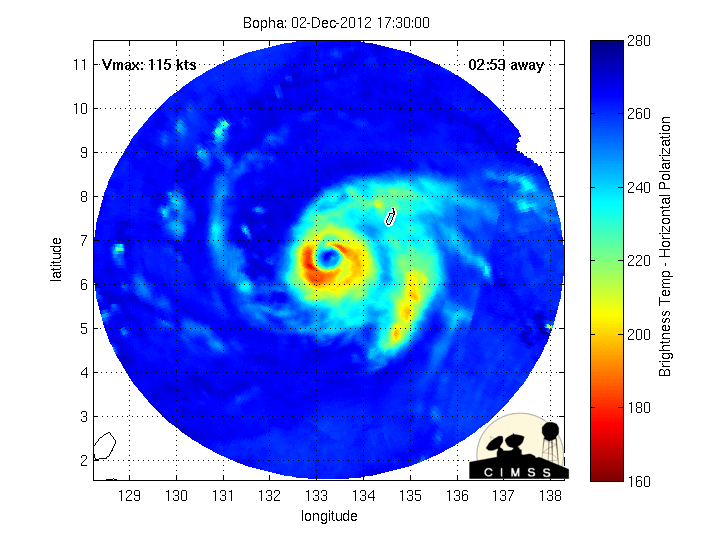
During the 01-03 December period, the MIMIC or Morphed Integrated Microwave Imagery at CIMSS product (below; click image to play animation) showed that Bopha experienced multiple eyewall replacement cycles as it moved south of the island of Palau (where it produced a wind gust of 70 mph at Koror) and toward the Philippines.
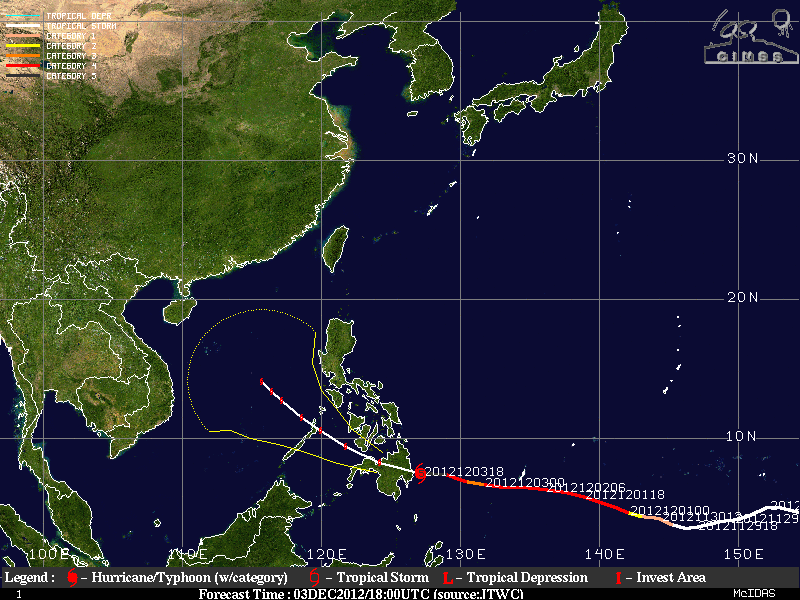
Bopha had an early storm track (below) that was unusually close to the Equator — in fact, the storm was classified as a typhoon at a latitude of 3.8º N on 30 November, making it the closest typhoon formation to the Equator on record for the West Pacific Basin.


