The residual impact of Hurricane Sandy on the Gulf Stream
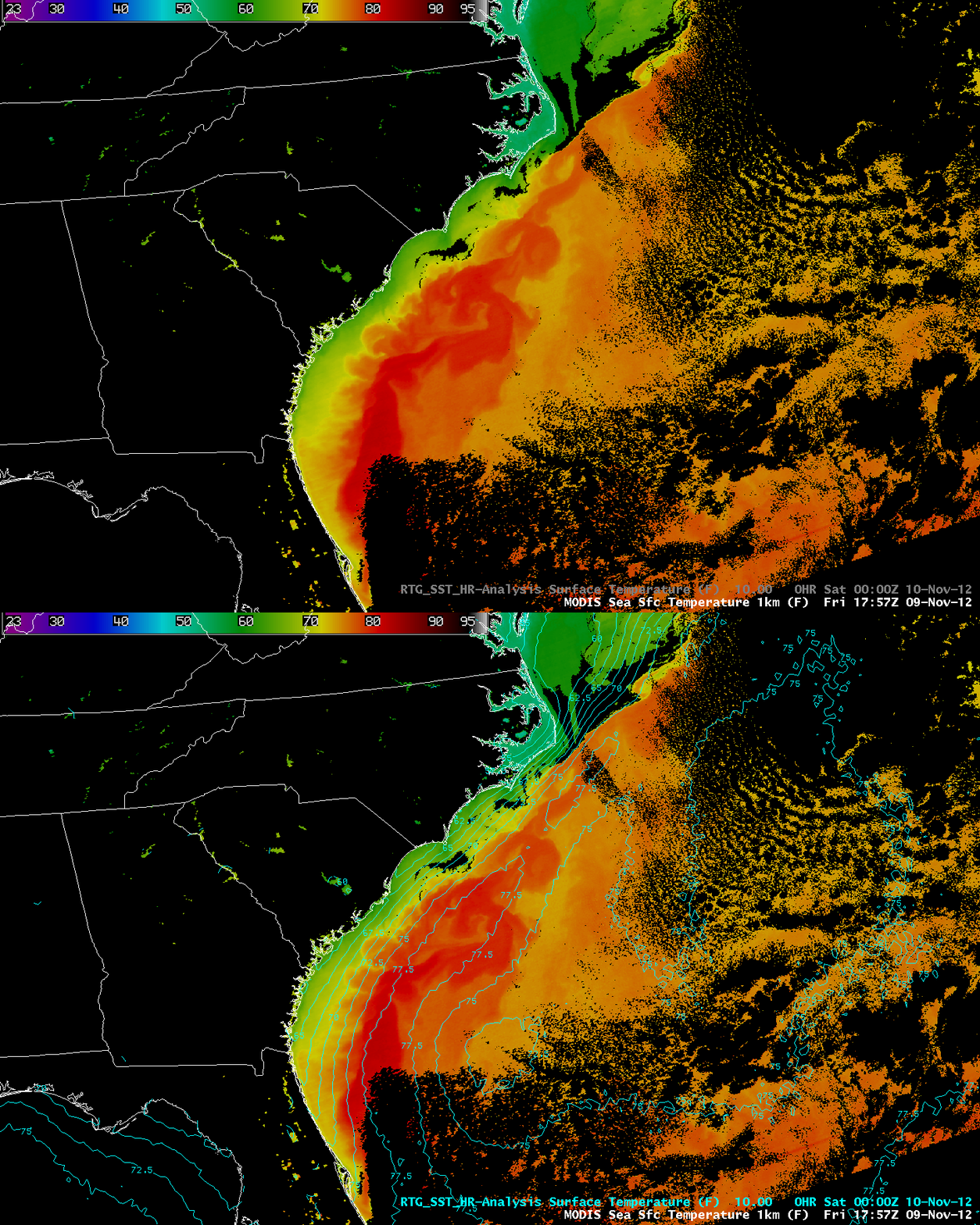
An AWIPS image of the MODIS Sea Surface Temperature (SST) product on 09 November 2012 with an overlay of SST contours from the RTG_SST High-Resolution model valid about 6 hours later (above) showed the residual impact of Hurricane Sandy on the axis of the Gulf Stream, almost 2 weeks after Sandy moved through that area. There were large eddy perturbations seen in the axis of the Gulf Stream, and MODIS SST values of 80º F or higher (darker red color enhancement) that were not captured by the model analysis.


