Pyrocumulus clouds associated with wildfires in Wyoming
McIDAS images of GOES-15 (GOES-West) and GOES-13 (GOES-East) 0.63 µm visible channel data (above; click image to play animation) revealed smoke plumes and pyrocumulus clouds associated with a pair of large wildfires that were burning in western Wyoming on 15 September 2012. Because of difference in viewing angle between the two satellites, the pyrocumulus clouds appeared brighter white on the GOES-15 images (due to more direct reflection of sunlight off the western edges of the clouds), while on the GOES-13 images the “overshooting” clouds cast more well-defined shadows on top of the smoke layer below.
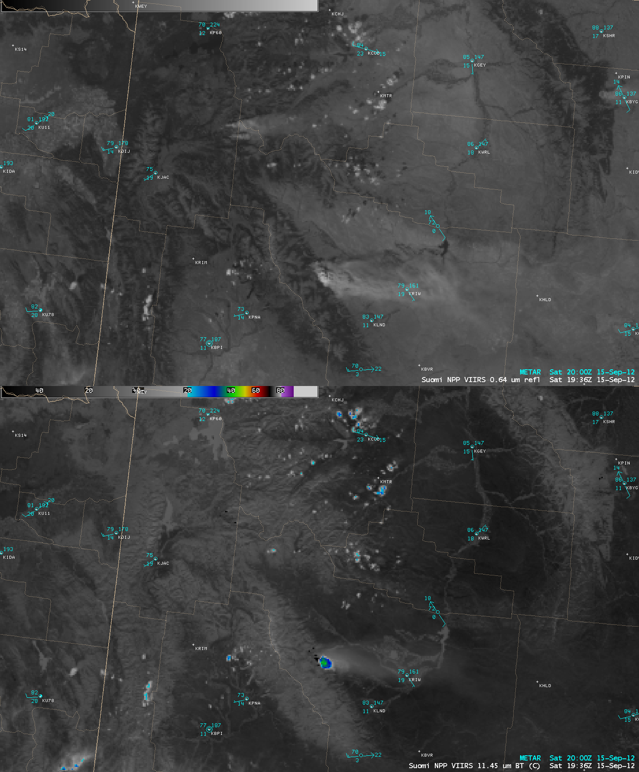
A comparison of AWIPS images of Suomi NPP VIIRS 0.64 µm visible channel and 11.45 µm IR channel data at 19:36 UTC or 1:36 PM local time (below) showed that the southernmost fire burning along the eastern slopes of the Wind River Range had already developed a pronounced pyrocumulus cloud, which exhibited an IR brightness temperature as cold as -40º C (green color enhancement).
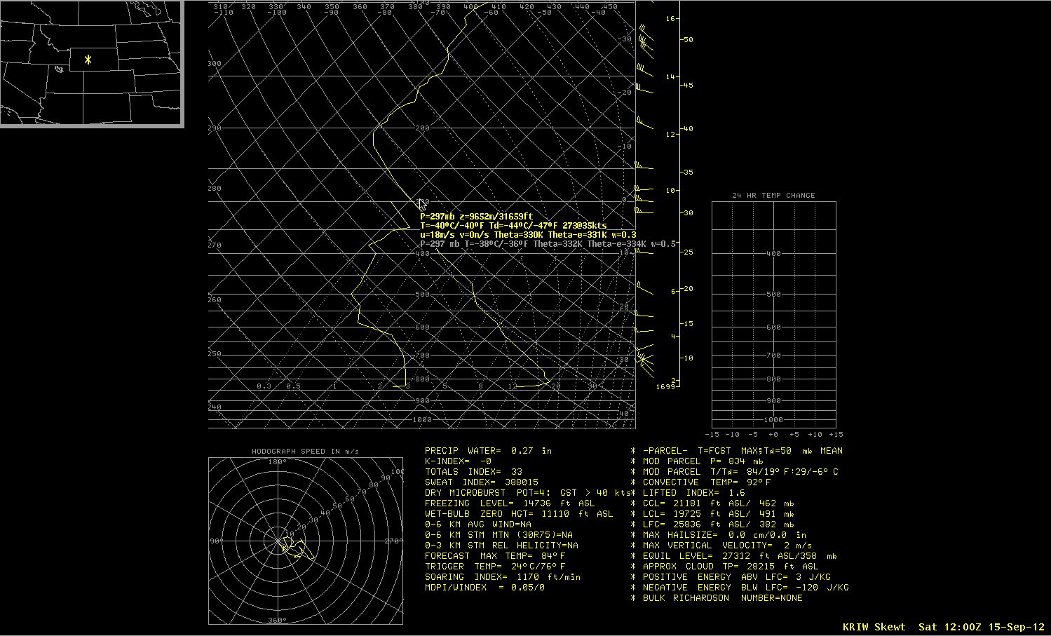
According to 12 UTC rawinsonde data from nearby Riverton, Wyoming (station identifier KRIW), the -40 C IR cloud top brightness temperature roughly corresponded to an altitude just over 31,000 feet or 9.6 km (below).


