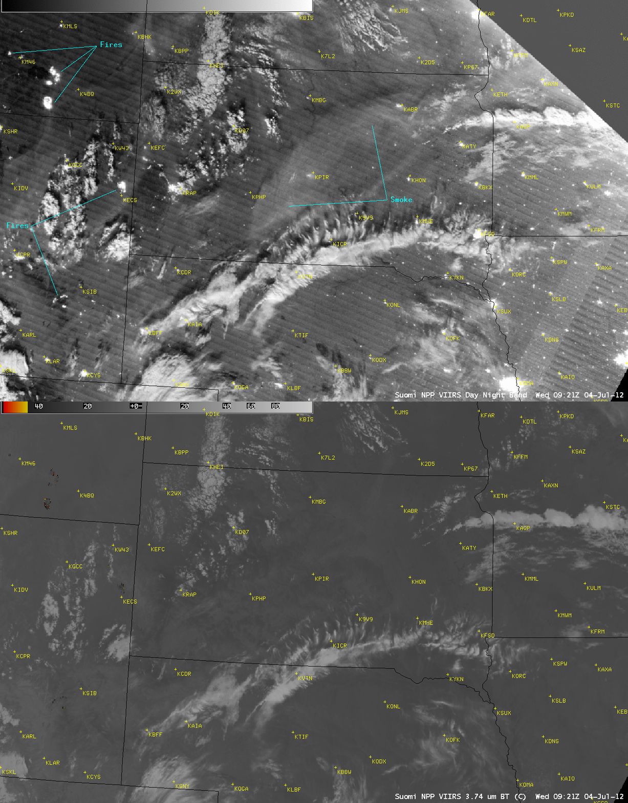
Night-time detection of a dense smoke layer aloft
A comparison of AWIPS images of the Suomi NPP VIIRS 0.7 µm Day/Night Band (DNB) with the corresponding 3.74 µm shortwave IR data (above) showed a large arc-shaped layer of dense smoke aloft over much of central South Dakota at 09:21 UTC (4:21 AM local time) on 04 July 2012, along with a number of shortwave IR “hot spots” (black to yellow to red color enhancement) and brightly-glowing DNB signatures from active wildfires that were burning in southeastern Montana and eastern Wyoming. Since the Moon was in the full phase, it provided good illumination of the various cloud features across the region.
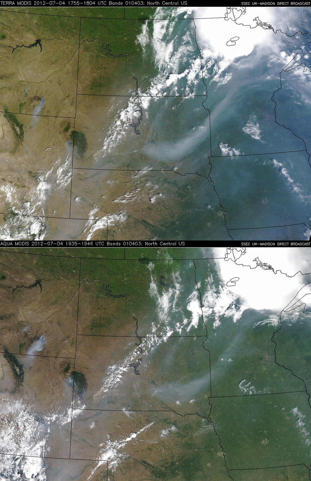
The following afternoon, the dense smoke feature was still very evident over eastern South Dakota into western Minnesota on Terra and Aqua MODIS true-color Red/Green/Blue (RGB) images from the SSEC MODIS Direct Broadcast site (below). Other areas of smoke were seen in the vicinity of the fires in Montana and Wyoming. High aerosol concentrations were also indicated by the Suomi NPP Ozone Mapper Profiler Suite.


