Intensifying upper-level low over Florida
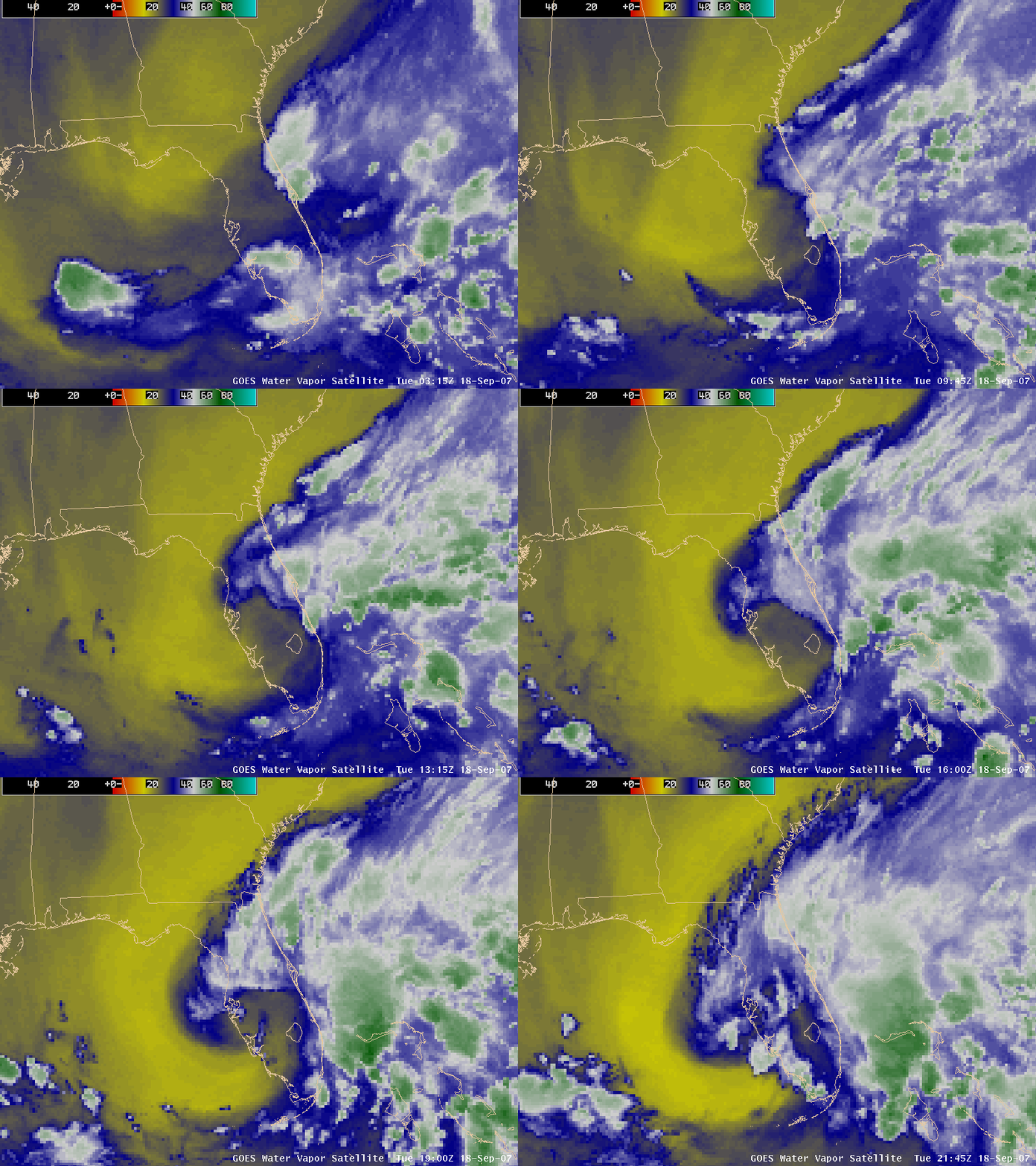
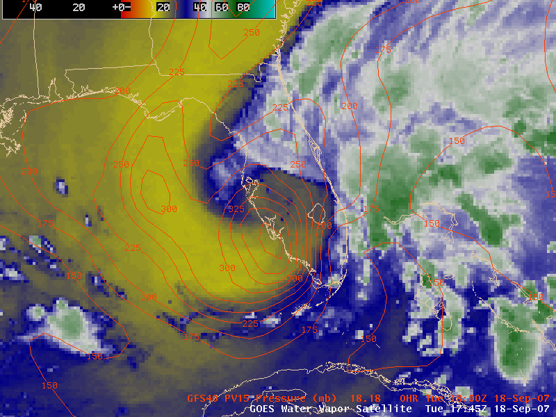
AWIPS images of the GOES-12 6.5µm “water vapor” channel (above) show an upper-level low that was intensifying over Florida during the day on 18 September 2007. As warm/dry middle to upper tropospheric air (yellow enhancement) wrapped around and into the southwestern quadrant of the cyclone, convection was seen to develop along the southern Gulf Coast of Florida. This dry air was associated with a tropopause anomaly, where the “dynamic tropopause” (taken to be the 1.5 Potential Vorticity Unit contour) descended to around the 380 hPa pressure level according to the GFS40 model (below).
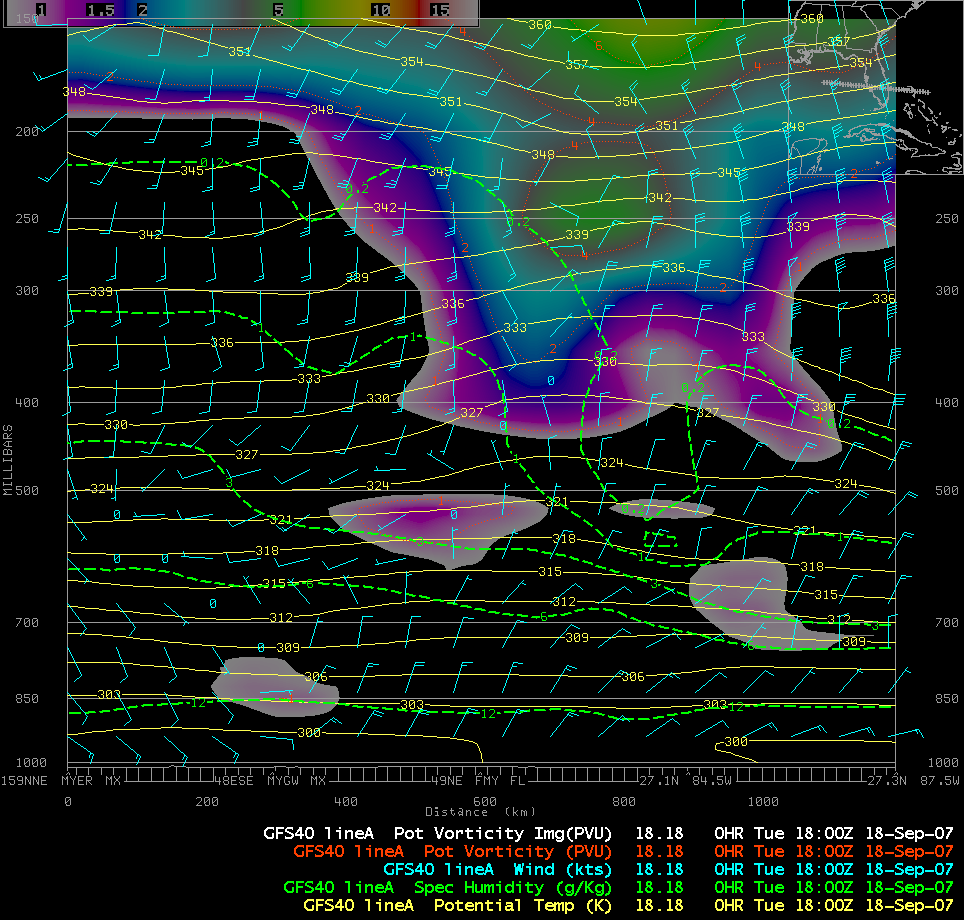
A cross section of GFS40 model fields (oriented from east on the left to west on the right) across Florida (below) reveals the lowering tropopause (color shaded potential vorticity values) and descending dry air (dashed green specific humidity contours) associated with the tropopause anomaly. Surface pressures were beginning to fall across that region in response to the tropopause anomaly, raising speculation that a subtropical or a tropical cyclone could eventually develop from this system as it moves slowly westward into the Gulf of Mexico.


