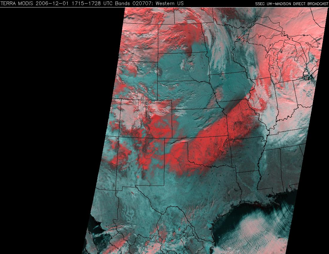
Heavy snow from Texas to Michigan
An impressive winter storm (which featured a TROWAL airstream) brought snow, sleet, and freezing rain to much of the central US during the 30 November to 01 December 2006 time frame — maximum snowfall totals included 8 inches in Texas, 15 inches in Oklahoma, 16 inches in Kansas, 18 inches in Missouri, 18 inches in Illinois, 17 inches in Wisconsin, and 17 inches in Michigan. The extensive swath of fresh snow cover was quite evident on the 01 December MODIS true color image (above; snow cover and clouds appear white) and false color image (below; snow cover and ice crystal clouds appear as shades of red, while water droplet clouds appear white). Note that if you fade between the MODIS true color and false color images (Java fader applet), you can see that there is also an area of ice-covered ground across parts of northern Missouri and southcentral Iowa (just north of the main snow band) — those areas received a significant glazing of ice due to freezing rain 2 days earlier (as discussed in the 30 November blog posting).
Also of interest is the rapid melting along the periphery of the southwestern portion of the snow cover (especially across Texas and Oklahoma) during the day on 01 December (QuickTime animation of GOES-12 visible images).


