Accessing VIIRS Imagery on the Internet
There are 3 handy places to freely access VIIRS imagery on the Interent, the VIIRS Today website from NOAA's Cooperative Institute for Meteorological Satellite Studies (CIMSS) in Madison Wisconsin, the JSTAR Mapper hosted by NOAA's National Environmental Satellite, Data, and Information Service (NESDIS), and the VIIRS Imagery Viewer also hosted by CIMSS.The VIIRS Today website features VIIRS images at 4000 meter resolution over the entire continental United States as well as 2000-, 1000-, and 370-meter resolution images for eight subset regions of the continental United States (CONUS). When polar-orbitting satellites pass over Wisconsin, the VIIRS data is downloaded via Direct Broadcast for processing. The images are usually available within 60 minutes of the time they are acquired onboard the spacecraft.
 |
 |
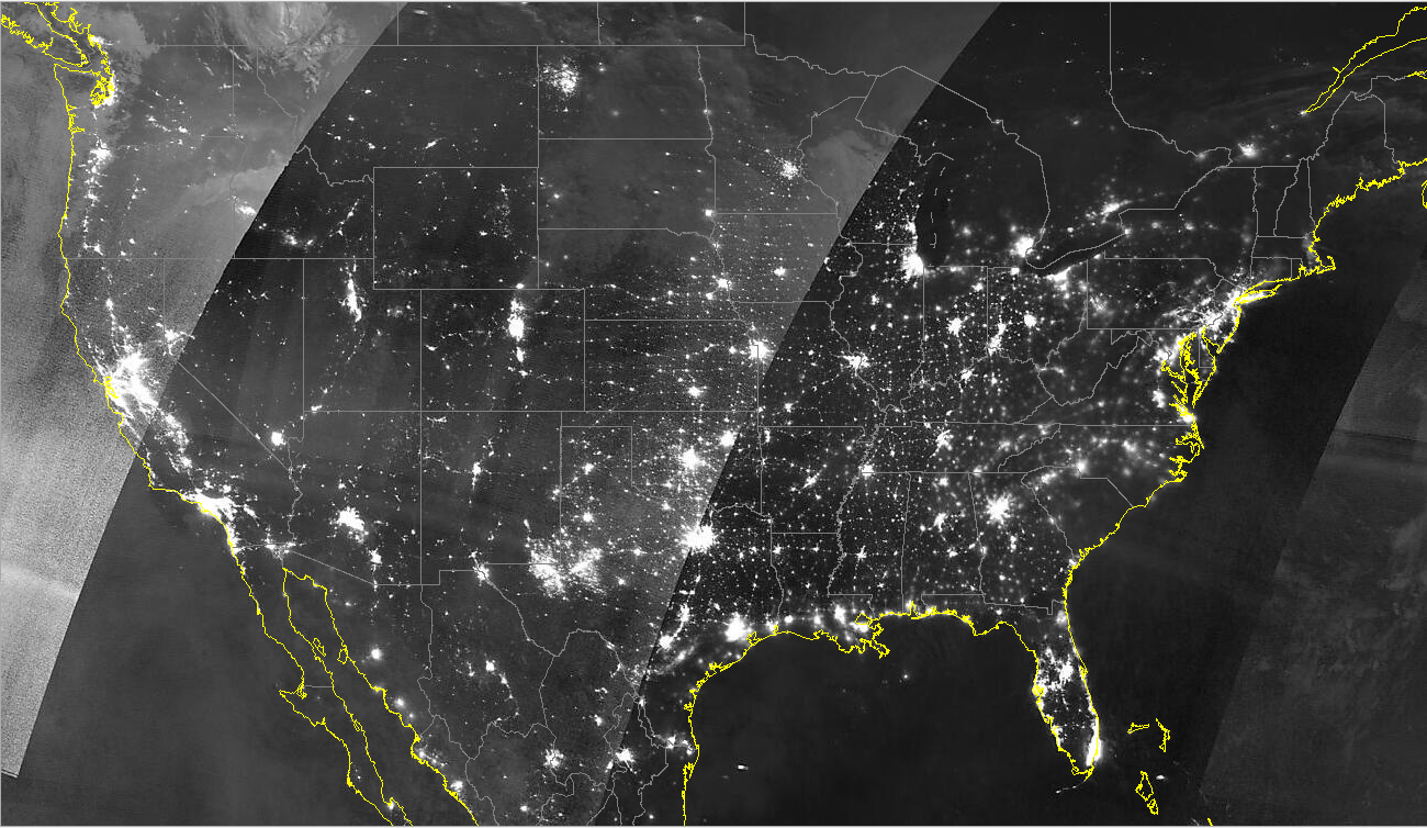 |
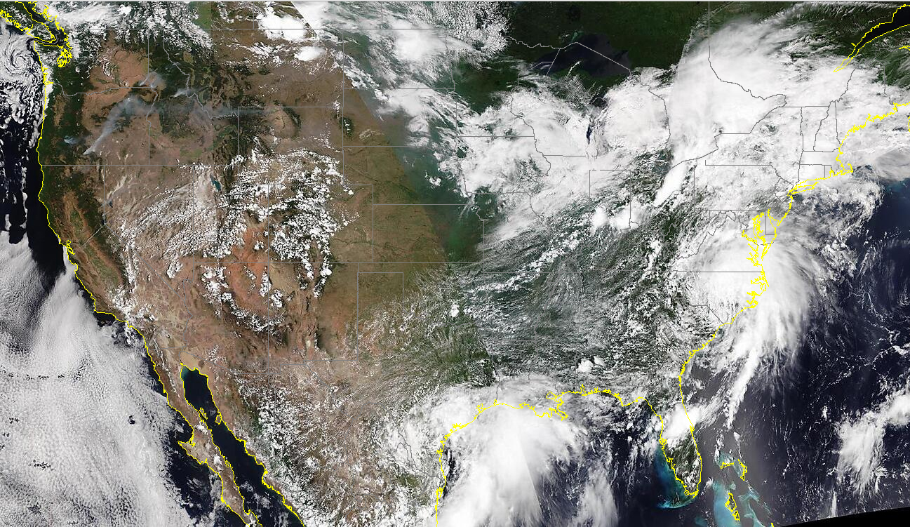
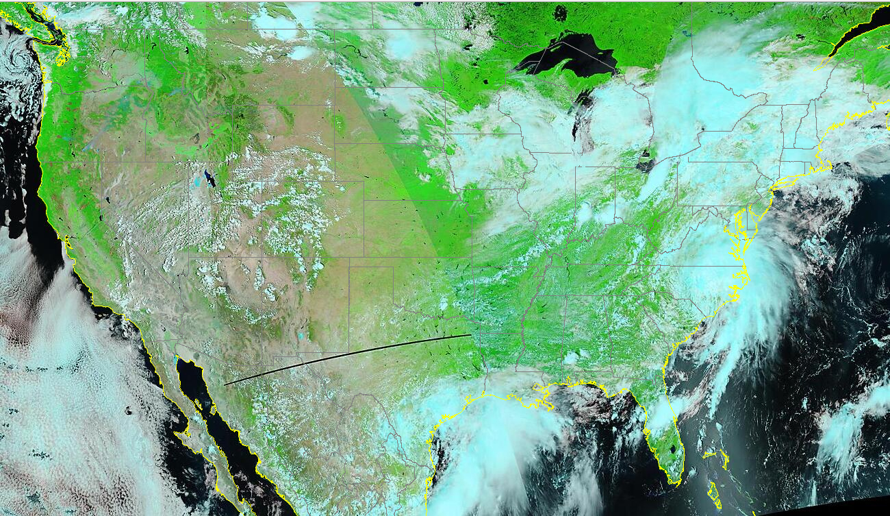
| These 3 images (True Color, False Color and Day Night Band) were acquired fom the VIIRS Today website on July 8, 2021 when Tropical Storm Elsa was over the U.S. East Coast. | ||
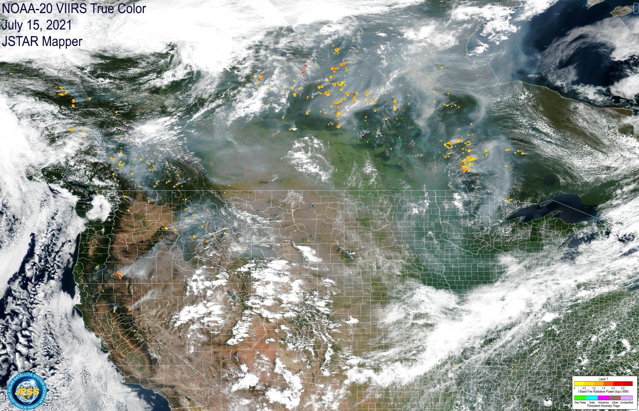
JSTAR Mapper displays VIIRS Data from Suomi NPP and NOAA-20. The left image below depicts VIIRS True Color images of wildfire smoke over Canada and the U.S. on July 15, 2021 plus the pixel-integrated radiative power of the flames. JSTAR Mapper supports 3 layers and multiple products, and features an easy-to-use tool to download imagery.
|
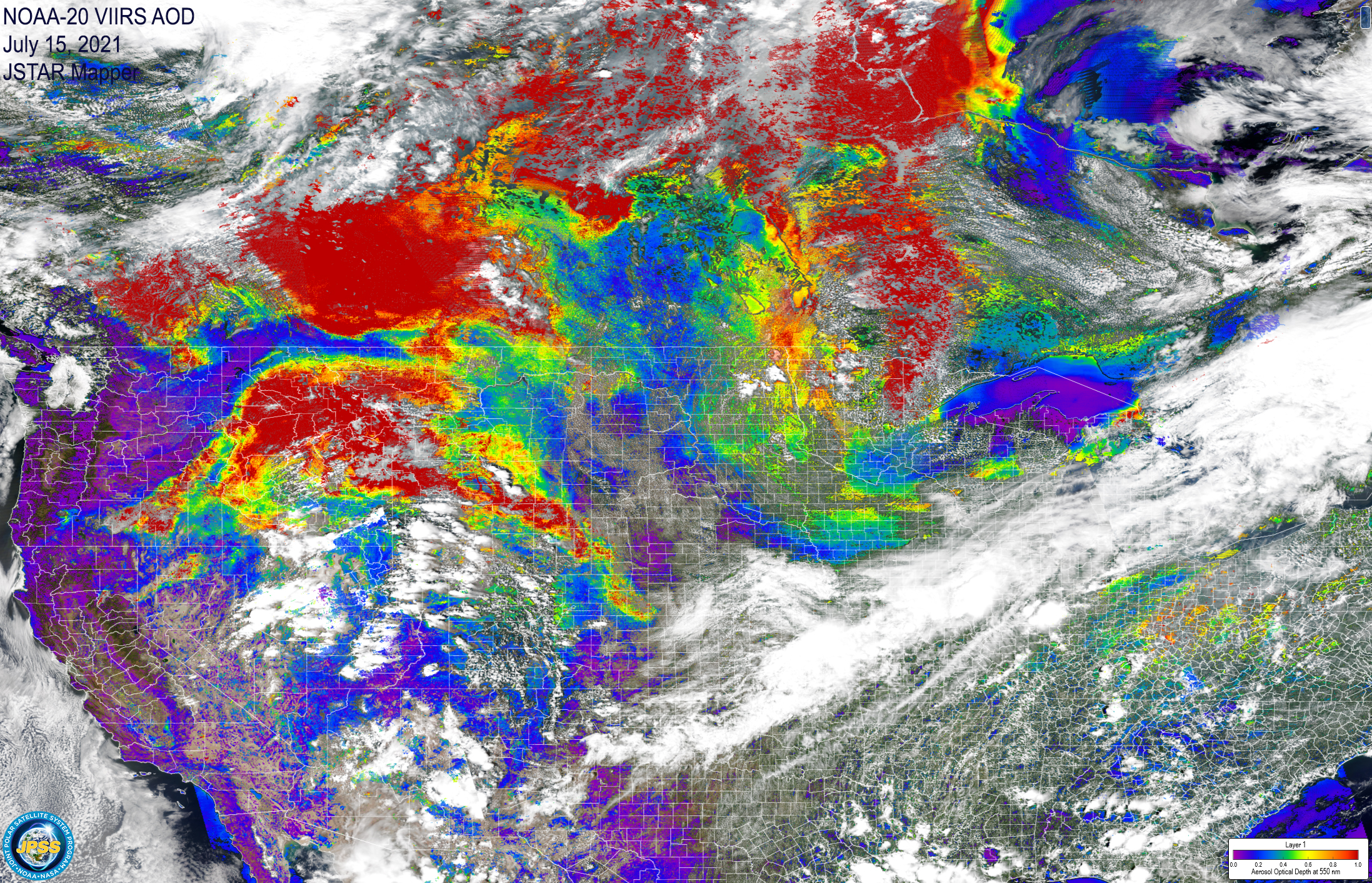
|
The image on the right includes an Aerosol Optical Depth (AOD) layer where reds indicates the thickest smoke and - very likely - poor air quality at the surface, which can be verified by checking the Air Quality Index (AQI) via the AirNow website.
 |
|
 |