The Geostationary Lightning Mapper (GLM)
The Geostationary Lightning Mapper is the first operational lightning mapper flown on a geostationary weather satellite. It can detect momentary changes in an optical scene, indicating the presence of lightning. GLM measures total lightning (in-cloud, cloud-to-cloud and cloud-to-ground) activity continuously over the Americas and adjacent ocean regions with near-uniform resolution of approximately 10 km.
GLM collects information such as the frequency, location and extent of lightning discharges to identify intensifying thunderstorms and tropical cyclones. Trends in total lightning available from the GLM provide critical information to forecasters, allowing them to focus on developing severe storms much earlier and before these storms produce damaging winds, hail or tornadoes.
The GOES-East Geostationary Lightning Mapper (GLM) captured this electrifying animation (below) showing lightning associated with a deadly severe weather event in the central U.S. in 2017 that begins around noon on Friday, April 28, and ends at midnight on Saturday, April, 29.
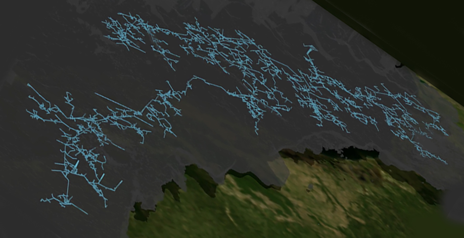 |
The Geostationary Lightning Mapper (GLM) enabled documentation of the world's longest lightning flash sprawling from near Houston 477 miles eastward (768 km) in 2020. Learn more via this GLM Story Map event report. |
 |
|
 |