This website works best with a newer web browser such as Chrome, Firefox, Safari or Microsoft Edge. Internet Explorer is not supported by this website.

Record-setting early winter season cold in Alaska

Much of interior Alaska experienced record-setting early winter season cold temperatures during the middle of November 2011:PUBLIC INFORMATION STATEMENT NATIONAL WEATHER SERVICE FAIRBANKS AK 304 AM AKST SAT NOV 19 2011 …THE RECORDS CONTINUE TO FALL AT FAIRBANKS… THE EARLY WINTER NOVEMBER COLD SNAP CONTINUES TO RE-WRITE THE RECORD BOOKS... Read More

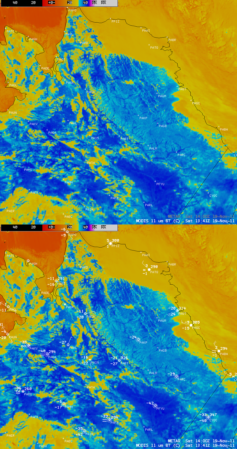
MODIS 11.0 µm IR image + METAR surface reports

MODIS 11.0 µm IR image + METAR surface reports

Much of interior Alaska experienced record-setting early winter season cold temperatures during the middle of November 2011:

PUBLIC INFORMATION STATEMENT
NATIONAL WEATHER SERVICE FAIRBANKS AK
304 AM AKST SAT NOV 19 2011

…THE RECORDS CONTINUE TO FALL AT FAIRBANKS…

THE EARLY WINTER NOVEMBER COLD SNAP CONTINUES TO RE-WRITE THE RECORD BOOKS AT FAIRBANKS. THE CURRENT COLD SNAP WILL GO DOWN IN THE RECORD BOOKS AS ONE OF THE MOST SEVERE EARLY SEASON COLD SNAPS AT FAIRBANKS.

THE HIGH TEMPERATURE YESTERDAY AT THE FAIRBANKS INTERNATIONAL AIRPORT WAS 21 BELOW. THIS BREAKS THE PREVIOUS RECORD LOW MAXIMUM TEMPERATURE OF 19 BELOW WHICH WAS ESTABLISHED IN 1969. THE LOW TEMPERATURE YESTERDAY OF 36 BELOW BREAKS THE PREVIOUS RECORD LOW FOR THE DATE OF 33 BELOW ALSO SET IN 1969.

AT 213 AM THIS MORNING…THE TEMPERATURE AT THE AIRPORT DROPPED TO 36 BELOW. THIS BREAKS THE OLD RECORD LOW FOR NOVEMBER 19TH OF 33 BELOW IN 1969.

TODAY (SATURDAY) MARKS THE 5TH CONSECUTIVE DAY WITH A LOW TEMPERATURE OF 30 BELOW OR COLDER AT THE AIRPORT. THIS TIES WITH 1956…1969 AND 1989 FOR THE MOST CONSECUTIVE DAYS WITH A
TEMPERATURE OF 30 BELOW OR COLDER SO EARLY IN THE WINTER SEASON.

THE LOW TEMPERATURE HAS NOW BEEN 35 BELOW OR COLDER EACH OF THE LAST 5 DAYS. THIS HAS NEVER HAPPENED BEFORE SO EARLY IN THE WINTER SEASON AT FAIRBANKS. THE OLD RECORD WAS ONLY 2 DAYS…AND WAS LAST RECORDED IN 1989.

THE HIGH TEMPERATURE HAS NOW BEEN 20 BELOW OR COLDER EACH OF THE LAST 3 DAYS. THIS TIES WITH 1989 FOR THE MOST CONSECUTIVE DAYS WITH A HIGH TEMPERATURE OF 20 BELOW OR COLDER SO EARLY IN THE WINTER SEASON.

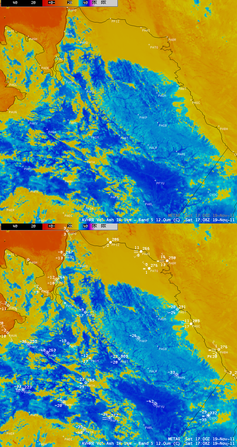
The coldest surface air temperature reported during the period was -54º F (-48º C) at Manley Hot Springs on 17 November. AWIPS images of MODIS 11.0 µm IR data (above) and POES AVHRR 12.0 µm IR data (below) showed thermal signatures of some the coldest air draining into river valleys and other low-lying areas (darker blue color enhancement).

POES AVHRR 12.0 µm IR image + METAR surface reports

POES AVHRR 12.0 µm IR image + METAR surface report


======== 20 November Update ========

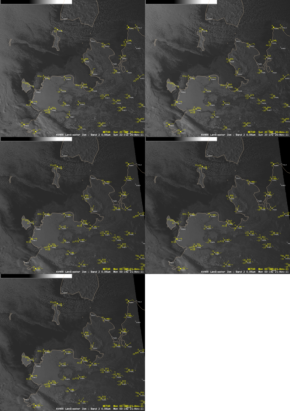
POES AVHRR 0.86 µm visible channel images

POES AVHRR 0.86 µm visible channel images

20 November marked the sixth consecutive day with a daily minimum temperature at Fairbanks International Airport of -35º F (-37º C) or colder — such a long cold streak had never been recorded before so early in the season. While western Alaska was not as cold as the interior, the air was cold enough to promote the rapid formation of sea ice off the west coast. A sequence of three 1-km resolution POES AVHRR 0.86 µm visible channel images (above) showed the extent of the sea ice on 20 November.

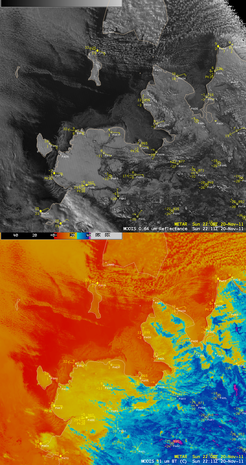
A comparison of 1-km resolution MODIS 0.64 µm visible channel and 11.0 µm IR channel images (below) showed that the sea ice exhibited much colder IR brightness temperatures (-10º to -15º C, orange color enhancement) than the adjacent ice-free waters.

MODIS 0.64 µm visible channel image + MODIS 11.0 µm IR image

MODIS 0.64 µm visible channel image + MODIS 11.0 µm IR image

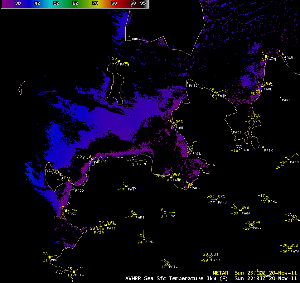
An AWIPS image of the 1-km resolution POES AVHRR Sea Surface Temperature (SST) product (below) indicated that the waters just beyond the ice edge had SST values in the upper 20s to low 30s F, which would be conducive to a further expansion of the ice field away from the coast.

POES AVHRR Sea Surface Temperature product

POES AVHRR Sea Surface Temperature product

View only this post Read Less
Caughlin Wildfire near Reno, Nevada

The 2000-acre “Caughlin Fire” started burning around 08:45 UTC (1:45 am local time) in the hilly terrain near Reno, Nevada, and soon grew out of control due to strong winds gusting as high as 74 mph. McIDAS images of GOES-15 3.9 µm shortwave IR data (above) showed the “hot spot”... Read More

GOES-15 3.9 µm shortwave IR images (click image to play animation)

GOES-15 3.9 µm shortwave IR images (click image to play animation)

The 2000-acre “Caughlin Fire” started burning around 08:45 UTC (1:45 am local time) in the hilly terrain near Reno, Nevada, and soon grew out of control due to strong winds gusting as high as 74 mph. McIDAS images of GOES-15 3.9 µm shortwave IR data (above) showed the “hot spot” (black to yellow to red enhanced pixels) associated with the fire. At least 30 homes were destroyed, with many more damaged by the fire. Thousands of residents were evacuated.

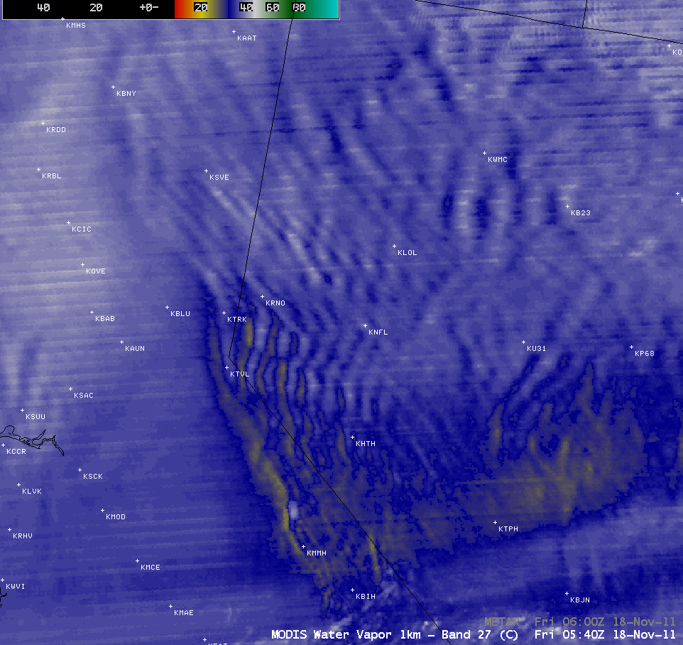
Evidence of the strong winds across the region could be seen on an AWIPS image of MODIS 6.7 µm water vapor channel data (below), with a number of very pronounced mountain waves showing up on the image. These mountain waves persisted for several hours, and were responsible for pilot reports of severe turbulence, wind shear, and 50-knot crosswinds during descent to final approach into the Reno airport. The highest wind gust reported at the Reno airport was 44 mph, and surface visibility was also reduced to 6 miles at the airport due to smoke.

MODIS 6.7 µm water vapor channel image

MODIS 6.7 µm water vapor channel image

View only this post Read Less
Mysterious Gravity Wave Over the Eastern Pacific Ocean

We received the following email from Ken Waters of the National Weather Service forecast office in Phoenix, Arizona:I noticed something interesting in this morning’s visible imagery off the Baja California coast. Here’s a link: https://docs.google.com/open?id=0B2ktDMIN5qWfODI2OTYzYjgtZjJkMS00MTU5LTk2ODctYzdhNzY5M2Y2MWIx I’m looking at the apparent wave pattern that’s going “upstream” towards the northeast whereas the low... Read More

We received the following email from Ken Waters of the National Weather Service forecast office in Phoenix, Arizona:

I noticed something interesting in this morning’s visible imagery off the Baja California coast.

Here’s a link: https://docs.google.com/open?id=0B2ktDMIN5qWfODI2OTYzYjgtZjJkMS00MTU5LTk2ODctYzdhNzY5M2Y2MWIx

I’m looking at the apparent wave pattern that’s going “upstream” towards the northeast whereas the low level flow is mostly towards the south. Is that a gravity wave? If so, what causes it? The vis can only go so far back so I looked at the IR and couldn’t find anything obvious.

Great question Ken — it certainly appears to be some sort of internal gravity wave, but what caused it and why was it propagating against the ambient flow shall remain a bit of a mystery until we can dig into this case a bit further. One more event for the “What the heck is this?” blog category.

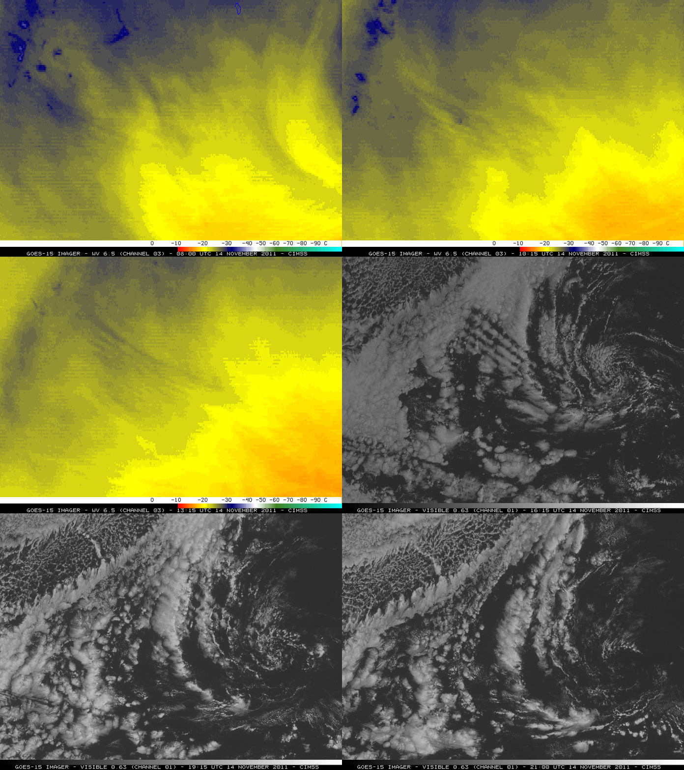
GOES-15 6.5 µm water vapor channel images + GOES-15 0.63 µm visible channel images

GOES-15 6.5 µm water vapor channel images + GOES-15 0.63 µm visible channel images

McIDAS images of GOES-15 6.5 µm water vapor channel data (prior to daylight) and then GOES-15 0.63 µm visible channel data after sunrise (above) on 14 November 2011 tell us one thing: this gravity wave was apparently fairly deep in the vertical, since it exibited a signal on both the water vapor channel imagery (which generally senses radiation from the middle troposphere: San Diego 12:00 UTC rawinsonde water vapor chanel weighting function profile) as well as on the lower-tropospheric cloud features seen on the visible channel imagery.

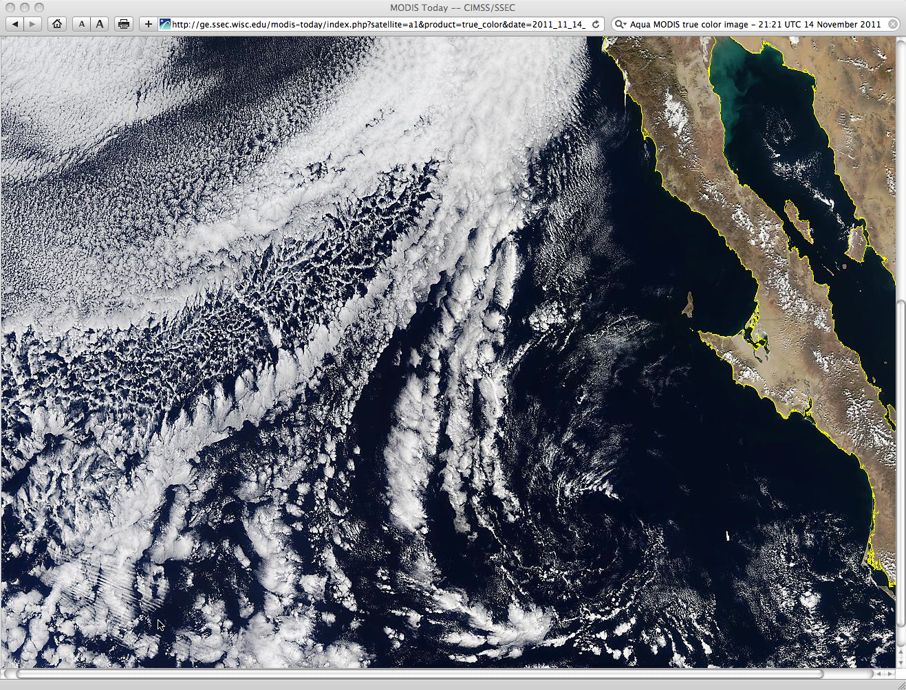
Note that there was a second packet of shorter-wavelength gravity waves that could be seen in the far southwestern portion of the GOES-15 visible image satellite scene toward the end of the animation. This second packet of gravity waves was very evident on a 500-meter resolution Aqua MODIS Red/Green/Blue (RGB) true color image at 21:21 UTC (below).

Aqua MODIS true color image

Aqua MODIS true color image

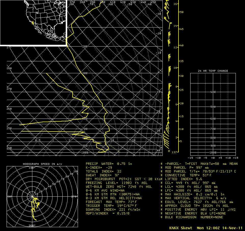
Gravity waves are usually ducted within a well-defined temperature inversion. A look at the 12:00 UTC rawinsonde profile from San Diego, California (below) did indicate the presence of a few inversions that might have been capable of ducting such a gravity wave — but the inversions existed at multiple levels.

San Deigo, California 12:00 UTC rawinsonde profile

San Deigo, California 12:00 UTC rawinsonde profile

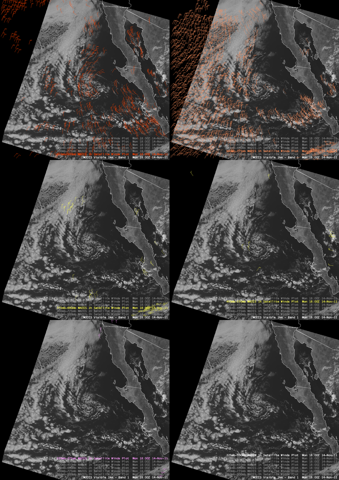
An AWIPS image of 18:00 UTC MODIS 0.65 µm visible channel data with overlays of 1-hour interval MADIS satellite winds (below) did not reveal any atmospheric motion vectors with a southwesterly component – but these would likely have been rejected by the winds quality control algorithms, since such a motion would have differed too greatly from the model first guess wind fields at 850 hPa, 500 hPa, 300 hPa, and 250 hPa.

MODIS 0.65 µm visible channel image + MADIS 1-hour interval satellite winds

MODIS 0.65 µm visible channel image + MADIS 1-hour interval satellite winds

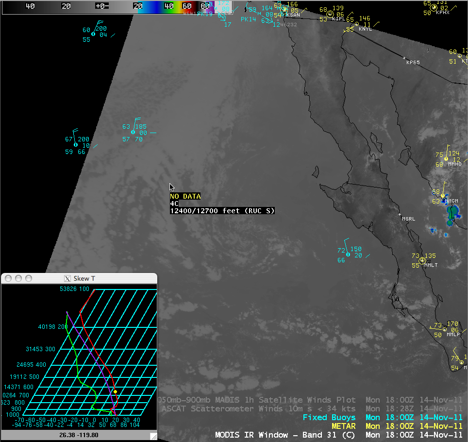
Regarding the effect of the gravity wave seen on the lower-tropospheric clouds bands, a MODIS 11.0 µm IR image detected cloud top IR brightness temperatures around +4ºC, which on a RUC model sounding at that location apparently corresponded to a cloud top height around 12,550 feet (below) — however, this value seemed to be a bit high judging from the appearance of the cloud band features on the GOES and MODIS visible and IR imagery.

MODIS 11.0 µm IR image + RUC model sounding

MODIS 11.0 µm IR image + RUC model sounding

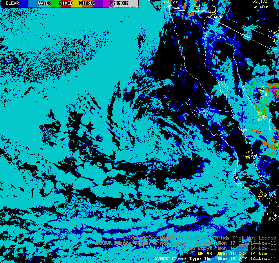
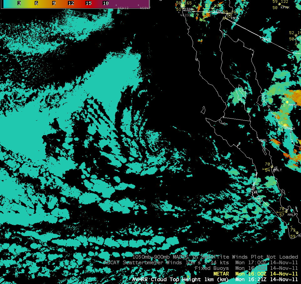
On the other hand, POES AVHRR Cloud Type and Cloud Top Height products indicated that these low-level cloud bands were water droplet clouds, with cloud top heights of around 1 km (below) — much more typical for marine boundary layer cloud features over this region.

POES AVHRR Cloud Type product

POES AVHRR Cloud Type product

POES AVHRR Cloud Top Height product

POES AVHRR Cloud Top Height product

View only this post Read Less
Mountain waves over Colorado and New Mexico

A comparison of 8-km resolution GOES-11 6.7 µm water vapor channel, 4-km resolution GOES-13 and GOES-15 6.5 µm water vapor channel, and 1-km resolution Aqua MODIS 6.7 µm water vapor channel images (above) demonstrated how differences in satellite viewing angle as well as differences in satellite sensor spatial resolution have... Read More

GOES-11, GOES-13, GOES-15, and MODIS water vapor channel images

GOES-11, GOES-13, GOES-15, and MODIS water vapor channel images

A comparison of 8-km resolution GOES-11 6.7 µm water vapor channel, 4-km resolution GOES-13 and GOES-15 6.5 µm water vapor channel, and 1-km resolution Aqua MODIS 6.7 µm water vapor channel images (above) demonstrated how differences in satellite viewing angle as well as differences in satellite sensor spatial resolution have an impact in being able to resolve the structure and areal coverage of small-scale features such as the mountain waves that existed across much of southeastern Colorado and northeastern New Mexico around 19:45 UTC on 12 November 2011.

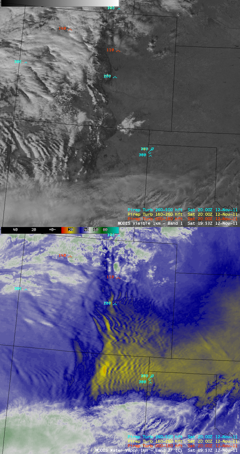
There were a number of pilot reports of moderate to severe turbulence aloft across the region – and at the surface, wind gusts as high as 115 mph were reported. As can be seen in a comparison of 1-km resolution MODIS 0.65 µm visible channel and MODIS 6.7 µm water vapor channel images (below), many of the mountain waves were located in cloud-free areas — this highlights the value of water vapor channel imagery for identifying such regions of potential aircraft turbulence.

MODIS 0.65 µm visible channel + MODIS 6.7 µm water vapor channel images

MODIS 0.65 µm visible channel + MODIS 6.7 µm water vapor channel images

View only this post Read Less