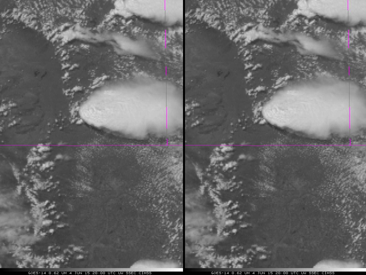
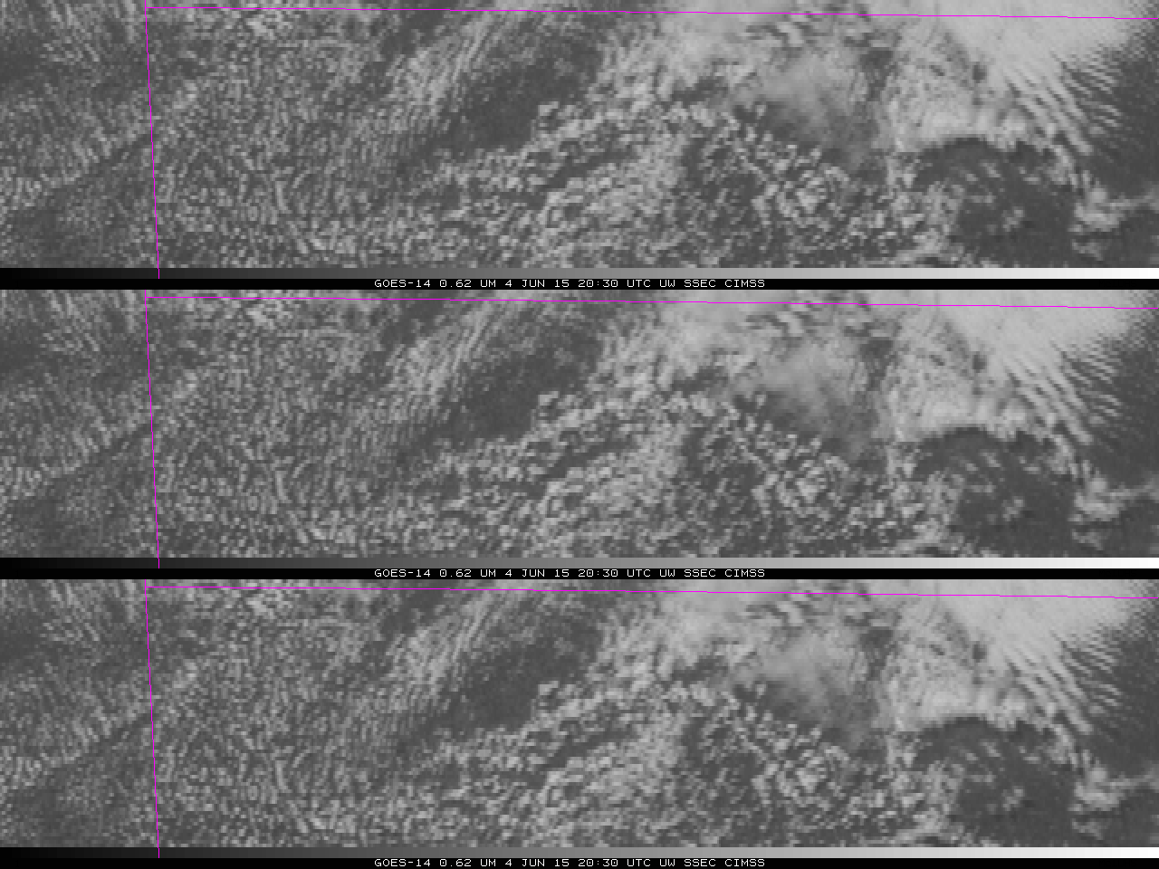
![GOES-14 Visible (0.6263 µm, top) and GOES-13 Visible (0.63 µm, bottom) imagery centered over Illinois, 10 June 2015 [Click to animate]](https://cimss.ssec.wisc.edu/satellite-blog/wp-content/uploads/sites/5/2015/06/GOES13_GOES14_ILLINOIS_10JUNE2015anim2038_0108.gif)
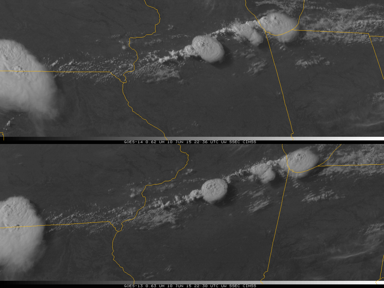
GOES-14 Visible (0.6263 µm, top) and GOES-13 Visible (0.63 µm, bottom) imagery centered over Illinois, 10 June 2015 [Click to animate]
The GOES-14 SRSO-R imagery depicts the convection evolving in a fluid atmosphere. Even the relatively fast GOES-13 RSO time-step cannot capture the full evolution and decay of overshooting tops. On the 1-minute GOES-14 images, note the development of prominent cloud-top plumes which spread out southeastward away from the more robust overshooting top regions, and also cloud-top gravity waves which form along the southeastern flank of some of the larger thunderstorm anvils. Another advantage of SRSO-R compared to the routine scanning strategy using visible imagery is discussed here.
A wider-scale view of the evolution of the atmosphere on 10 June over the Upper Midwest is available here as a YouTube video, here as an mp4, and here as an animated gif image (warning: 300+ Megabyte file). A closer-scale view of the developing convection with GOES-14 visible images is available as an mp4 movie file, or on YouTube; an animation of GOES-14 10.7 µm IR images is available as an mp4 file.
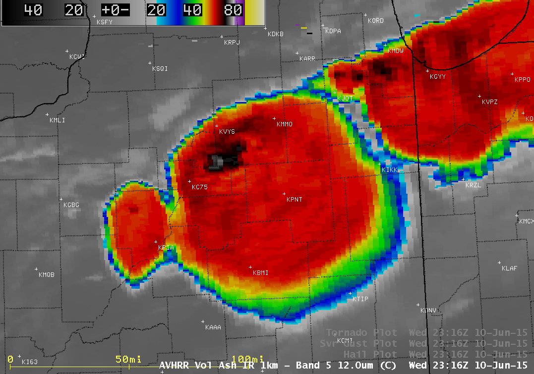
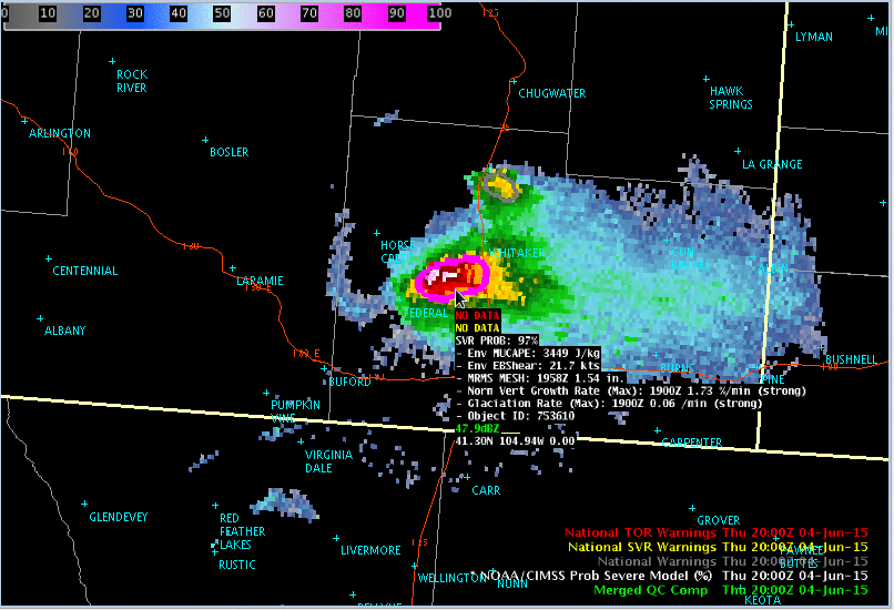
POES AVHRR 12.0 µm IR channel image, with SPC storm reports of large hail and damaging winds
The line of severe thunderstorms developed just ahead of a cold frontal boundary (animation) that was sagging southward and stalling across northern Illinois during the day on 10 June. About an hour before the 4.75-inch diameter hail was reported in Minooka IL (located about 12 miles southwest of Joliet, KJOT), a 1-km resolution POES AVHRR 12.0 µm IR image at 2316 UTC (above) showed that particular cluster of thunderstorms just southwest of the Chicago area around the time of initial hail report (1.25 inch diameter at 2318 UTC); less than a half hour later there was a report of 2.00 inch hail at 2345 UTC. Farther to the southwest, the larger thunderstorm complex was also producing hail and damaging winds, near and to the southwest of the region of coldest cloud-top IR brightness temperatures (-77º C) exhibited by the overshooting tops.
![GOES-13 sounder Lifted Index derived product images [click to play animation]](https://cimss.ssec.wisc.edu/satellite-blog/wp-content/uploads/sites/5/2015/06/150610_goes13_sounder_li_IL_anim.gif)
GOES-13 sounder Lifted Index derived product images [click to play animation]
![GOES-13 sounder Total Precipitable Water derived product images [click to play animation]](https://cimss.ssec.wisc.edu/satellite-blog/wp-content/uploads/sites/5/2015/06/150610_goes13_sounder_tpw_IL_anim.gif)
GOES-13 sounder Total Precipitable Water derived product images [click to play animation]
View only this post Read Less
