Tornadic Thunderstorm over eastern Colorado

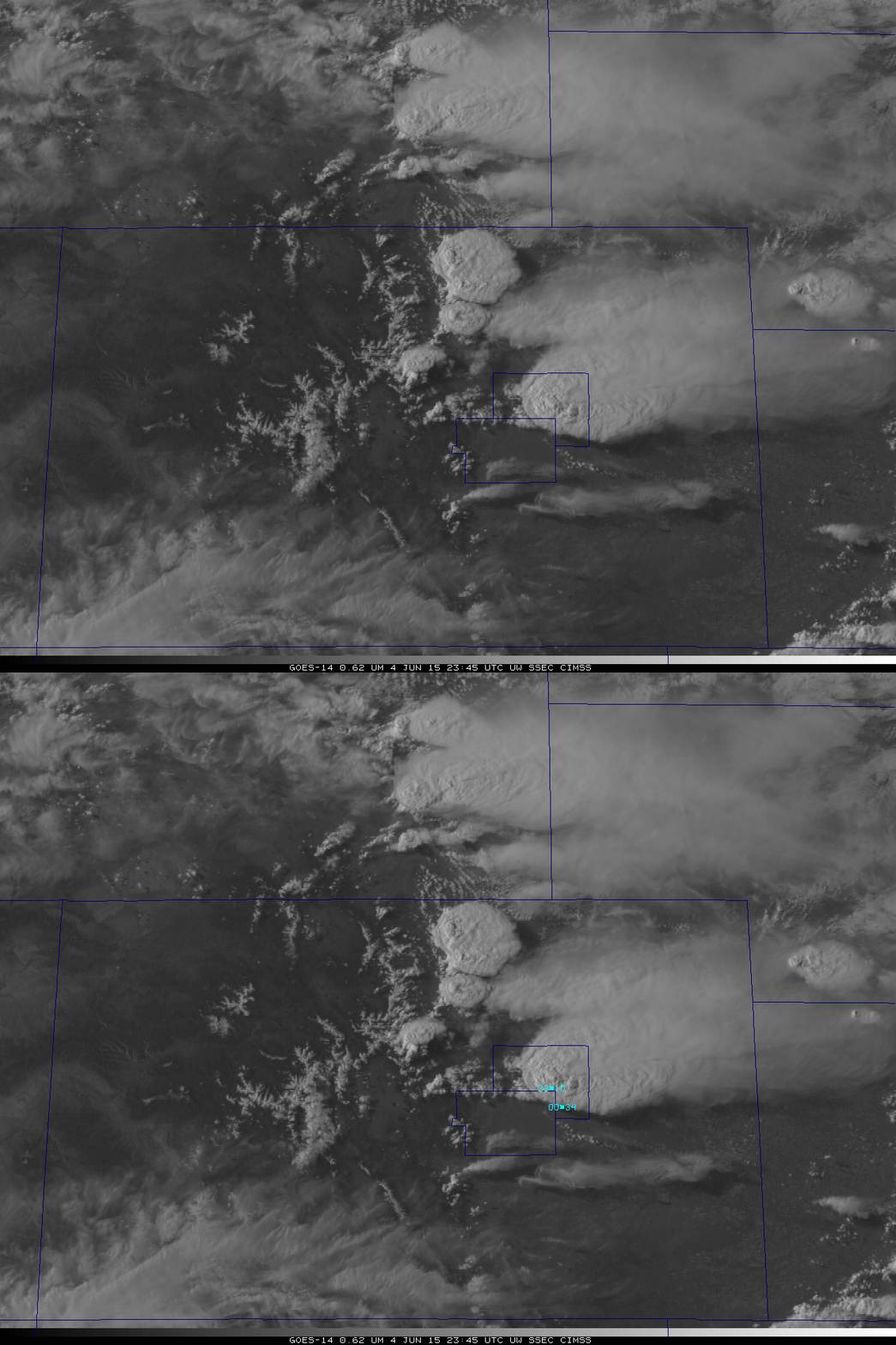
GOES-14 Visible 0.6263 µm Visible imagery over Colorado, 2345 UTC 5 June 2015. See text for details (Click to enlarge)
The Storm Prediction Center in Norman OK had the Plains of northeast Colorado and adjacent States in a Slight Risk (or higher) threat of severe weather on 4 June 2015. The visible image, above, shows a tornado-producing severe thunderstorm over Elbert County that produced a long-lived tornado, according to the SPC Storm Reports. The reported start and end points of the tornado (and observed times) are indicated as well. Elbert (farther northeast) and El Paso (farther southwest) counties are outlined.
The evolution of the tornadic cell was captured while GOES-14 was operating in SRSO-R mode. An animated gif of the evolution from 1915 UTC 4 June through 0130 UTC on 5 June is (warning: 190M animation!) here. A YouTube video of the mp4 is below. Note that the tornado formed along the obvious moisture boundary made visible by the arc of cumulus clouds south and east of the severe storm. (This post from the Hazardous Weather Testbed blog shows the moisture gradient as a gradient in CAPE) One-minute imagery allows an extraordinarily detailed look at features in the very dynamic cloud-top; overshooting tops develop and decay very quickly as the storm develops and matures. An animation of 10.7µm imagery from 2100 UTC through 0600 UTC on 5 June is available on YouTube here. Click here (180M gif) for a storm-centered animated gif of the tornadic storm (Also available as an mp4 and on YouTube).

