
It is mid to late July, and the western Pacific Ocean is starting to see its share of tropical activity. While Tropical Storm Francisco is spinning toward the Ryuku Islands of southwestern Japan, the people of Guam have their eyes on Invest 98W, an intensifying system closely approaching their island. As of 0900 UTC on 23 July 2025, Invest 98W is exhibiting winds between 18 and 23 kts. However, the Joint Typhoon Warning Center is projecting a high potential for this system to intensify to a tropical cyclone within 24 hours. Initial satellite imagery using Band 13 (the infrared window) from the Himawari-9 Advanced Himawari Imager (AHI) shows the system as of 1900 UTC on the 23rd. This can be seen on SSEC Real Earthas the group of cold brightness temperatures (therefore deep convection) between 10 and 15 deg N and 140 and 150 deg W.
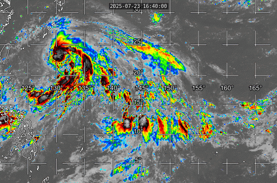
Note that the invest does not appear to have the clear cyclonic circulation of a more developed tropical storm like what can be seen in Tropical Storm Francisco in the northwest part of the image. However, low leevl winds resolved by scatterometry indicate that a circulation is in place just ot the southwest of Guam.

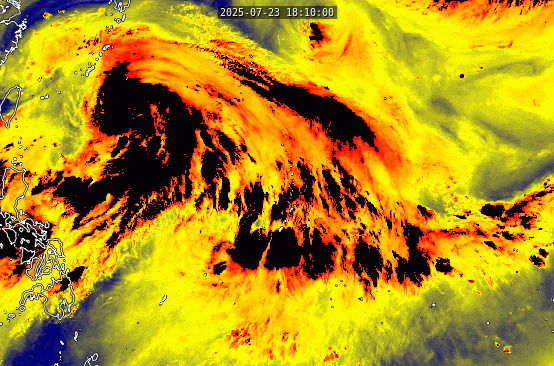
The biggest concern for Guam right now is significant rainfall. Satellite imagery can help tell that story by indicating the large quantity of water vapor available for precipitation. The AHI Band 8 (6.2 microns) shows large regions of cold brightness temperatures in yellow, indicating dep layers of the atmosphere with high water vapor content.
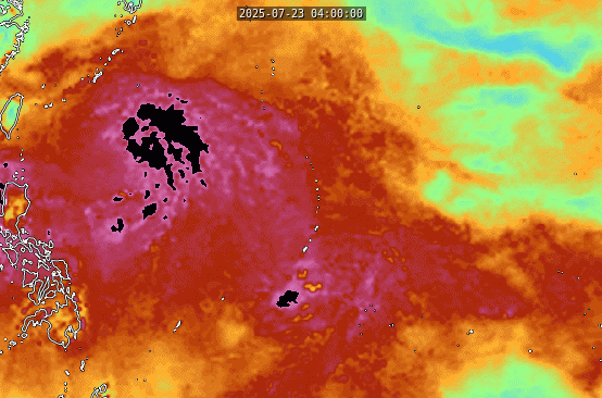
This can be further seen in the CIMSS MIMIC-TPW2 product, which quantifies the total precipitable water through compositing microwave imagery from several different polar orbiting satellites. While MIMIC does not have the temporal resolution of the geostationary orbiter, its innovative morphological compositing technique is still able to produce hourly observations. The microwave instruments are able to penetrate the upper level clouds and thus the cyclonic circulation of Invest 98W is more readily apparent. This product shows that TPW values near Guam are exceeding 70 mm.
These high values for water vapor are going to contribute to significant rainfall totals for Guam in the coming days. The Global Ensemble Forecast System (GEFS) has 21 members and gives a general assessment of the breadth of potential forecast outcomes over the next week. While the mean outcome is a total of 4 inches of rain and the greatest clustering is between 2 and 3 inches, individual members are showing anywhere between 2 and 14 inches of rainfall between the 23rd and the 31st of July.

More information about this system can be obtained from the Joint Typhoon Warning Center at https://www.metoc.navy.mil/jtwc/jtwc.html.
View only this post Read Less


