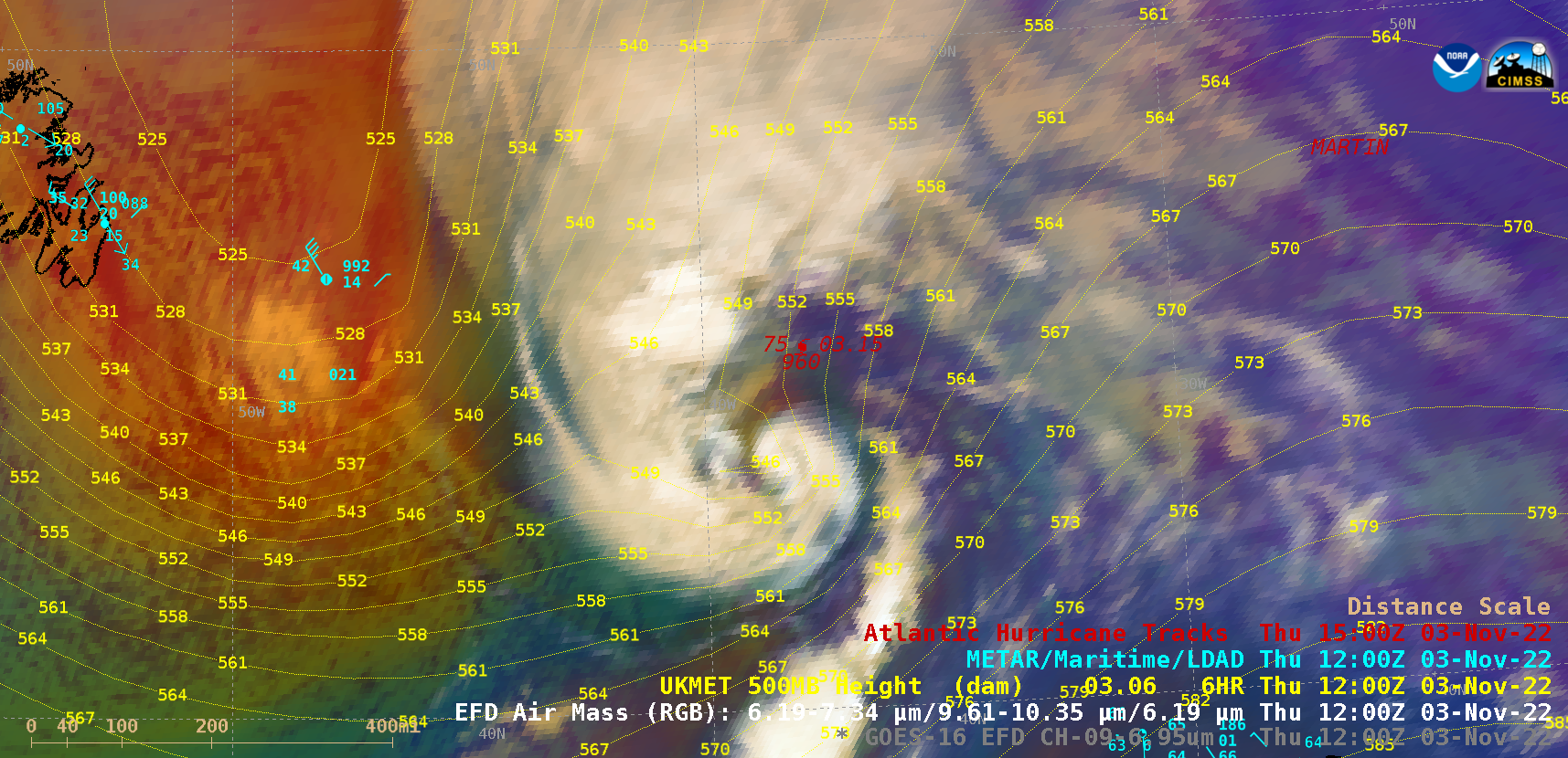
GOES-16 (GOES-East) Mid-Level Water Vapor (6.9 µm) and Air Mass RGB images (above) covered the period 0600-1800 UTC on 03 November 2022 — during which Category 1 Hurricane Martin transitioned to an extratropical cyclone over the North Atlantic Ocean (surface analyses). West of Martin, the large area of orange-to-red hues on the Air Mass... Read More

GOES-16 Mid-Level Water Vapor (6.9 µm) and Air Mass RGB images [click to play animated GIF | MP4]
GOES-16
(GOES-East) Mid-Level Water Vapor (
6.9 µm) and
Air Mass RGB images
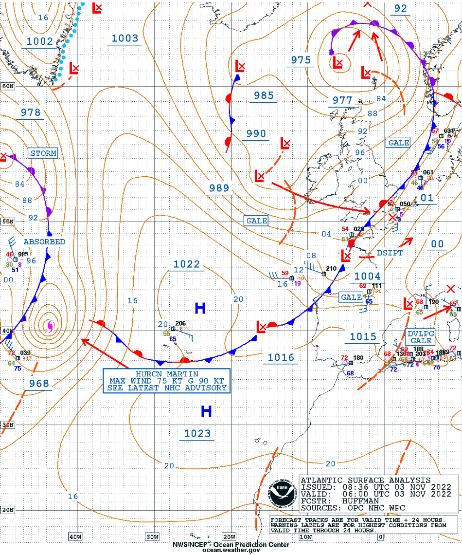
(above) covered the period 0600-1800 UTC on 03 November 2022 — during which Category 1
Hurricane Martin transitioned to an extratropical cyclone over the North Atlantic Ocean (
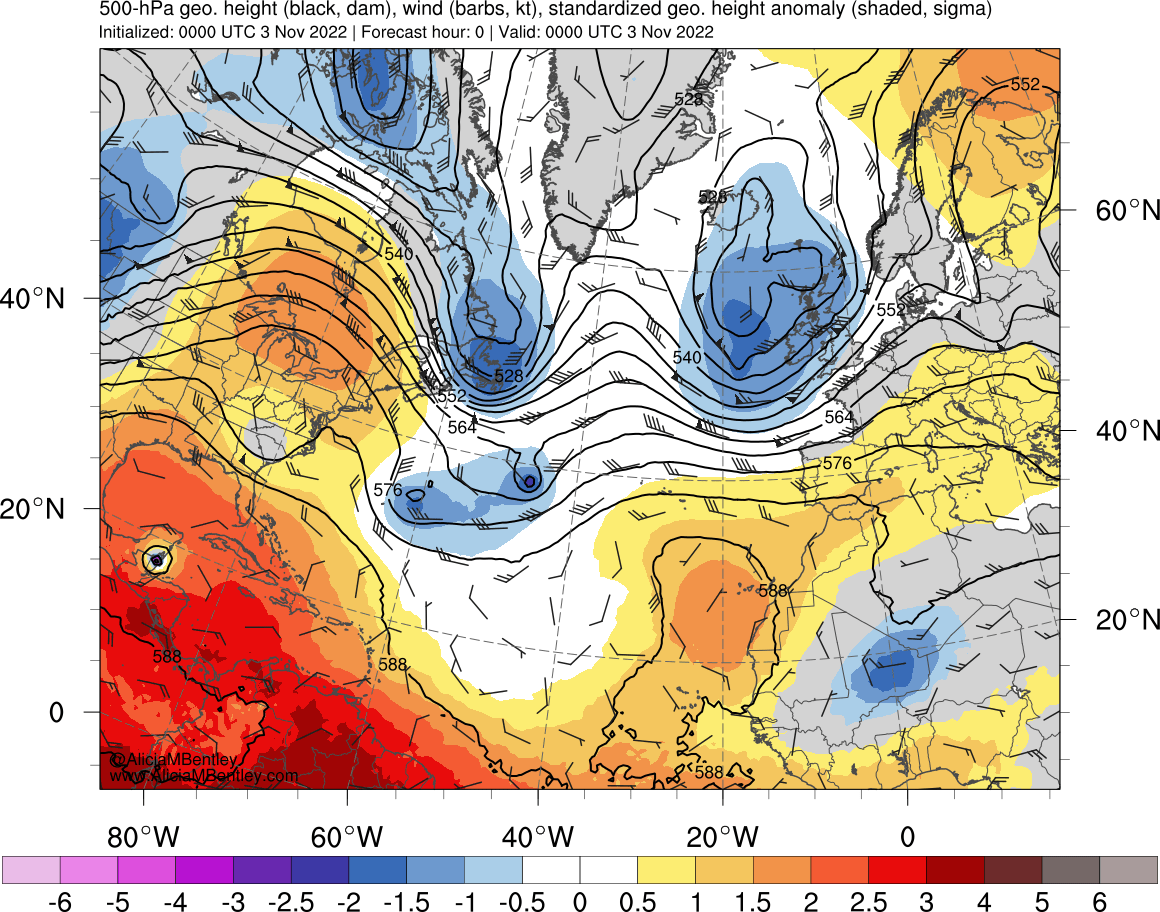
surface analyses). West of Martin, the large area of orange-to-red hues on the Air Mass RGB images highlighted an
anomalously-deep mid-tropospheric trough that was moving eastward (also shown by UKMET model 500 hPa height contours) — which began to phase with and absorb the mid-tropospheric circulation of Martin as the extratropical transition completed.
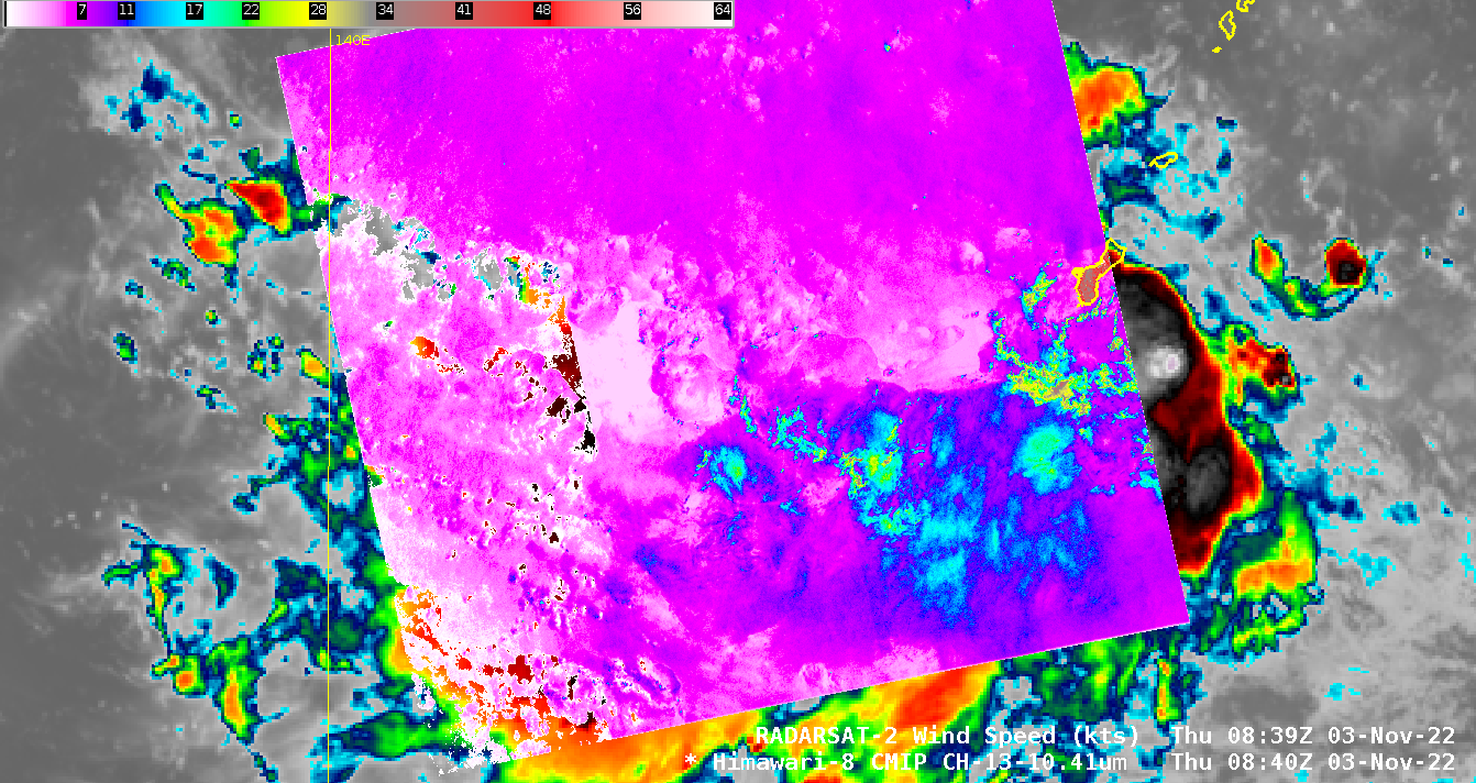
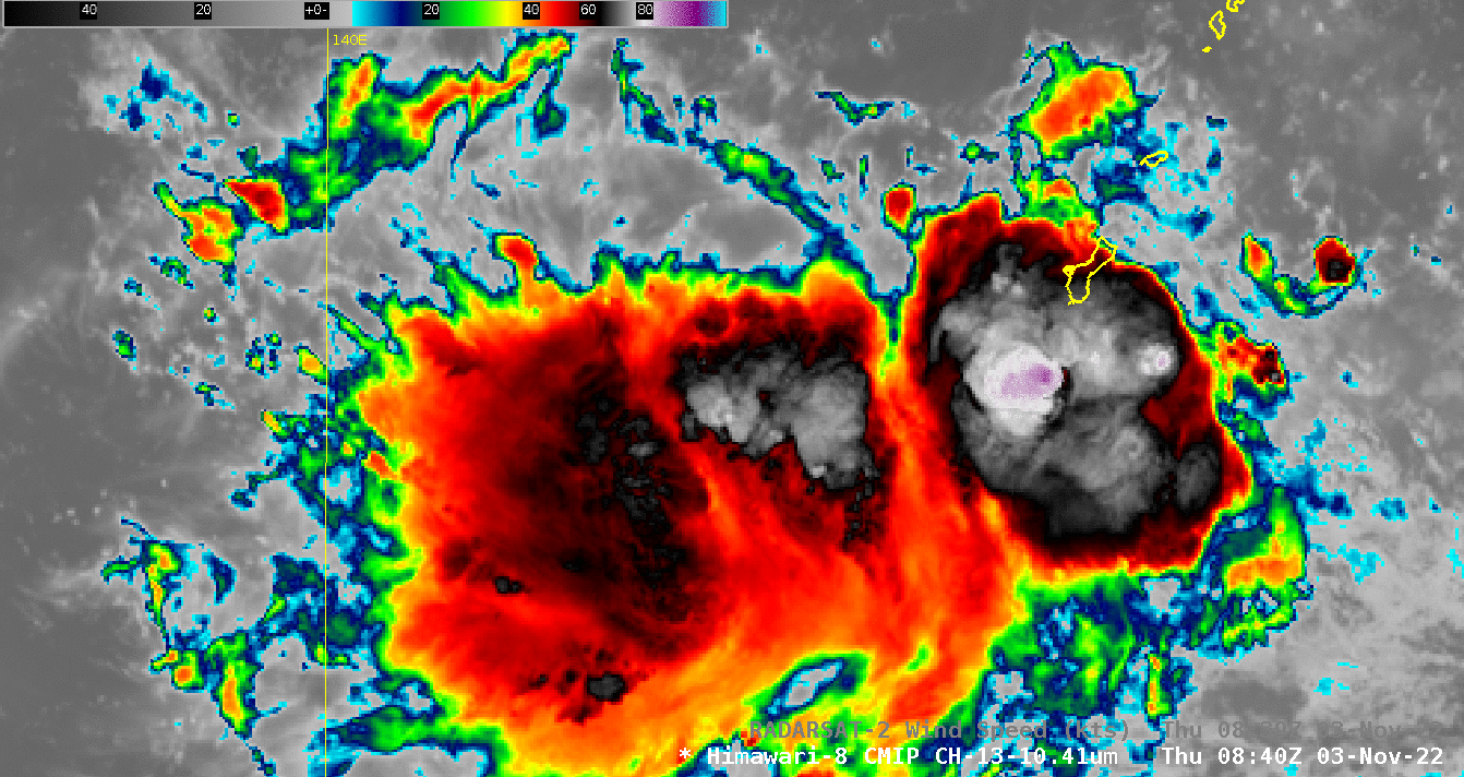
DMSP-17 SSMIS Microwave (85 GHz) imagery at 1005 UTC (below) — from the CIMSS Tropical Cyclones site — indicated that a closed eyewall was not present with Martin at that time.
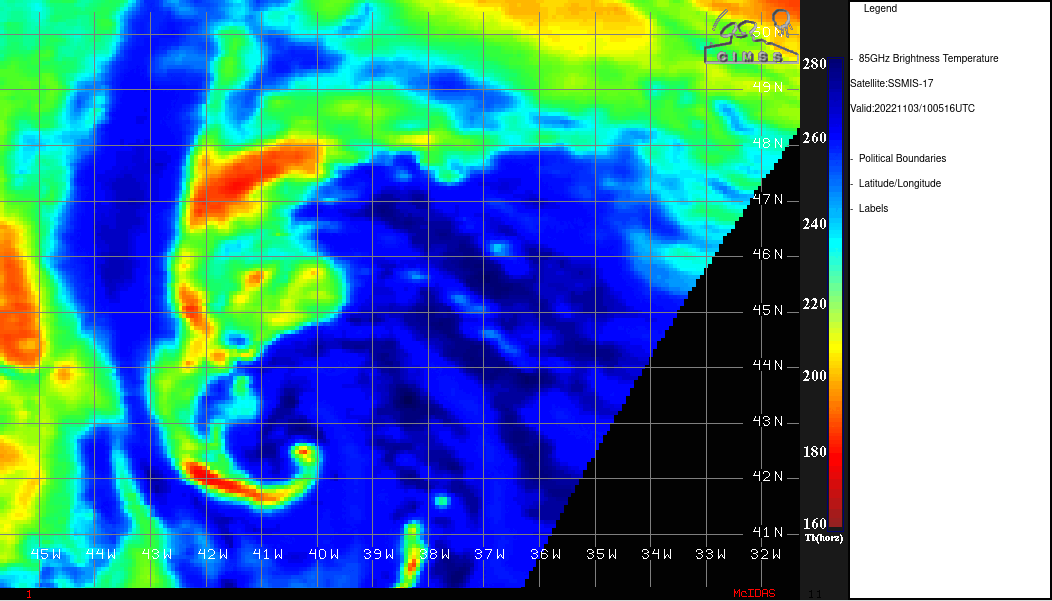
DMSP-17 SSMIS Microwave (85 GHz) image at 1005 UTC [click to enlarge]
VIIRS True Color RGB and Infrared Window (11.45 µm) images from Suomi-NPP (at 1447 UTC) and NOAA-20 (at 1537 UTC) viewed using
RealEarth (below) showed Martin around the time that extratropical transition was nearly complete.
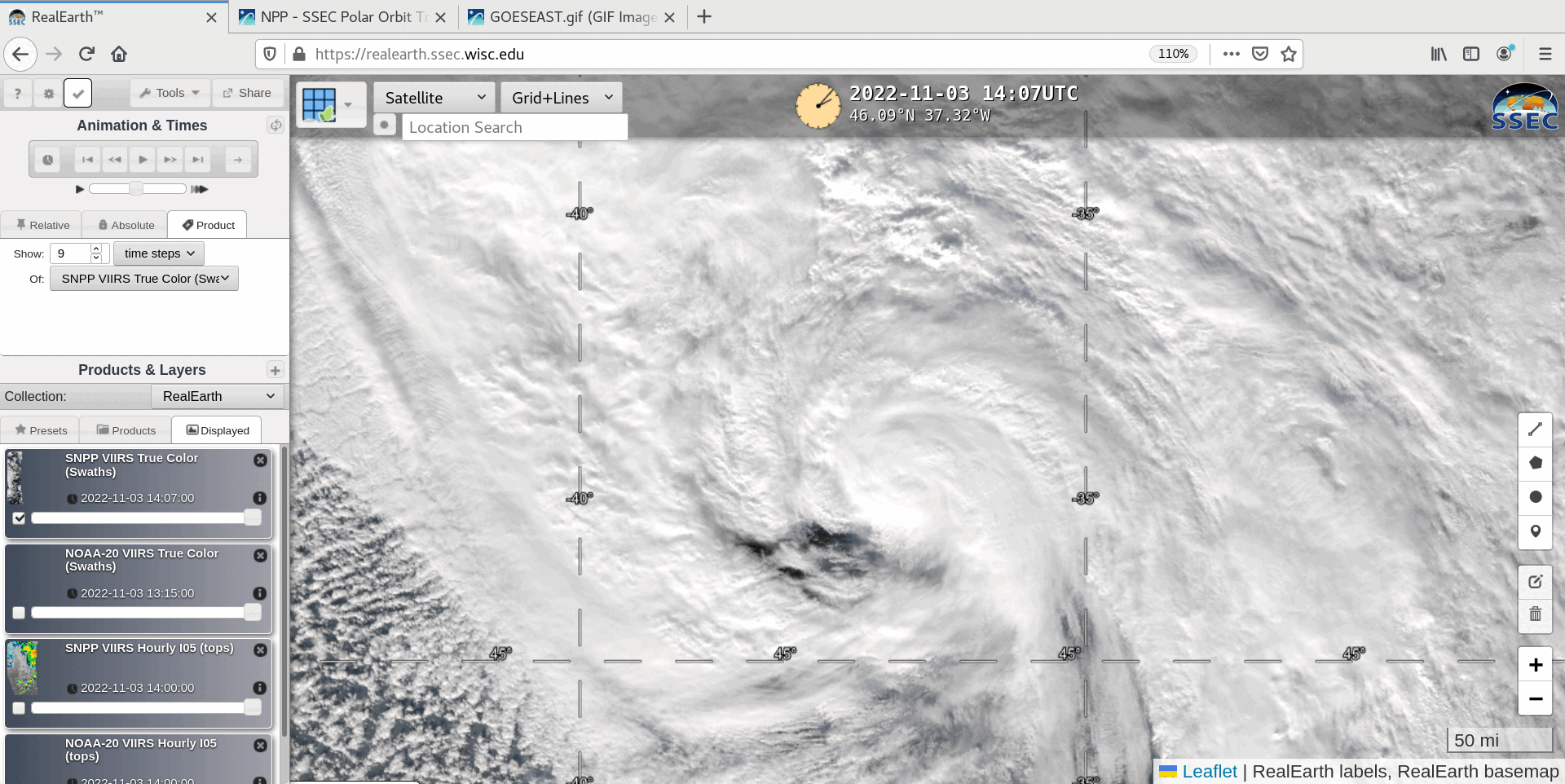
VIIRS True Color RGB and Infrared Window (11.45 µm) images from Suomi-NPP (at 1447 UTC) and NOAA-20 (at 1537 UTC) [clic to enlarge]
GOES-16 Nighttime Microphysics RGB and daytime True Color RGB images from the
CSPP GeoSphere site
(below) displayed the center of Martin moving rapidly north-northeastward (at speeds of 40-50 knots) during the day.
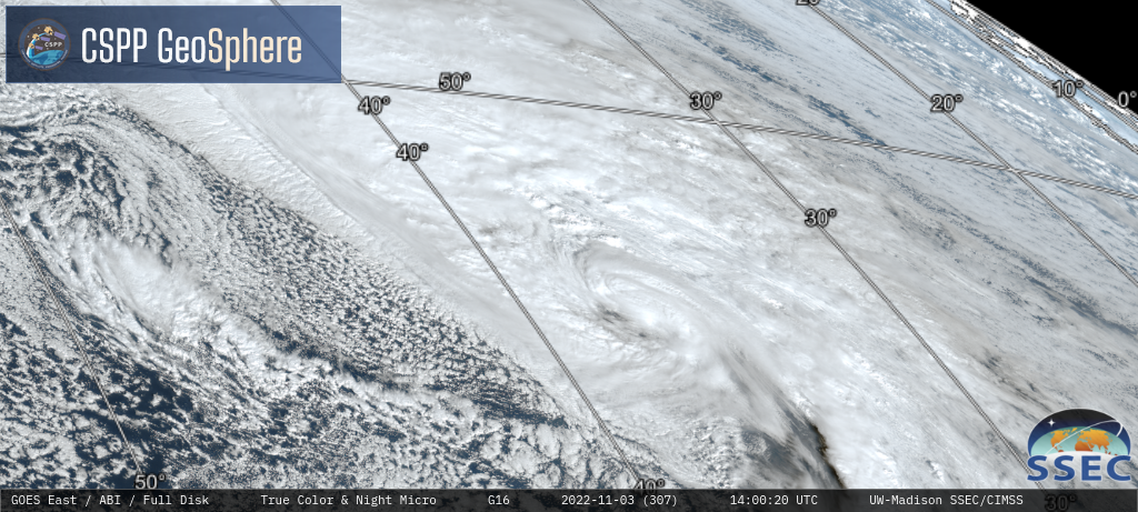
GOES-16 Nighttime Microphysics RGB and daytime True Color RGB images [click to play MP4 animation]
Additional imagery of Martin can be seen in
this blog post.
View only this post
Read Less


